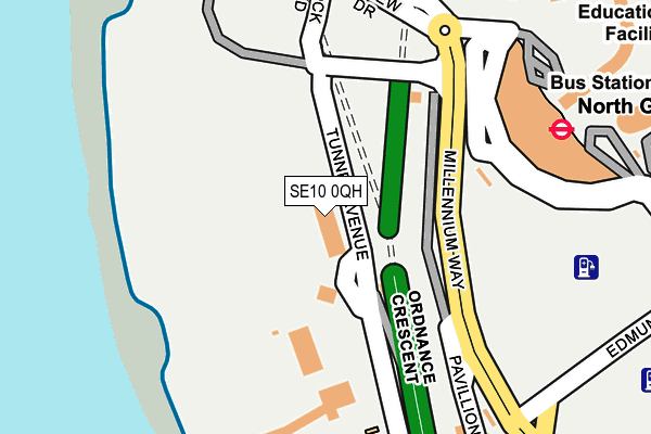
SE10 0QH is located in the Greenwich Peninsula electoral ward, within the London borough of Greenwich and the English Parliamentary constituency of Greenwich and Woolwich. The Sub Integrated Care Board (ICB) Location is NHS South East London ICB - 72Q and the police force is Metropolitan Police. This postcode has been in use since January 1980.


GetTheData
Source: OS OpenMap – Local (Ordnance Survey)
Source: OS VectorMap District (Ordnance Survey)
Licence: Open Government Licence (requires attribution)
| Easting | 538966 |
| Northing | 179743 |
| Latitude | 51.499550 |
| Longitude | 0.000645 |
GetTheData
Source: Open Postcode Geo
Licence: Open Government Licence
| Country | England |
| Postcode District | SE10 |
| ➜ SE10 open data dashboard ➜ See where SE10 is on a map ➜ Where is London? | |
GetTheData
Source: Land Registry Price Paid Data
Licence: Open Government Licence
Elevation or altitude of SE10 0QH as distance above sea level:
| Metres | Feet | |
|---|---|---|
| Elevation | 0m | 0ft |
Elevation is measured from the approximate centre of the postcode, to the nearest point on an OS contour line from OS Terrain 50, which has contour spacing of ten vertical metres.
➜ How high above sea level am I? Find the elevation of your current position using your device's GPS.
GetTheData
Source: Open Postcode Elevation
Licence: Open Government Licence
| Ward | Greenwich Peninsula |
| Constituency | Greenwich And Woolwich |
GetTheData
Source: ONS Postcode Database
Licence: Open Government Licence
| June 2022 | Robbery | On or near Shopping Area | 50m |
| June 2022 | Robbery | On or near Shopping Area | 50m |
| June 2022 | Anti-social behaviour | On or near Shopping Area | 50m |
| ➜ Get more crime data in our Crime section | |||
GetTheData
Source: data.police.uk
Licence: Open Government Licence
| North Greenwich Station | North Greenwich | 111m |
| North Greenwich Station | North Greenwich | 125m |
| North Greenwich Station | North Greenwich | 128m |
| North Greenwich Station | North Greenwich | 176m |
| North Greenwich Station | North Greenwich | 179m |
| North Greenwich Underground Station | North Greenwich | 273m |
| Emirates Greenwich Peninsula (East Parkside) | North Greenwich | 534m |
| Blackwall Dlr Station (Preston's Road) | Blackwall | 1,077m |
| East India Dlr Station (Aspen Way) | East India | 1,110m |
| Crossharbour Dlr Station (Limeharbour) | Crossharbour | 1,141m |
| Maze Hill Station | 1.9km |
| Westcombe Park Station | 2.1km |
| Charlton Station | 2.6km |
GetTheData
Source: NaPTAN
Licence: Open Government Licence
GetTheData
Source: ONS Postcode Database
Licence: Open Government Licence


➜ Get more ratings from the Food Standards Agency
GetTheData
Source: Food Standards Agency
Licence: FSA terms & conditions
| Last Collection | |||
|---|---|---|---|
| Location | Mon-Fri | Sat | Distance |
| Wood Wharf Business Park | 19:00 | 706m | |
| Prestons Road | 17:30 | 11:30 | 723m |
| Manchester Road | 17:30 | 11:30 | 774m |
GetTheData
Source: Dracos
Licence: Creative Commons Attribution-ShareAlike
| Facility | Distance |
|---|---|
| Greenwich Peninsula Golf Range Tunnel Avenue, London Golf | 128m |
| Better Gym North Greenwich (Closed) Green Place, London Health and Fitness Gym | 451m |
| The London Soccerdome (Closed) East Parkside, London Artificial Grass Pitch | 632m |
GetTheData
Source: Active Places
Licence: Open Government Licence
| School | Phase of Education | Distance |
|---|---|---|
| Ravensbourne 6 Penrose Way, London, SE10 0EW | Not applicable | 384m |
| Mulberry Wood Wharf Primary School 20 Brannan Street, Tower Hamlets, London, E14 9ZR | Primary | 784m |
| Cubitt Town Primary School Manchester Road, Isle of Dogs, Cubitt Town Primary School, Manchester Road, London, E14 3NE | Primary | 898m |
GetTheData
Source: Edubase
Licence: Open Government Licence
| Risk of SE10 0QH flooding from rivers and sea | Very Low |
| ➜ SE10 0QH flood map | |
GetTheData
Source: Open Flood Risk by Postcode
Licence: Open Government Licence
The below table lists the International Territorial Level (ITL) codes (formerly Nomenclature of Territorial Units for Statistics (NUTS) codes) and Local Administrative Units (LAU) codes for SE10 0QH:
| ITL 1 Code | Name |
|---|---|
| TLI | London |
| ITL 2 Code | Name |
| TLI5 | Outer London - East and North East |
| ITL 3 Code | Name |
| TLI51 | Bexley and Greenwich |
| LAU 1 Code | Name |
| E09000011 | Greenwich |
GetTheData
Source: ONS Postcode Directory
Licence: Open Government Licence
The below table lists the Census Output Area (OA), Lower Layer Super Output Area (LSOA), and Middle Layer Super Output Area (MSOA) for SE10 0QH:
| Code | Name | |
|---|---|---|
| OA | E00008308 | |
| LSOA | E01001667 | Greenwich 036B |
| MSOA | E02006929 | Greenwich 036 |
GetTheData
Source: ONS Postcode Directory
Licence: Open Government Licence
| SE10 0QE | Tunnel Avenue | 441m |
| E14 3YH | Folly Wall | 580m |
| E14 3EU | Capstan Square | 585m |
| E14 3EX | Stewart Street | 606m |
| E14 3FB | Manchester Road | 606m |
| E14 3JL | Stewart Street | 627m |
| E14 3JN | Stewart Street | 627m |
| E14 3JQ | Stewart Street | 627m |
| E14 3FD | Manchester Road | 642m |
| E14 9NU | Coldharbour | 648m |
GetTheData
Source: Open Postcode Geo; Land Registry Price Paid Data
Licence: Open Government Licence