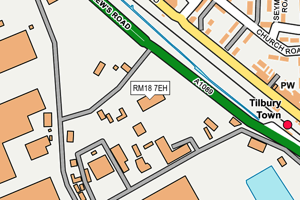
RM18 7EH is located in the Tilbury Riverside and Thurrock Park electoral ward, within the unitary authority of Thurrock and the English Parliamentary constituency of Thurrock. The Sub Integrated Care Board (ICB) Location is NHS Mid and South Essex ICB - 07G and the police force is Essex. This postcode has been in use since August 1992.


GetTheData
Source: OS OpenMap – Local (Ordnance Survey)
Source: OS VectorMap District (Ordnance Survey)
Licence: Open Government Licence (requires attribution)
| Easting | 563097 |
| Northing | 176494 |
| Latitude | 51.463921 |
| Longitude | 0.346532 |
GetTheData
Source: Open Postcode Geo
Licence: Open Government Licence
| Country | England |
| Postcode District | RM18 |
| ➜ RM18 open data dashboard ➜ See where RM18 is on a map ➜ Where is Tilbury? | |
GetTheData
Source: Land Registry Price Paid Data
Licence: Open Government Licence
Elevation or altitude of RM18 7EH as distance above sea level:
| Metres | Feet | |
|---|---|---|
| Elevation | 0m | 0ft |
Elevation is measured from the approximate centre of the postcode, to the nearest point on an OS contour line from OS Terrain 50, which has contour spacing of ten vertical metres.
➜ How high above sea level am I? Find the elevation of your current position using your device's GPS.
GetTheData
Source: Open Postcode Elevation
Licence: Open Government Licence
| Ward | Tilbury Riverside And Thurrock Park |
| Constituency | Thurrock |
GetTheData
Source: ONS Postcode Database
Licence: Open Government Licence
| June 2022 | Vehicle crime | On or near St Andrew'S Road | 351m |
| May 2022 | Other theft | On or near St Andrew'S Road | 351m |
| May 2022 | Anti-social behaviour | On or near Russell Road | 395m |
| ➜ Get more crime data in our Crime section | |||
GetTheData
Source: data.police.uk
Licence: Open Government Licence
| Tilbury Docks Main Entrance (St Andrews Road) | Tilbury | 223m |
| Russell Road (Dock Road) | Tilbury | 277m |
| Russell Road (Dock Road) | Tilbury | 298m |
| Railway Station (Dock Road) | Tilbury | 529m |
| Railway Station (Dock Road) | Tilbury | 536m |
| Tilbury Town Station | 0.6km |
| Grays Station | 2.2km |
| Northfleet Station | 2.5km |
GetTheData
Source: NaPTAN
Licence: Open Government Licence
GetTheData
Source: ONS Postcode Database
Licence: Open Government Licence


➜ Get more ratings from the Food Standards Agency
GetTheData
Source: Food Standards Agency
Licence: FSA terms & conditions
| Last Collection | |||
|---|---|---|---|
| Location | Mon-Fri | Sat | Distance |
| Gipsy Lane | 17:00 | 12:00 | 1,545m |
| Grays Railway Station | 17:00 | 11:30 | 2,133m |
| Orsett Road | 17:30 | 12:30 | 2,248m |
GetTheData
Source: Dracos
Licence: Creative Commons Attribution-ShareAlike
| Facility | Distance |
|---|---|
| Uk Fitness Club Dock Road, Tilbury Health and Fitness Gym, Studio | 798m |
| St. Chads School (Closed) St. Chads Road, Tilbury Grass Pitches | 1.2km |
| S6 Gym Calcutta Road, Tilbury Health and Fitness Gym | 1.2km |
GetTheData
Source: Active Places
Licence: Open Government Licence
| School | Phase of Education | Distance |
|---|---|---|
| Lansdowne Primary Academy Lansdowne Road, Tilbury, RM18 7QB | Primary | 813m |
| St Mary's Catholic Primary School St. Mary's Catholic Primary School, Calcutta Road, Tilbury, RM18 7QH | Primary | 873m |
| Olive AP Academy - Thurrock Leicester Road, Tilbury, RM18 7AX | Not applicable | 955m |
GetTheData
Source: Edubase
Licence: Open Government Licence
| Risk of RM18 7EH flooding from rivers and sea | Very Low |
| ➜ RM18 7EH flood map | |
GetTheData
Source: Open Flood Risk by Postcode
Licence: Open Government Licence
The below table lists the International Territorial Level (ITL) codes (formerly Nomenclature of Territorial Units for Statistics (NUTS) codes) and Local Administrative Units (LAU) codes for RM18 7EH:
| ITL 1 Code | Name |
|---|---|
| TLH | East |
| ITL 2 Code | Name |
| TLH3 | Essex |
| ITL 3 Code | Name |
| TLH32 | Thurrock |
| LAU 1 Code | Name |
| E06000034 | Thurrock |
GetTheData
Source: ONS Postcode Directory
Licence: Open Government Licence
The below table lists the Census Output Area (OA), Lower Layer Super Output Area (LSOA), and Middle Layer Super Output Area (MSOA) for RM18 7EH:
| Code | Name | |
|---|---|---|
| OA | E00080923 | |
| LSOA | E01016003 | Thurrock 018A |
| MSOA | E02003313 | Thurrock 018 |
GetTheData
Source: ONS Postcode Directory
Licence: Open Government Licence
| RM18 7AZ | Melbourne Road | 330m |
| RM18 7AE | Russell Road | 342m |
| RM18 7AB | Melbourne Road | 356m |
| RM18 7AD | Russell Road | 376m |
| RM18 7AJ | Church Road | 458m |
| RM18 7AH | Russell Road | 476m |
| RM18 7AP | Seymour Road | 503m |
| RM18 7BS | Dock Road | 528m |
| RM18 7AS | Gaylor Road | 564m |
| RM18 7AR | Dunlop Road | 567m |
GetTheData
Source: Open Postcode Geo; Land Registry Price Paid Data
Licence: Open Government Licence