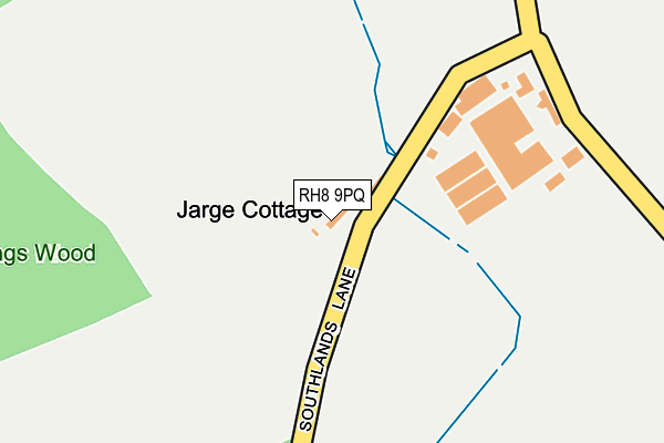
RH8 9PQ lies on Southlands Lane in Oxted. RH8 9PQ is located in the Oxted South electoral ward, within the local authority district of Tandridge and the English Parliamentary constituency of East Surrey. The Sub Integrated Care Board (ICB) Location is NHS Surrey Heartlands ICB - 92A and the police force is Surrey. This postcode has been in use since January 1980.


GetTheData
Source: OS OpenMap – Local (Ordnance Survey)
Source: OS VectorMap District (Ordnance Survey)
Licence: Open Government Licence (requires attribution)
| Easting | 538625 |
| Northing | 150733 |
| Latitude | 51.238943 |
| Longitude | -0.015568 |
GetTheData
Source: Open Postcode Geo
Licence: Open Government Licence
| Street | Southlands Lane |
| Town/City | Oxted |
| Country | England |
| Postcode District | RH8 |
| ➜ RH8 open data dashboard ➜ See where RH8 is on a map | |
GetTheData
Source: Land Registry Price Paid Data
Licence: Open Government Licence
Elevation or altitude of RH8 9PQ as distance above sea level:
| Metres | Feet | |
|---|---|---|
| Elevation | 80m | 262ft |
Elevation is measured from the approximate centre of the postcode, to the nearest point on an OS contour line from OS Terrain 50, which has contour spacing of ten vertical metres.
➜ How high above sea level am I? Find the elevation of your current position using your device's GPS.
GetTheData
Source: Open Postcode Elevation
Licence: Open Government Licence
| Ward | Oxted South |
| Constituency | East Surrey |
GetTheData
Source: ONS Postcode Database
Licence: Open Government Licence
| June 2022 | Criminal damage and arson | On or near Grove Road | 387m |
| May 2022 | Criminal damage and arson | On or near Grove Road | 387m |
| April 2022 | Other theft | On or near Broadham Green Road | 298m |
| ➜ Get more crime data in our Crime section | |||
GetTheData
Source: data.police.uk
Licence: Open Government Licence
| Broadham Green (Hall Hill) | Broadham Green | 552m |
| Broadham Green (Broadham Green Road) | Broadham Green | 561m |
| Tandridge Lane End (Tandridge Lane) | Tandridge | 1,300m |
| Vicarage (Tandridge Lane) | Tandridge | 1,301m |
| Tandridge Lane End (Tandridge Lane) | Tandridge | 1,317m |
| Hurst Green Station | 1.5km |
| Oxted Station | 2.2km |
| Godstone Station | 3.3km |
GetTheData
Source: NaPTAN
Licence: Open Government Licence
| Percentage of properties with Next Generation Access | 100.0% |
| Percentage of properties with Superfast Broadband | 50.0% |
| Percentage of properties with Ultrafast Broadband | 50.0% |
| Percentage of properties with Full Fibre Broadband | 50.0% |
Superfast Broadband is between 30Mbps and 300Mbps
Ultrafast Broadband is > 300Mbps
| Percentage of properties unable to receive 2Mbps | 0.0% |
| Percentage of properties unable to receive 5Mbps | 0.0% |
| Percentage of properties unable to receive 10Mbps | 25.0% |
| Percentage of properties unable to receive 30Mbps | 50.0% |
GetTheData
Source: Ofcom
Licence: Ofcom Terms of Use (requires attribution)
GetTheData
Source: ONS Postcode Database
Licence: Open Government Licence


➜ Get more ratings from the Food Standards Agency
GetTheData
Source: Food Standards Agency
Licence: FSA terms & conditions
| Last Collection | |||
|---|---|---|---|
| Location | Mon-Fri | Sat | Distance |
| Hall Hill | 16:15 | 08:45 | 1,004m |
| Quarry Road | 17:30 | 12:00 | 1,445m |
| High Street | 17:00 | 12:00 | 1,468m |
GetTheData
Source: Dracos
Licence: Creative Commons Attribution-ShareAlike
| Facility | Distance |
|---|---|
| Tandridge Golf Club Godstone Road, Oxted Golf | 1.2km |
| Mill Lane Playing Fields (Hurst Green) Mill Lane, Hurst Green Grass Pitches, Outdoor Tennis Courts, Athletics | 1.2km |
| Bushey Croft Playing Field Bushey Croft, Oxted Grass Pitches | 1.3km |
GetTheData
Source: Active Places
Licence: Open Government Licence
| School | Phase of Education | Distance |
|---|---|---|
| Moor House School & College Mill Lane, Hurst Green, Oxted, RH8 9AQ | Not applicable | 1.2km |
| St Peter's CofE Infant School Tandridge Lane, Tandridge, Oxted, RH8 9NN | Primary | 1.4km |
| Hurst Green Infant School Wolfs Wood, Hurst Green, Oxted, RH8 0HJ | Primary | 1.8km |
GetTheData
Source: Edubase
Licence: Open Government Licence
The below table lists the International Territorial Level (ITL) codes (formerly Nomenclature of Territorial Units for Statistics (NUTS) codes) and Local Administrative Units (LAU) codes for RH8 9PQ:
| ITL 1 Code | Name |
|---|---|
| TLJ | South East (England) |
| ITL 2 Code | Name |
| TLJ2 | Surrey, East and West Sussex |
| ITL 3 Code | Name |
| TLJ26 | East Surrey |
| LAU 1 Code | Name |
| E07000215 | Tandridge |
GetTheData
Source: ONS Postcode Directory
Licence: Open Government Licence
The below table lists the Census Output Area (OA), Lower Layer Super Output Area (LSOA), and Middle Layer Super Output Area (MSOA) for RH8 9PQ:
| Code | Name | |
|---|---|---|
| OA | E00157252 | |
| LSOA | E01030843 | Tandridge 007D |
| MSOA | E02006434 | Tandridge 007 |
GetTheData
Source: ONS Postcode Directory
Licence: Open Government Licence
| RH8 9PF | Broadham Green Road | 406m |
| RH8 9PH | Southlands Lane | 498m |
| RH8 9NX | Gibbs Brook Lane | 635m |
| RH8 9PJ | Popes Lane | 672m |
| RH8 9PA | Hall Hill | 767m |
| RH8 9PE | Tanhouse Road | 814m |
| RH8 9PD | Broadham Place | 851m |
| RH8 9JZ | Neb Lane | 994m |
| RH8 9PB | Spring Lane | 1145m |
| RH8 9BT | Hurst Green Road | 1154m |
GetTheData
Source: Open Postcode Geo; Land Registry Price Paid Data
Licence: Open Government Licence