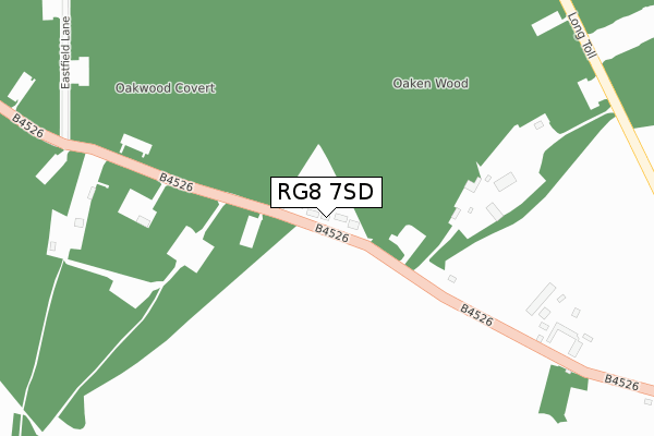
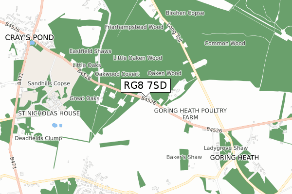
RG8 7SD lies on Penny Royal in Goring Heath, Reading. RG8 7SD is located in the Kidmore End & Whitchurch electoral ward, within the local authority district of South Oxfordshire and the English Parliamentary constituency of Henley. The Sub Integrated Care Board (ICB) Location is NHS Buckinghamshire, Oxfordshire and Berkshire West ICB - 10Q and the police force is Thames Valley. This postcode has been in use since January 1980.


GetTheData
Source: OS Open Zoomstack (Ordnance Survey)
Licence: Open Government Licence (requires attribution)
Attribution: Contains OS data © Crown copyright and database right 2024
Source: Open Postcode Geo
Licence: Open Government Licence (requires attribution)
Attribution: Contains OS data © Crown copyright and database right 2024; Contains Royal Mail data © Royal Mail copyright and database right 2024; Source: Office for National Statistics licensed under the Open Government Licence v.3.0
| Easting | 464712 |
| Northing | 180052 |
| Latitude | 51.515694 |
| Longitude | -1.068812 |
GetTheData
Source: Open Postcode Geo
Licence: Open Government Licence
| Street | Penny Royal |
| Locality | Goring Heath |
| Town/City | Reading |
| Country | England |
| Postcode District | RG8 |
| ➜ RG8 open data dashboard ➜ See where RG8 is on a map | |
GetTheData
Source: Land Registry Price Paid Data
Licence: Open Government Licence
Elevation or altitude of RG8 7SD as distance above sea level:
| Metres | Feet | |
|---|---|---|
| Elevation | 140m | 459ft |
Elevation is measured from the approximate centre of the postcode, to the nearest point on an OS contour line from OS Terrain 50, which has contour spacing of ten vertical metres.
➜ How high above sea level am I? Find the elevation of your current position using your device's GPS.
GetTheData
Source: Open Postcode Elevation
Licence: Open Government Licence
| Ward | Kidmore End & Whitchurch |
| Constituency | Henley |
GetTheData
Source: ONS Postcode Database
Licence: Open Government Licence
| June 2022 | Vehicle crime | On or near B4526 | 261m |
| May 2022 | Violence and sexual offences | On or near B4526 | 261m |
| May 2022 | Violence and sexual offences | On or near B4526 | 261m |
| ➜ Get more crime data in our Crime section | |||
GetTheData
Source: data.police.uk
Licence: Open Government Licence
| Fieldways Cottage (Village Road) | Whitchurch Hill | 836m |
| Fieldways Cottage (Village Road) | Whitchurch Hill | 843m |
| The Sun Ph (Village Road) | Whitchurch Hill | 848m |
| The Sun Ph (Village Road) | Whitchurch Hill | 857m |
| White Lion Ph (Goring Road) | Crays Pond | 1,099m |
| Pangbourne Station | 3.7km |
| Goring & Streatley Station | 4.5km |
| Tilehurst Station | 5.6km |
GetTheData
Source: NaPTAN
Licence: Open Government Licence
➜ Broadband speed and availability dashboard for RG8 7SD
| Percentage of properties with Next Generation Access | 100.0% |
| Percentage of properties with Superfast Broadband | 100.0% |
| Percentage of properties with Ultrafast Broadband | 0.0% |
| Percentage of properties with Full Fibre Broadband | 0.0% |
Superfast Broadband is between 30Mbps and 300Mbps
Ultrafast Broadband is > 300Mbps
| Median download speed | 39.1Mbps |
| Average download speed | 32.8Mbps |
| Maximum download speed | 47.12Mbps |
| Median upload speed | 8.5Mbps |
| Average upload speed | 7.4Mbps |
| Maximum upload speed | 12.85Mbps |
| Percentage of properties unable to receive 2Mbps | 0.0% |
| Percentage of properties unable to receive 5Mbps | 0.0% |
| Percentage of properties unable to receive 10Mbps | 0.0% |
| Percentage of properties unable to receive 30Mbps | 0.0% |
➜ Broadband speed and availability dashboard for RG8 7SD
GetTheData
Source: Ofcom
Licence: Ofcom Terms of Use (requires attribution)
Estimated total energy consumption in RG8 7SD by fuel type, 2015.
| Consumption (kWh) | 61,613 |
|---|---|
| Meter count | 10 |
| Mean (kWh/meter) | 6,161 |
| Median (kWh/meter) | 6,224 |
GetTheData
Source: Postcode level gas estimates: 2015 (experimental)
Source: Postcode level electricity estimates: 2015 (experimental)
Licence: Open Government Licence
GetTheData
Source: ONS Postcode Database
Licence: Open Government Licence


➜ Get more ratings from the Food Standards Agency
GetTheData
Source: Food Standards Agency
Licence: FSA terms & conditions
| Last Collection | |||
|---|---|---|---|
| Location | Mon-Fri | Sat | Distance |
| Goring Heath | 16:30 | 08:00 | 763m |
| Crays Pond | 16:15 | 09:45 | 1,113m |
| Path Hill | 16:30 | 07:00 | 1,637m |
GetTheData
Source: Dracos
Licence: Creative Commons Attribution-ShareAlike
| Facility | Distance |
|---|---|
| The Oratory Preparatory School Great Oaks, Goring Heath, Reading Swimming Pool, Sports Hall, Grass Pitches, Artificial Grass Pitch | 765m |
| Langtree School Reading Road, Woodcote, Reading Grass Pitches, Sports Hall, Artificial Grass Pitch, Outdoor Tennis Courts | 1.9km |
| The Oratory Sports Centre Woodcote, Reading Grass Pitches, Sports Hall, Swimming Pool, Golf, Squash Courts, Indoor Tennis Centre, Outdoor Tennis Courts, Health and Fitness Gym | 2km |
GetTheData
Source: Active Places
Licence: Open Government Licence
| School | Phase of Education | Distance |
|---|---|---|
| Oratory Preparatory School Goring Heath, Reading, RG8 7SF | Not applicable | 765m |
| Langtree School Reading Road, Woodcote, Reading, RG8 0RA | Secondary | 1.9km |
| The Oratory School Woodcote, Reading, South Oxfordshire, RG8 0PJ | Not applicable | 2km |
GetTheData
Source: Edubase
Licence: Open Government Licence
The below table lists the International Territorial Level (ITL) codes (formerly Nomenclature of Territorial Units for Statistics (NUTS) codes) and Local Administrative Units (LAU) codes for RG8 7SD:
| ITL 1 Code | Name |
|---|---|
| TLJ | South East (England) |
| ITL 2 Code | Name |
| TLJ1 | Berkshire, Buckinghamshire and Oxfordshire |
| ITL 3 Code | Name |
| TLJ14 | Oxfordshire CC |
| LAU 1 Code | Name |
| E07000179 | South Oxfordshire |
GetTheData
Source: ONS Postcode Directory
Licence: Open Government Licence
The below table lists the Census Output Area (OA), Lower Layer Super Output Area (LSOA), and Middle Layer Super Output Area (MSOA) for RG8 7SD:
| Code | Name | |
|---|---|---|
| OA | E00145903 | |
| LSOA | E01028643 | South Oxfordshire 018C |
| MSOA | E02005975 | South Oxfordshire 018 |
GetTheData
Source: ONS Postcode Directory
Licence: Open Government Licence
| RG8 7SB | 211m | |
| RG8 7RT | Lady Grove | 774m |
| RG8 7PY | Gashes Lane | 844m |
| RG8 7PU | Hill Bottom | 864m |
| RG8 7ST | Eastfield Lane | 872m |
| RG8 7PT | Hill Bottom | 884m |
| RG8 7QP | Rivacres | 917m |
| RG8 7RU | Lady Grove | 920m |
| RG8 7SG | Beechwood Close | 931m |
| RG8 7SU | Eastfield Lane | 970m |
GetTheData
Source: Open Postcode Geo; Land Registry Price Paid Data
Licence: Open Government Licence