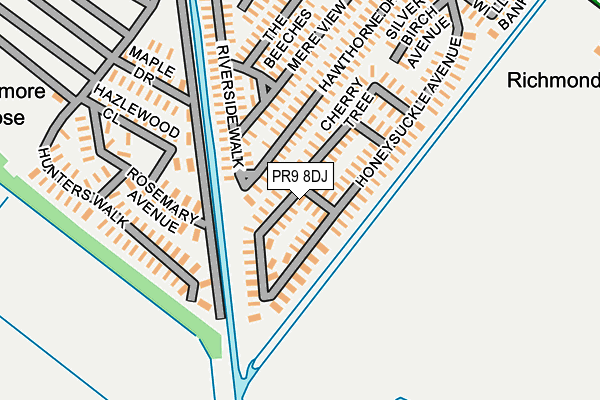
PR9 8DJ is located in the Burscough Bridge & Rufford electoral ward, within the local authority district of West Lancashire and the English Parliamentary constituency of South Ribble. The Sub Integrated Care Board (ICB) Location is NHS Lancashire and South Cumbria ICB - 02G and the police force is Lancashire. This postcode has been in use since February 2007.


GetTheData
Source: OS OpenMap – Local (Ordnance Survey)
Source: OS VectorMap District (Ordnance Survey)
Licence: Open Government Licence (requires attribution)
| Easting | 340698 |
| Northing | 419002 |
| Latitude | 53.664136 |
| Longitude | -2.898940 |
GetTheData
Source: Open Postcode Geo
Licence: Open Government Licence
| Country | England |
| Postcode District | PR9 |
| ➜ PR9 open data dashboard ➜ See where PR9 is on a map | |
GetTheData
Source: Land Registry Price Paid Data
Licence: Open Government Licence
Elevation or altitude of PR9 8DJ as distance above sea level:
| Metres | Feet | |
|---|---|---|
| Elevation | 10m | 33ft |
Elevation is measured from the approximate centre of the postcode, to the nearest point on an OS contour line from OS Terrain 50, which has contour spacing of ten vertical metres.
➜ How high above sea level am I? Find the elevation of your current position using your device's GPS.
GetTheData
Source: Open Postcode Elevation
Licence: Open Government Licence
| Ward | Burscough Bridge & Rufford |
| Constituency | South Ribble |
GetTheData
Source: ONS Postcode Database
Licence: Open Government Licence
| June 2022 | Violence and sexual offences | On or near Gravel Lane | 393m |
| May 2022 | Other crime | On or near Gravel Lane | 393m |
| April 2022 | Violence and sexual offences | On or near Gravel Lane | 393m |
| ➜ Get more crime data in our Crime section | |||
GetTheData
Source: data.police.uk
Licence: Open Government Licence
| Riverside Caravan Park (Southport New Road) | Banks | 316m |
| Riverside Leisure Centre (Gravel Lane) | Banks | 388m |
| Brooklyn Country Club (Southport New Road) | Banks | 433m |
| Southport New Road | Mere Brow | 675m |
| Southport New Road | Mere Brow | 769m |
| Bescar Lane Station | 4.6km |
GetTheData
Source: NaPTAN
Licence: Open Government Licence
| Median download speed | 40.0Mbps |
| Average download speed | 32.8Mbps |
| Maximum download speed | 59.77Mbps |
| Median upload speed | 6.5Mbps |
| Average upload speed | 5.9Mbps |
| Maximum upload speed | 12.82Mbps |
GetTheData
Source: Ofcom
Licence: Ofcom Terms of Use (requires attribution)
GetTheData
Source: ONS Postcode Database
Licence: Open Government Licence


➜ Get more ratings from the Food Standards Agency
GetTheData
Source: Food Standards Agency
Licence: FSA terms & conditions
| Last Collection | |||
|---|---|---|---|
| Location | Mon-Fri | Sat | Distance |
| The Crescent | 17:45 | 11:00 | 3,329m |
| The Ferry | 17:00 | 11:00 | 3,336m |
| Crossens Post Office | 17:30 | 11:00 | 3,370m |
GetTheData
Source: Dracos
Licence: Creative Commons Attribution-ShareAlike
| Facility | Distance |
|---|---|
| Riverside Health & Leisure Club (Closed) Southport New Road, Southport Swimming Pool, Health and Fitness Gym, Studio | 371m |
| Southport Golf Academy The Gravel, Mere Brow, Preston Golf | 1km |
| Banks Leisure Centre Greaves Hall Avenue, Southport Sports Hall, Health and Fitness Gym, Artificial Grass Pitch | 1.7km |
GetTheData
Source: Active Places
Licence: Open Government Licence
| School | Phase of Education | Distance |
|---|---|---|
| Tarleton Mere Brow Church of England Primary School The Gravel, Mere Brow, Preston, PR4 6JX | Primary | 846m |
| Banks St Stephen's CofE School Greaves Hall Avenue, Banks, Southport, PR9 8BL | Primary | 1.8km |
| Banks Methodist School Chapel Lane, Banks, Southport, PR9 8EY | Primary | 2.3km |
GetTheData
Source: Edubase
Licence: Open Government Licence
| Risk of PR9 8DJ flooding from rivers and sea | Very Low |
| ➜ PR9 8DJ flood map | |
GetTheData
Source: Open Flood Risk by Postcode
Licence: Open Government Licence
The below table lists the International Territorial Level (ITL) codes (formerly Nomenclature of Territorial Units for Statistics (NUTS) codes) and Local Administrative Units (LAU) codes for PR9 8DJ:
| ITL 1 Code | Name |
|---|---|
| TLD | North West (England) |
| ITL 2 Code | Name |
| TLD4 | Lancashire |
| ITL 3 Code | Name |
| TLD47 | Chorley and West Lancashire |
| LAU 1 Code | Name |
| E07000127 | West Lancashire |
GetTheData
Source: ONS Postcode Directory
Licence: Open Government Licence
The below table lists the Census Output Area (OA), Lower Layer Super Output Area (LSOA), and Middle Layer Super Output Area (MSOA) for PR9 8DJ:
| Code | Name | |
|---|---|---|
| OA | E00129558 | |
| LSOA | E01025531 | West Lancashire 002E |
| MSOA | E02005305 | West Lancashire 002 |
GetTheData
Source: ONS Postcode Directory
Licence: Open Government Licence
| PR9 8DF | Dalweb Industrial Park | 520m |
| PR9 8DB | Gravel Lane | 722m |
| PR4 6JB | Southport New Road | 845m |
| PR4 6JX | The Gravel | 1045m |
| PR4 6LD | Moss Side Lane | 1089m |
| PR9 8BY | Gravel Lane | 1141m |
| PR4 6LA | Tabby Nook | 1147m |
| PR4 6JY | Cinder Lane | 1191m |
| PR4 6LX | Longfold | 1307m |
| PR4 6JW | Barn Close | 1413m |
GetTheData
Source: Open Postcode Geo; Land Registry Price Paid Data
Licence: Open Government Licence