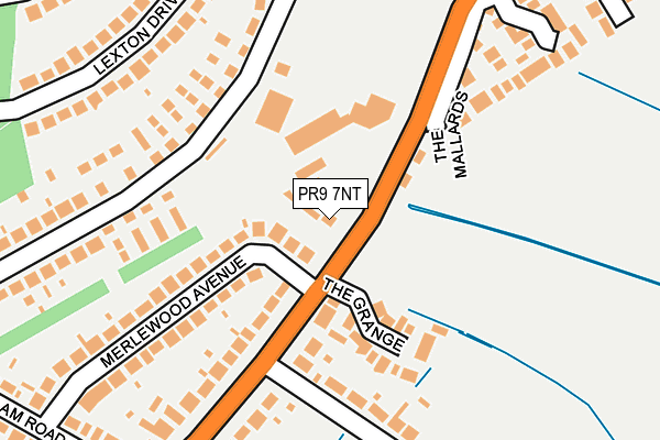
PR9 7NT is located in the Meols electoral ward, within the metropolitan district of Sefton and the English Parliamentary constituency of Southport. The Sub Integrated Care Board (ICB) Location is NHS Cheshire and Merseyside ICB - 01V and the police force is Merseyside. This postcode has been in use since January 1980.


GetTheData
Source: OS OpenMap – Local (Ordnance Survey)
Source: OS VectorMap District (Ordnance Survey)
Licence: Open Government Licence (requires attribution)
| Easting | 337112 |
| Northing | 419190 |
| Latitude | 53.665391 |
| Longitude | -2.953241 |
GetTheData
Source: Open Postcode Geo
Licence: Open Government Licence
| Country | England |
| Postcode District | PR9 |
| ➜ PR9 open data dashboard ➜ See where PR9 is on a map ➜ Where is Southport? | |
GetTheData
Source: Land Registry Price Paid Data
Licence: Open Government Licence
Elevation or altitude of PR9 7NT as distance above sea level:
| Metres | Feet | |
|---|---|---|
| Elevation | 0m | 0ft |
Elevation is measured from the approximate centre of the postcode, to the nearest point on an OS contour line from OS Terrain 50, which has contour spacing of ten vertical metres.
➜ How high above sea level am I? Find the elevation of your current position using your device's GPS.
GetTheData
Source: Open Postcode Elevation
Licence: Open Government Licence
| Ward | Meols |
| Constituency | Southport |
GetTheData
Source: ONS Postcode Database
Licence: Open Government Licence
| January 2024 | Public order | On or near Parking Area | 448m |
| June 2022 | Violence and sexual offences | On or near The Grange | 91m |
| June 2022 | Violence and sexual offences | On or near Balmoral Close | 199m |
| ➜ Get more crime data in our Crime section | |||
GetTheData
Source: data.police.uk
Licence: Open Government Licence
| Merlewood Avenue (Bankfield Lane) | Crossens | 92m |
| Balmoral Close (Balmoral Drive) | Crossens | 133m |
| Blundell Lane (Bankfield Lane) | Crossens | 162m |
| Philips Components Factory (Balmoral Drive) | Crossens | 184m |
| North Road (Balmoral Drive) | Crossens | 193m |
| Meols Cop Station | 2.6km |
| Southport Station | 3.9km |
| Bescar Lane Station | 5.3km |
GetTheData
Source: NaPTAN
Licence: Open Government Licence
GetTheData
Source: ONS Postcode Database
Licence: Open Government Licence


➜ Get more ratings from the Food Standards Agency
GetTheData
Source: Food Standards Agency
Licence: FSA terms & conditions
| Last Collection | |||
|---|---|---|---|
| Location | Mon-Fri | Sat | Distance |
| Balmoral Drive | 17:45 | 11:15 | 147m |
| 80 Bankfield Lane | 17:45 | 11:30 | 153m |
| 10 Lexton Drive | 17:45 | 11:15 | 427m |
GetTheData
Source: Dracos
Licence: Creative Commons Attribution-ShareAlike
| Facility | Distance |
|---|---|
| Bankfield Lane Bankfield Lane, Southport Grass Pitches | 322m |
| Preston New Road Recreation Ground Preston New Road, Southport Grass Pitches | 602m |
| Peterhouse School Preston New Road, Southport Sports Hall | 624m |
GetTheData
Source: Active Places
Licence: Open Government Licence
| School | Phase of Education | Distance |
|---|---|---|
| Larkfield Primary School Preston New Road, Southport, PR9 8PA | Primary | 608m |
| Crossens Nursery School Preston New Road, Southport, PR9 8PA | Nursery | 623m |
| Peterhouse School Preston New Road, Churchtown, Southport, PR9 8PA | Not applicable | 624m |
GetTheData
Source: Edubase
Licence: Open Government Licence
| Risk of PR9 7NT flooding from rivers and sea | Very Low |
| ➜ PR9 7NT flood map | |
GetTheData
Source: Open Flood Risk by Postcode
Licence: Open Government Licence
The below table lists the International Territorial Level (ITL) codes (formerly Nomenclature of Territorial Units for Statistics (NUTS) codes) and Local Administrative Units (LAU) codes for PR9 7NT:
| ITL 1 Code | Name |
|---|---|
| TLD | North West (England) |
| ITL 2 Code | Name |
| TLD7 | Merseyside |
| ITL 3 Code | Name |
| TLD73 | Sefton |
| LAU 1 Code | Name |
| E08000014 | Sefton |
GetTheData
Source: ONS Postcode Directory
Licence: Open Government Licence
The below table lists the Census Output Area (OA), Lower Layer Super Output Area (LSOA), and Middle Layer Super Output Area (MSOA) for PR9 7NT:
| Code | Name | |
|---|---|---|
| OA | E00035652 | |
| LSOA | E01007031 | Sefton 002B |
| MSOA | E02001430 | Sefton 002 |
GetTheData
Source: ONS Postcode Directory
Licence: Open Government Licence
| PR9 7NZ | The Grange | 114m |
| PR9 7NS | Merlewood Avenue | 167m |
| PR9 7NP | Blundells Lane | 167m |
| PR9 7NL | Bankfield Lane | 183m |
| PR9 8RJ | The Mallards | 210m |
| PR9 8QW | Lexton Drive | 230m |
| PR9 8QH | Balmoral Drive | 234m |
| PR9 8PY | Balmoral Drive | 258m |
| PR9 8QN | Lexton Drive | 274m |
| PR9 8QJ | Balmoral Drive | 275m |
GetTheData
Source: Open Postcode Geo; Land Registry Price Paid Data
Licence: Open Government Licence