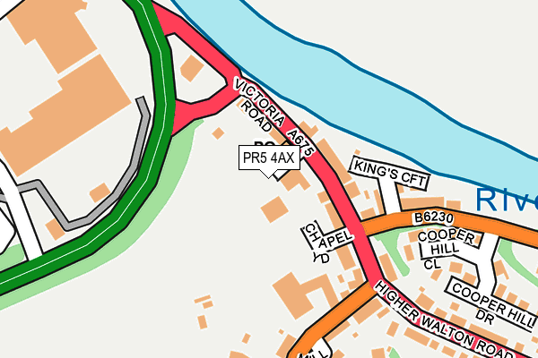
PR5 4AX is located in the Samlesbury & Walton electoral ward, within the local authority district of South Ribble and the English Parliamentary constituency of Ribble Valley. The Sub Integrated Care Board (ICB) Location is NHS Lancashire and South Cumbria ICB - 01E and the police force is Lancashire. This postcode has been in use since June 2002.


GetTheData
Source: OS OpenMap – Local (Ordnance Survey)
Source: OS VectorMap District (Ordnance Survey)
Licence: Open Government Licence (requires attribution)
| Easting | 355709 |
| Northing | 428238 |
| Latitude | 53.748635 |
| Longitude | -2.673108 |
GetTheData
Source: Open Postcode Geo
Licence: Open Government Licence
| Country | England |
| Postcode District | PR5 |
| ➜ PR5 open data dashboard ➜ See where PR5 is on a map ➜ Where is Bamber Bridge? | |
GetTheData
Source: Land Registry Price Paid Data
Licence: Open Government Licence
Elevation or altitude of PR5 4AX as distance above sea level:
| Metres | Feet | |
|---|---|---|
| Elevation | 10m | 33ft |
Elevation is measured from the approximate centre of the postcode, to the nearest point on an OS contour line from OS Terrain 50, which has contour spacing of ten vertical metres.
➜ How high above sea level am I? Find the elevation of your current position using your device's GPS.
GetTheData
Source: Open Postcode Elevation
Licence: Open Government Licence
| Ward | Samlesbury & Walton |
| Constituency | Ribble Valley |
GetTheData
Source: ONS Postcode Database
Licence: Open Government Licence
| January 2024 | Anti-social behaviour | On or near Petrol Station | 159m |
| January 2024 | Violence and sexual offences | On or near Petrol Station | 159m |
| January 2024 | Anti-social behaviour | On or near Capitol Way | 334m |
| ➜ Get more crime data in our Crime section | |||
GetTheData
Source: data.police.uk
Licence: Open Government Licence
| Sir Robert Peel (Victoria Road) | Walton-le-dale | 66m |
| Yew Tree (Victoria Road) | Walton-le-dale | 88m |
| Chorley Road | Walton-le-dale | 177m |
| Higher Walton Road | Walton-le-dale | 200m |
| Walton Green (Chorley Road) | Walton-le-dale | 351m |
| Preston Station | 2.5km |
| Bamber Bridge Station | 2.6km |
| Lostock Hall Station | 2.9km |
GetTheData
Source: NaPTAN
Licence: Open Government Licence
GetTheData
Source: ONS Postcode Database
Licence: Open Government Licence


➜ Get more ratings from the Food Standards Agency
GetTheData
Source: Food Standards Agency
Licence: FSA terms & conditions
| Last Collection | |||
|---|---|---|---|
| Location | Mon-Fri | Sat | Distance |
| Walton Le Dale Post Office | 17:00 | 11:00 | 38m |
| 48 Higher Walton Road | 17:00 | 11:00 | 589m |
| Church Brow, Knot House | 16:00 | 10:30 | 688m |
GetTheData
Source: Dracos
Licence: Creative Commons Attribution-ShareAlike
| Facility | Distance |
|---|---|
| Walton-le-dale Recreation Ground Higher Walton Road, Higher Walton Grass Pitches | 400m |
| Scholars Health & Leisure (Closed) Church Brow, Walton-le-dale, Preston Studio, Health and Fitness Gym, Squash Courts | 401m |
| St Leonard's Primary School Walton Green, Walton-le-dale, Preston Grass Pitches | 408m |
GetTheData
Source: Active Places
Licence: Open Government Licence
| School | Phase of Education | Distance |
|---|---|---|
| Walton-le-Dale, St Leonard's Church of England Primary School Walton Green, Walton-le-Dale, Preston, PR5 4JL | Primary | 362m |
| St Patrick's Roman Catholic Primary School, Walton-le-Dale Higher Walton Road, Walton-le-Dale, Preston, PR5 4HD | Primary | 724m |
| Christ The King Catholic High School Lawrence Avenue, Frenchwood, Preston, PR1 4PR | Secondary | 1km |
GetTheData
Source: Edubase
Licence: Open Government Licence
| Risk of PR5 4AX flooding from rivers and sea | Low |
| ➜ PR5 4AX flood map | |
GetTheData
Source: Open Flood Risk by Postcode
Licence: Open Government Licence
The below table lists the International Territorial Level (ITL) codes (formerly Nomenclature of Territorial Units for Statistics (NUTS) codes) and Local Administrative Units (LAU) codes for PR5 4AX:
| ITL 1 Code | Name |
|---|---|
| TLD | North West (England) |
| ITL 2 Code | Name |
| TLD4 | Lancashire |
| ITL 3 Code | Name |
| TLD45 | Mid Lancashire |
| LAU 1 Code | Name |
| E07000126 | South Ribble |
GetTheData
Source: ONS Postcode Directory
Licence: Open Government Licence
The below table lists the Census Output Area (OA), Lower Layer Super Output Area (LSOA), and Middle Layer Super Output Area (MSOA) for PR5 4AX:
| Code | Name | |
|---|---|---|
| OA | E00129189 | |
| LSOA | E01025457 | South Ribble 004B |
| MSOA | E02005290 | South Ribble 004 |
GetTheData
Source: ONS Postcode Directory
Licence: Open Government Licence
| PR5 4AU | Victoria Road | 54m |
| PR5 4BA | Victoria Road | 64m |
| PR5 4AY | Victoria Road | 78m |
| PR5 4BD | Kings Croft | 122m |
| PR5 4BE | Cooper Hill Close | 181m |
| PR5 4BB | Church Brow | 188m |
| PR5 4JA | Chorley Road | 193m |
| PR5 4HA | Higher Walton Road | 268m |
| PR5 4HE | Cooper Hill Drive | 271m |
| PR5 4JL | Walton Green | 363m |
GetTheData
Source: Open Postcode Geo; Land Registry Price Paid Data
Licence: Open Government Licence