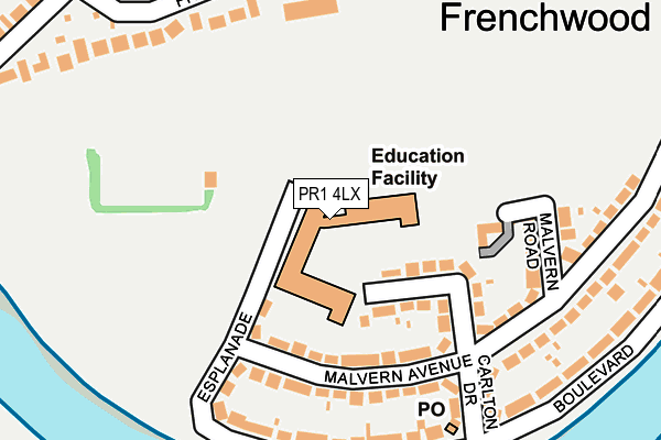
PR1 4LX is located in the Fishwick & Frenchwood electoral ward, within the local authority district of Preston and the English Parliamentary constituency of Preston. The Sub Integrated Care Board (ICB) Location is NHS Lancashire and South Cumbria ICB - 01E and the police force is Lancashire. This postcode has been in use since January 1980.


GetTheData
Source: OS OpenMap – Local (Ordnance Survey)
Source: OS VectorMap District (Ordnance Survey)
Licence: Open Government Licence (requires attribution)
| Easting | 354705 |
| Northing | 428561 |
| Latitude | 53.751436 |
| Longitude | -2.688382 |
GetTheData
Source: Open Postcode Geo
Licence: Open Government Licence
| Country | England |
| Postcode District | PR1 |
| ➜ PR1 open data dashboard ➜ See where PR1 is on a map ➜ Where is Preston? | |
GetTheData
Source: Land Registry Price Paid Data
Licence: Open Government Licence
Elevation or altitude of PR1 4LX as distance above sea level:
| Metres | Feet | |
|---|---|---|
| Elevation | 10m | 33ft |
Elevation is measured from the approximate centre of the postcode, to the nearest point on an OS contour line from OS Terrain 50, which has contour spacing of ten vertical metres.
➜ How high above sea level am I? Find the elevation of your current position using your device's GPS.
GetTheData
Source: Open Postcode Elevation
Licence: Open Government Licence
| Ward | Fishwick & Frenchwood |
| Constituency | Preston |
GetTheData
Source: ONS Postcode Database
Licence: Open Government Licence
| January 2024 | Anti-social behaviour | On or near Herschell Street | 418m |
| January 2024 | Violence and sexual offences | On or near Herschell Street | 418m |
| November 2023 | Anti-social behaviour | On or near Herschell Street | 418m |
| ➜ Get more crime data in our Crime section | |||
GetTheData
Source: data.police.uk
Licence: Open Government Licence
| Christ The King Rchs (The Esplanade) | Frenchwood | 97m |
| Malvern Avenue | Frenchwood | 221m |
| Carleton Drive (Boulevard) | Frenchwood | 252m |
| Boulevard | Frenchwood | 342m |
| Bence Road (Frenchwood Avenue) | Frenchwood | 389m |
| Preston Station | 1.4km |
| Lostock Hall Station | 3km |
| Bamber Bridge Station | 3.3km |
GetTheData
Source: NaPTAN
Licence: Open Government Licence
GetTheData
Source: ONS Postcode Database
Licence: Open Government Licence


➜ Get more ratings from the Food Standards Agency
GetTheData
Source: Food Standards Agency
Licence: FSA terms & conditions
| Last Collection | |||
|---|---|---|---|
| Location | Mon-Fri | Sat | Distance |
| Manchester Road | 17:30 | 11:30 | 676m |
| Harris Institute | 17:30 | 11:30 | 759m |
| 12 Winckley Square | 18:30 | 11:30 | 929m |
GetTheData
Source: Dracos
Licence: Creative Commons Attribution-ShareAlike
| Facility | Distance |
|---|---|
| Christ The King Catholic High School Lawrence Avenue, Preston Health and Fitness Gym, Grass Pitches, Sports Hall, Artificial Grass Pitch | 0m |
| Frenchwood Park The Esplanade, Preston Grass Pitches, Outdoor Tennis Courts | 189m |
| Nuffield Health (Preston) Capitol Centre, Walton-le-dale, Preston Swimming Pool, Health and Fitness Gym, Studio | 580m |
GetTheData
Source: Active Places
Licence: Open Government Licence
| School | Phase of Education | Distance |
|---|---|---|
| Christ The King Catholic High School Lawrence Avenue, Frenchwood, Preston, PR1 4PR | Secondary | 95m |
| Frenchwood Community Primary School Frenchwood Knoll, Preston, PR1 4LE | Primary | 268m |
| St Augustine's Catholic Primary School, Preston St Austin's Place, Avenham, Preston, PR1 3YJ | Primary | 529m |
GetTheData
Source: Edubase
Licence: Open Government Licence
| Risk of PR1 4LX flooding from rivers and sea | Low |
| ➜ PR1 4LX flood map | |
GetTheData
Source: Open Flood Risk by Postcode
Licence: Open Government Licence
The below table lists the International Territorial Level (ITL) codes (formerly Nomenclature of Territorial Units for Statistics (NUTS) codes) and Local Administrative Units (LAU) codes for PR1 4LX:
| ITL 1 Code | Name |
|---|---|
| TLD | North West (England) |
| ITL 2 Code | Name |
| TLD4 | Lancashire |
| ITL 3 Code | Name |
| TLD45 | Mid Lancashire |
| LAU 1 Code | Name |
| E07000123 | Preston |
GetTheData
Source: ONS Postcode Directory
Licence: Open Government Licence
The below table lists the Census Output Area (OA), Lower Layer Super Output Area (LSOA), and Middle Layer Super Output Area (MSOA) for PR1 4LX:
| Code | Name | |
|---|---|---|
| OA | E00128450 | |
| LSOA | E01025304 | Preston 016E |
| MSOA | E02005268 | Preston 016 |
GetTheData
Source: ONS Postcode Directory
Licence: Open Government Licence
| PR1 4PR | Lawrence Avenue | 87m |
| PR1 4PS | Ashworth Court | 143m |
| PR1 4PJ | The Esplanade | 158m |
| PR1 4PP | Carlton Drive | 167m |
| PR1 4PN | Malvern Avenue | 171m |
| PR1 4PQ | Malvern Road | 180m |
| PR1 4PH | The Boulevard | 200m |
| PR1 4LE | Frenchwood Knoll | 204m |
| PR1 4PL | Malvern Avenue | 213m |
| PR1 4PE | The Boulevard | 286m |
GetTheData
Source: Open Postcode Geo; Land Registry Price Paid Data
Licence: Open Government Licence