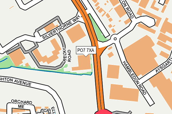
PO7 7XA is located in the Waterloo electoral ward, within the local authority district of Havant and the English Parliamentary constituency of Meon Valley. The Sub Integrated Care Board (ICB) Location is NHS Hampshire and Isle of Wight ICB - D9Y0V and the police force is Hampshire. This postcode has been in use since April 1987.


GetTheData
Source: OS OpenMap – Local (Ordnance Survey)
Source: OS VectorMap District (Ordnance Survey)
Licence: Open Government Licence (requires attribution)
| Easting | 467808 |
| Northing | 109709 |
| Latitude | 50.882903 |
| Longitude | -1.037469 |
GetTheData
Source: Open Postcode Geo
Licence: Open Government Licence
| Country | England |
| Postcode District | PO7 |
| ➜ PO7 open data dashboard ➜ See where PO7 is on a map ➜ Where is Waterlooville? | |
GetTheData
Source: Land Registry Price Paid Data
Licence: Open Government Licence
Elevation or altitude of PO7 7XA as distance above sea level:
| Metres | Feet | |
|---|---|---|
| Elevation | 40m | 131ft |
Elevation is measured from the approximate centre of the postcode, to the nearest point on an OS contour line from OS Terrain 50, which has contour spacing of ten vertical metres.
➜ How high above sea level am I? Find the elevation of your current position using your device's GPS.
GetTheData
Source: Open Postcode Elevation
Licence: Open Government Licence
| Ward | Waterloo |
| Constituency | Meon Valley |
GetTheData
Source: ONS Postcode Database
Licence: Open Government Licence
| January 2024 | Vehicle crime | On or near Relay Road | 176m |
| January 2024 | Anti-social behaviour | On or near Elettra Avenue | 365m |
| January 2024 | Burglary | On or near Elettra Avenue | 365m |
| ➜ Get more crime data in our Crime section | |||
GetTheData
Source: data.police.uk
Licence: Open Government Licence
| Parkwood Centre (B2150) | Waterlooville | 60m |
| Parkwood Centre (B2150) | Waterlooville | 99m |
| Sainsbury (Store Access Road) | Waterlooville | 195m |
| Milton Road Rbt (Hambledon Road B2150) | Waterlooville | 253m |
| Berewood Development (Grainger Street) | Waterlooville | 372m |
| Bedhampton Station | 4.4km |
| Cosham Station | 5km |
| Havant Station | 5km |
GetTheData
Source: NaPTAN
Licence: Open Government Licence
GetTheData
Source: ONS Postcode Database
Licence: Open Government Licence


➜ Get more ratings from the Food Standards Agency
GetTheData
Source: Food Standards Agency
Licence: FSA terms & conditions
| Last Collection | |||
|---|---|---|---|
| Location | Mon-Fri | Sat | Distance |
| Old Hambledon Road | 17:15 | 12:30 | 111m |
| Waterlooville | 18:30 | 13:00 | 281m |
| Asda Store | 17:15 | 11:30 | 420m |
GetTheData
Source: Dracos
Licence: Creative Commons Attribution-ShareAlike
| Facility | Distance |
|---|---|
| Waterlooville Leisure Centre Waterberry Drive, Waterlooville Swimming Pool, Health and Fitness Gym, Studio | 546m |
| The Waterloo School Warfield Avenue, Waterlooville Sports Hall | 640m |
| Waterlooville Recreation Ground Rowlands Avenue, Waterlooville Grass Pitches, Outdoor Tennis Courts | 661m |
GetTheData
Source: Active Places
Licence: Open Government Licence
| School | Phase of Education | Distance |
|---|---|---|
| Berewood Primary School Kentidge Way, Waterlooville, PO7 3BE | Primary | 396m |
| Jubilee School 84-86 Jubilee Road, Waterlooville, PO7 7RE | Not applicable | 506m |
| The Waterloo School Warfield Avenue, Waterlooville, PO7 7JJ | Not applicable | 750m |
GetTheData
Source: Edubase
Licence: Open Government Licence
| Risk of PO7 7XA flooding from rivers and sea | Low |
| ➜ PO7 7XA flood map | |
GetTheData
Source: Open Flood Risk by Postcode
Licence: Open Government Licence
The below table lists the International Territorial Level (ITL) codes (formerly Nomenclature of Territorial Units for Statistics (NUTS) codes) and Local Administrative Units (LAU) codes for PO7 7XA:
| ITL 1 Code | Name |
|---|---|
| TLJ | South East (England) |
| ITL 2 Code | Name |
| TLJ3 | Hampshire and Isle of Wight |
| ITL 3 Code | Name |
| TLJ35 | South Hampshire |
| LAU 1 Code | Name |
| E07000090 | Havant |
GetTheData
Source: ONS Postcode Directory
Licence: Open Government Licence
The below table lists the Census Output Area (OA), Lower Layer Super Output Area (LSOA), and Middle Layer Super Output Area (MSOA) for PO7 7XA:
| Code | Name | |
|---|---|---|
| OA | E00116713 | |
| LSOA | E01022975 | Havant 003D |
| MSOA | E02004764 | Havant 003 |
GetTheData
Source: ONS Postcode Directory
Licence: Open Government Licence
| PO7 7XE | Aston Road | 193m |
| PO7 7UB | Hambledon Road | 195m |
| PO7 3AP | Ellisons Crescent | 270m |
| PO7 7HT | The Parkwood Centre | 270m |
| PO7 3AE | Orchard Mead | 271m |
| PO7 3AF | Orchard Mead | 275m |
| PO7 7XD | Jubilee Business Centre | 279m |
| PO7 3AQ | Russet Lane | 283m |
| PO7 7UG | Aysgarth Road | 284m |
| PO7 3AN | Ellisons Crescent | 288m |
GetTheData
Source: Open Postcode Geo; Land Registry Price Paid Data
Licence: Open Government Licence