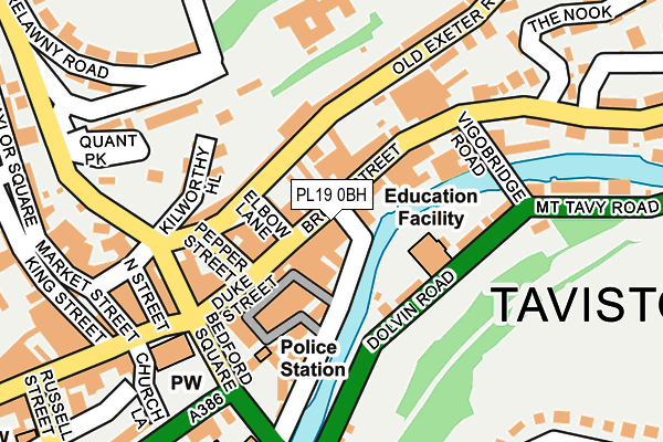
PL19 0BH is located in the Tavistock North electoral ward, within the local authority district of West Devon and the English Parliamentary constituency of Torridge and West Devon. The Sub Integrated Care Board (ICB) Location is NHS Devon ICB - 15N and the police force is Devon & Cornwall. This postcode has been in use since January 1980.


GetTheData
Source: OS OpenMap – Local (Ordnance Survey)
Source: OS VectorMap District (Ordnance Survey)
Licence: Open Government Licence (requires attribution)
| Easting | 248271 |
| Northing | 74550 |
| Latitude | 50.550969 |
| Longitude | -4.143104 |
GetTheData
Source: Open Postcode Geo
Licence: Open Government Licence
| Country | England |
| Postcode District | PL19 |
| ➜ PL19 open data dashboard ➜ See where PL19 is on a map ➜ Where is Tavistock? | |
GetTheData
Source: Land Registry Price Paid Data
Licence: Open Government Licence
Elevation or altitude of PL19 0BH as distance above sea level:
| Metres | Feet | |
|---|---|---|
| Elevation | 80m | 262ft |
Elevation is measured from the approximate centre of the postcode, to the nearest point on an OS contour line from OS Terrain 50, which has contour spacing of ten vertical metres.
➜ How high above sea level am I? Find the elevation of your current position using your device's GPS.
GetTheData
Source: Open Postcode Elevation
Licence: Open Government Licence
| Ward | Tavistock North |
| Constituency | Torridge And West Devon |
GetTheData
Source: ONS Postcode Database
Licence: Open Government Licence
| October 2022 | Robbery | On or near Russell Street | 323m |
| June 2022 | Shoplifting | On or near Brook Street | 59m |
| June 2022 | Anti-social behaviour | On or near Duke Street | 97m |
| ➜ Get more crime data in our Crime section | |||
GetTheData
Source: data.police.uk
Licence: Open Government Licence
| Lawsons (Brook Street) | Tavistock | 19m |
| St. Rumons School (Dolvin Road) | Tavistock | 110m |
| Bedford Square | Tavistock | 163m |
| Lawsons (Parkwood Road) | Tavistock | 172m |
| Lawsons (Parkwood Road) | Tavistock | 174m |
GetTheData
Source: NaPTAN
Licence: Open Government Licence
GetTheData
Source: ONS Postcode Database
Licence: Open Government Licence


➜ Get more ratings from the Food Standards Agency
GetTheData
Source: Food Standards Agency
Licence: FSA terms & conditions
| Last Collection | |||
|---|---|---|---|
| Location | Mon-Fri | Sat | Distance |
| Duke Street | 16:45 | 12:45 | 25m |
| Exeter Street | 12:00 | 12:00 | 139m |
| Brook Street | 16:45 | 12:00 | 147m |
GetTheData
Source: Dracos
Licence: Creative Commons Attribution-ShareAlike
| Facility | Distance |
|---|---|
| Anchorage Centre Chapel Street, Tavistock Sports Hall | 412m |
| St Peters Church Of England Junior School School Close, Greenlands, Tavistock Swimming Pool, Grass Pitches | 441m |
| Meadowlands Leisure Centre The Wharf, Tavistock Swimming Pool, Outdoor Tennis Courts, Studio, Health and Fitness Gym | 551m |
GetTheData
Source: Active Places
Licence: Open Government Licence
| School | Phase of Education | Distance |
|---|---|---|
| St Rumon's Church of England (VC) Infants School Dolvin Road, Tavistock, PL19 9EA | Primary | 98m |
| St Peter's Church of England (VA) Junior School School Close, Greenlands Estate, Tavistock, PL19 9HW | Primary | 439m |
| Mount Kelly Parkwood Road, Tavistock, PL19 0HZ | Not applicable | 791m |
GetTheData
Source: Edubase
Licence: Open Government Licence
| Risk of PL19 0BH flooding from rivers and sea | Medium |
| ➜ PL19 0BH flood map | |
GetTheData
Source: Open Flood Risk by Postcode
Licence: Open Government Licence
The below table lists the International Territorial Level (ITL) codes (formerly Nomenclature of Territorial Units for Statistics (NUTS) codes) and Local Administrative Units (LAU) codes for PL19 0BH:
| ITL 1 Code | Name |
|---|---|
| TLK | South West (England) |
| ITL 2 Code | Name |
| TLK4 | Devon |
| ITL 3 Code | Name |
| TLK43 | Devon CC |
| LAU 1 Code | Name |
| E07000047 | West Devon |
GetTheData
Source: ONS Postcode Directory
Licence: Open Government Licence
The below table lists the Census Output Area (OA), Lower Layer Super Output Area (LSOA), and Middle Layer Super Output Area (MSOA) for PL19 0BH:
| Code | Name | |
|---|---|---|
| OA | E00165949 | |
| LSOA | E01020332 | West Devon 005A |
| MSOA | E02004233 | West Devon 005 |
GetTheData
Source: ONS Postcode Directory
Licence: Open Government Licence
| PL19 0BW | Market Road | 30m |
| PL19 0HD | Brook Street | 50m |
| PL19 0HF | Paddons Row | 51m |
| PL19 0GZ | Brook Street | 74m |
| PL19 0HE | Brook Street | 79m |
| PL19 0BA | Duke Street | 94m |
| PL19 9EA | Dolvin Road | 98m |
| PL19 0FG | Barley Market Street | 104m |
| PL19 0BD | Pepper Street | 113m |
| PL19 0BT | Newmarket Court | 119m |
GetTheData
Source: Open Postcode Geo; Land Registry Price Paid Data
Licence: Open Government Licence