PL14 6DA maps, stats, and open data
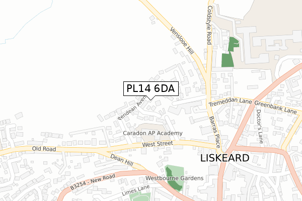
PL14 6DA lies on Pendean Avenue in Liskeard. PL14 6DA is located in the Liskeard Central electoral ward, within the unitary authority of Cornwall and the English Parliamentary constituency of South East Cornwall. The Sub Integrated Care Board (ICB) Location is NHS Cornwall and the Isles of Scilly ICB - 11N and the police force is Devon & Cornwall. This postcode has been in use since January 1980.
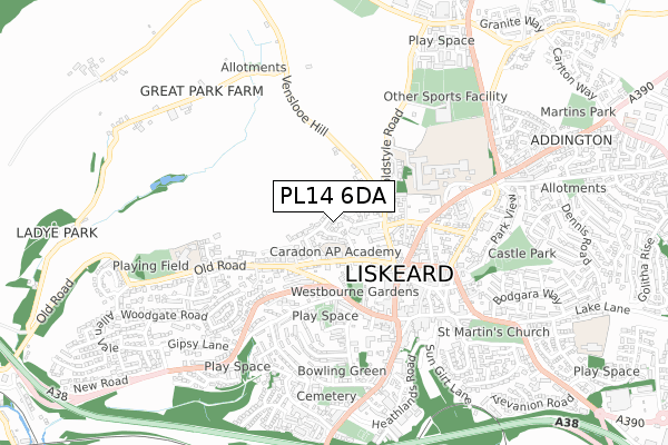
PL14 6DA maps


Licence: Open Government Licence (requires attribution)
Attribution: Contains OS data © Crown copyright and database right 2025
Source: Open Postcode Geo
Licence: Open Government Licence (requires attribution)
Attribution: Contains OS data © Crown copyright and database right 2025; Contains Royal Mail data © Royal Mail copyright and database right 2025; Source: Office for National Statistics licensed under the Open Government Licence v.3.0
PL14 6DA geodata
| Easting | 224871 |
| Northing | 64809 |
| Latitude | 50.456905 |
| Longitude | -4.468534 |
Where is PL14 6DA?
| Street | Pendean Avenue |
| Town/City | Liskeard |
| Country | England |
| Postcode District | PL14 |
PL14 6DA Elevation
Elevation or altitude of PL14 6DA as distance above sea level:
| Metres | Feet | |
|---|---|---|
| Elevation | 140m | 459ft |
Elevation is measured from the approximate centre of the postcode, to the nearest point on an OS contour line from OS Terrain 50, which has contour spacing of ten vertical metres.
➜ How high above sea level am I? Find the elevation of your current position using your device's GPS.
Politics
| Ward | Liskeard Central |
|---|---|
| Constituency | South East Cornwall |
House Prices
Sales of detached houses in PL14 6DA
2024 17 JUL £430,000 |
THE FOXES DEN, 12, PENDEAN AVENUE, LISKEARD, PL14 6DA 2022 7 JUN £475,000 |
2020 17 DEC £290,000 |
2019 4 JAN £347,000 |
2016 7 OCT £187,000 |
5, PENDEAN AVENUE, LISKEARD, PL14 6DA 2016 8 JAN £220,000 |
2013 20 FEB £225,000 |
2011 19 DEC £205,000 |
THE FOXES DEN, 12, PENDEAN AVENUE, LISKEARD, PL14 6DA 2011 5 MAY £349,950 |
24, PENDEAN AVENUE, LISKEARD, PL14 6DA 2010 16 JUL £224,000 |
Licence: Contains HM Land Registry data © Crown copyright and database right 2025. This data is licensed under the Open Government Licence v3.0.
Transport
Nearest bus stops to PL14 6DA
| Lloyds Bank | Liskeard | 311m |
| Post Office (Barras Street) | Liskeard | 332m |
| School & Community College | Liskeard | 450m |
| Hotel Nebula (Higher Lux Street) | Liskeard | 487m |
| Hotel Nebula (Higher Lux Street) | Liskeard | 494m |
Nearest railway stations to PL14 6DA
| Liskeard Station | 1.1km |
| Coombe Junction Halt (Station) | 1.5km |
| St Keyne Wishing Well Halt (Station) | 3.8km |
Broadband
Broadband access in PL14 6DA (2020 data)
| Percentage of properties with Next Generation Access | 100.0% |
| Percentage of properties with Superfast Broadband | 100.0% |
| Percentage of properties with Ultrafast Broadband | 5.1% |
| Percentage of properties with Full Fibre Broadband | 5.1% |
Superfast Broadband is between 30Mbps and 300Mbps
Ultrafast Broadband is > 300Mbps
Broadband speed in PL14 6DA (2019 data)
Download
| Median download speed | 27.4Mbps |
| Average download speed | 26.4Mbps |
| Maximum download speed | 52.94Mbps |
Upload
| Median upload speed | 5.2Mbps |
| Average upload speed | 5.2Mbps |
| Maximum upload speed | 15.57Mbps |
Broadband limitations in PL14 6DA (2020 data)
| Percentage of properties unable to receive 2Mbps | 0.0% |
| Percentage of properties unable to receive 5Mbps | 0.0% |
| Percentage of properties unable to receive 10Mbps | 0.0% |
| Percentage of properties unable to receive 30Mbps | 0.0% |
PL14 6DA gas and electricity consumption
Estimated total energy consumption in PL14 6DA by fuel type, 2015.
Gas
| Consumption (kWh) | 568,360 |
|---|---|
| Meter count | 37 |
| Mean (kWh/meter) | 15,361 |
| Median (kWh/meter) | 12,562 |
Electricity
| Consumption (kWh) | 128,899 |
|---|---|
| Meter count | 30 |
| Mean (kWh/meter) | 4,297 |
| Median (kWh/meter) | 3,573 |
- Consumption: The estimated total energy consumption, in kWh, across all meters in PL14 6DA, for 2015.
- Meter count: The total number of meters in PL14 6DA.
- Mean: The mean average consumption per meter, in kWh.
- Median: The median average consumption per meter, in kWh.
Source: Postcode level electricity estimates: 2015 (experimental)
Licence: Open Government Licence
Deprivation
68.6% of English postcodes are less deprived than PL14 6DA:Food Standards Agency
Three nearest food hygiene ratings to PL14 6DA (metres)


➜ Get more ratings from the Food Standards Agency
Nearest post box to PL14 6DA
| Last Collection | |||
|---|---|---|---|
| Location | Mon-Fri | Sat | Distance |
| Market Street | 15:00 | 12:15 | 459m |
| Barn Street | 16:30 | 12:00 | 586m |
| Church Street | 15:00 | 12:15 | 602m |
PL14 6DA ITL and PL14 6DA LAU
The below table lists the International Territorial Level (ITL) codes (formerly Nomenclature of Territorial Units for Statistics (NUTS) codes) and Local Administrative Units (LAU) codes for PL14 6DA:
| ITL 1 Code | Name |
|---|---|
| TLK | South West (England) |
| ITL 2 Code | Name |
| TLK3 | Cornwall and Isles of Scilly |
| ITL 3 Code | Name |
| TLK30 | Cornwall and Isles of Scilly |
| LAU 1 Code | Name |
| E06000052 | Cornwall |
PL14 6DA census areas
The below table lists the Census Output Area (OA), Lower Layer Super Output Area (LSOA), and Middle Layer Super Output Area (MSOA) for PL14 6DA:
| Code | Name | |
|---|---|---|
| OA | E00094743 | |
| LSOA | E01018769 | Cornwall 016C |
| MSOA | E02003895 | Cornwall 016 |
Nearest postcodes to PL14 6DA
| PL14 6DE | Pendean Close | 58m |
| PL14 6BP | Horn Lane | 109m |
| PL14 6AS | Passmore Edwards Court | 137m |
| PL14 6DD | Caradon Drive | 155m |
| PL14 6BT | West Street | 162m |
| PL14 6DX | Barras Close | 173m |
| PL14 6DB | Pendean Drive | 174m |
| PL14 6BE | Barras Cross | 183m |
| PL14 6BJ | Venslooe Hill | 186m |
| PL14 6BW | West Street | 208m |