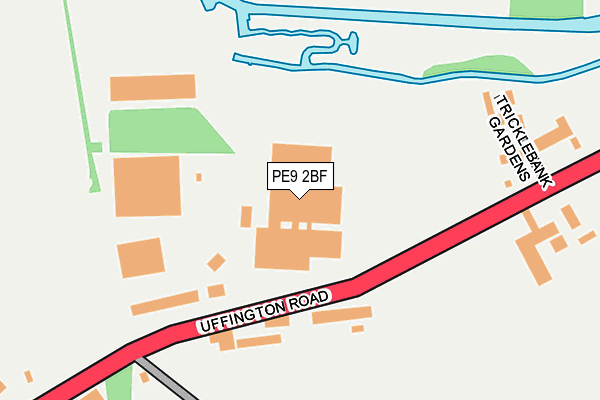
PE9 2BF is located in the Stamford St Mary's electoral ward, within the local authority district of South Kesteven and the English Parliamentary constituency of Grantham and Stamford. The Sub Integrated Care Board (ICB) Location is NHS Lincolnshire ICB - 71E and the police force is Lincolnshire. This postcode has been in use since February 2016.


GetTheData
Source: OS OpenMap – Local (Ordnance Survey)
Source: OS VectorMap District (Ordnance Survey)
Licence: Open Government Licence (requires attribution)
| Easting | 504227 |
| Northing | 307660 |
| Latitude | 52.656677 |
| Longitude | -0.460548 |
GetTheData
Source: Open Postcode Geo
Licence: Open Government Licence
| Country | England |
| Postcode District | PE9 |
| ➜ PE9 open data dashboard ➜ See where PE9 is on a map ➜ Where is Stamford? | |
GetTheData
Source: Land Registry Price Paid Data
Licence: Open Government Licence
Elevation or altitude of PE9 2BF as distance above sea level:
| Metres | Feet | |
|---|---|---|
| Elevation | 20m | 66ft |
Elevation is measured from the approximate centre of the postcode, to the nearest point on an OS contour line from OS Terrain 50, which has contour spacing of ten vertical metres.
➜ How high above sea level am I? Find the elevation of your current position using your device's GPS.
GetTheData
Source: Open Postcode Elevation
Licence: Open Government Licence
| Ward | Stamford St Mary's |
| Constituency | Grantham And Stamford |
GetTheData
Source: ONS Postcode Database
Licence: Open Government Licence
| June 2022 | Shoplifting | On or near Uffington Road | 124m |
| June 2022 | Other theft | On or near Uffington Road | 124m |
| June 2022 | Other theft | On or near Uffington Road | 124m |
| ➜ Get more crime data in our Crime section | |||
GetTheData
Source: data.police.uk
Licence: Open Government Licence
| Meadow View (Uffington Road) | Stamford | 89m |
| Meadow View (Uffington Road) | Stamford | 100m |
| Morrison Car Park (Uffington Road) | Stamford | 308m |
| Stamford & Rutland Hospital (Ryhall Road) | Stamford | 513m |
| Drift Road (Ryhall Road) | Stamford | 525m |
| Stamford Station | 1.6km |
GetTheData
Source: NaPTAN
Licence: Open Government Licence
GetTheData
Source: ONS Postcode Database
Licence: Open Government Licence


➜ Get more ratings from the Food Standards Agency
GetTheData
Source: Food Standards Agency
Licence: FSA terms & conditions
| Last Collection | |||
|---|---|---|---|
| Location | Mon-Fri | Sat | Distance |
| Ryhall Road Post Office | 17:30 | 11:15 | 422m |
| Newstead | 16:45 | 07:30 | 478m |
| Doughty Street | 17:30 | 10:45 | 718m |
GetTheData
Source: Dracos
Licence: Creative Commons Attribution-ShareAlike
| Facility | Distance |
|---|---|
| Uffington Road Playing Field Uffington Road, Stamford Grass Pitches | 414m |
| Stamford Leisure Pool Drift Road, Stamford Swimming Pool, Health and Fitness Gym | 675m |
| Blackstone Sports And Social Club Lincoln Road, Stamford Grass Pitches | 820m |
GetTheData
Source: Active Places
Licence: Open Government Licence
| School | Phase of Education | Distance |
|---|---|---|
| Stamford Endowed Schools Brazenose House, St Pauls Street, Stamford, Lincolnshire, PE9 2BE | Not applicable | 966m |
| St George's Church of England Aided Primary School Kesteven Road, Stamford, PE9 1SX | Primary | 1km |
| St Augustine's Catholic Voluntary Academy Kesteven Road, Stamford, PE9 1SR | Primary | 1.2km |
GetTheData
Source: Edubase
Licence: Open Government Licence
The below table lists the International Territorial Level (ITL) codes (formerly Nomenclature of Territorial Units for Statistics (NUTS) codes) and Local Administrative Units (LAU) codes for PE9 2BF:
| ITL 1 Code | Name |
|---|---|
| TLF | East Midlands (England) |
| ITL 2 Code | Name |
| TLF3 | Lincolnshire |
| ITL 3 Code | Name |
| TLF30 | Lincolnshire CC |
| LAU 1 Code | Name |
| E07000141 | South Kesteven |
GetTheData
Source: ONS Postcode Directory
Licence: Open Government Licence
The below table lists the Census Output Area (OA), Lower Layer Super Output Area (LSOA), and Middle Layer Super Output Area (MSOA) for PE9 2BF:
| Code | Name | |
|---|---|---|
| OA | E00133855 | |
| LSOA | E01026350 | South Kesteven 016B |
| MSOA | E02005491 | South Kesteven 016 |
GetTheData
Source: ONS Postcode Directory
Licence: Open Government Licence
| PE9 2EX | Uffington Road | 186m |
| PE9 3AA | Uffington Road | 320m |
| PE9 1UF | Ryhall Road | 446m |
| PE9 4TF | 449m | |
| PE9 1UQ | Ryhall Road | 488m |
| PE9 1XY | St Georges Avenue | 496m |
| PE9 1UZ | Drift Road | 521m |
| PE9 1TY | Ryhall Road | 564m |
| PE9 1UJ | Ryhall Road | 578m |
| PE9 1UH | Blackstones Court | 583m |
GetTheData
Source: Open Postcode Geo; Land Registry Price Paid Data
Licence: Open Government Licence