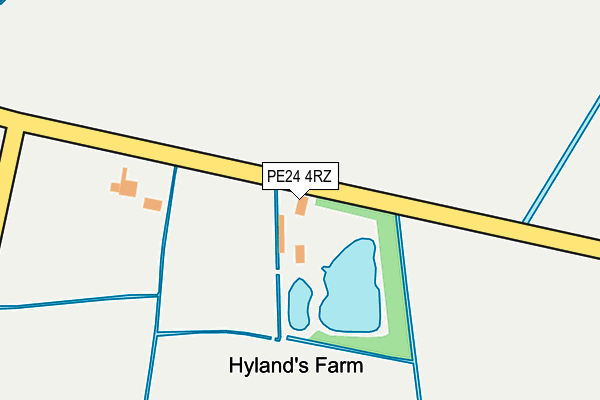
PE24 4RZ is located in the Croft electoral ward, within the local authority district of East Lindsey and the English Parliamentary constituency of Boston and Skegness. The Sub Integrated Care Board (ICB) Location is NHS Lincolnshire ICB - 71E and the police force is Lincolnshire. This postcode has been in use since January 1980.


GetTheData
Source: OS OpenMap – Local (Ordnance Survey)
Source: OS VectorMap District (Ordnance Survey)
Licence: Open Government Licence (requires attribution)
| Easting | 552156 |
| Northing | 362279 |
| Latitude | 53.135976 |
| Longitude | 0.273048 |
GetTheData
Source: Open Postcode Geo
Licence: Open Government Licence
| Country | England |
| Postcode District | PE24 |
| ➜ PE24 open data dashboard ➜ See where PE24 is on a map | |
GetTheData
Source: Land Registry Price Paid Data
Licence: Open Government Licence
Elevation or altitude of PE24 4RZ as distance above sea level:
| Metres | Feet | |
|---|---|---|
| Elevation | 0m | 0ft |
Elevation is measured from the approximate centre of the postcode, to the nearest point on an OS contour line from OS Terrain 50, which has contour spacing of ten vertical metres.
➜ How high above sea level am I? Find the elevation of your current position using your device's GPS.
GetTheData
Source: Open Postcode Elevation
Licence: Open Government Licence
| Ward | Croft |
| Constituency | Boston And Skegness |
GetTheData
Source: ONS Postcode Database
Licence: Open Government Licence
| Demand Responsive Area | Croft | 1,376m |
| Low Road (Croft Bank) | Croft | 1,450m |
| Low Road (Croft Bank) | Croft | 1,451m |
| The Wigwam (Church Lane) | Croft | 1,470m |
| The Wigwam (Church Lane) | Croft | 1,479m |
| Havenhouse Station | 2.4km |
| Skegness Station | 4.2km |
| Wainfleet Station | 4.3km |
GetTheData
Source: NaPTAN
Licence: Open Government Licence
| Percentage of properties with Next Generation Access | 100.0% |
| Percentage of properties with Superfast Broadband | 0.0% |
| Percentage of properties with Ultrafast Broadband | 0.0% |
| Percentage of properties with Full Fibre Broadband | 0.0% |
Superfast Broadband is between 30Mbps and 300Mbps
Ultrafast Broadband is > 300Mbps
| Percentage of properties unable to receive 2Mbps | 0.0% |
| Percentage of properties unable to receive 5Mbps | 0.0% |
| Percentage of properties unable to receive 10Mbps | 0.0% |
| Percentage of properties unable to receive 30Mbps | 100.0% |
GetTheData
Source: Ofcom
Licence: Ofcom Terms of Use (requires attribution)
GetTheData
Source: ONS Postcode Database
Licence: Open Government Licence


➜ Get more ratings from the Food Standards Agency
GetTheData
Source: Food Standards Agency
Licence: FSA terms & conditions
| Last Collection | |||
|---|---|---|---|
| Location | Mon-Fri | Sat | Distance |
| Lumley Road-lloyds Bank | 17:30 | 11:45 | 4,514m |
| South Parade | 17:30 | 11:45 | 4,734m |
GetTheData
Source: Dracos
Licence: Creative Commons Attribution-ShareAlike
| Facility | Distance |
|---|---|
| Burgh Le Marsh Playing Fields Marsh Lane, Burgh Le Marsh Grass Pitches | 2.7km |
| Elms Golf Centre (Closed) Croft Bank, Croft, Skegness Golf | 3km |
| Skegness Town Fc (Vertigo Stadium) Wainfleet Road, Skegness Grass Pitches | 3.4km |
GetTheData
Source: Active Places
Licence: Open Government Licence
| School | Phase of Education | Distance |
|---|---|---|
| The St Peter and St Paul C of E Primary School Wainfleet Road, Burgh-le-Marsh, Skegness, PE24 5ED | Primary | 3.5km |
| The Wainfleet Magdalen Church of England/Methodist School Magdalen Road, Wainfleet, Skegness, PE24 4DD | Primary | 4.1km |
| The Richmond School, Skegness Richmond Drive, Skegness, PE25 3SH | Primary | 4.1km |
GetTheData
Source: Edubase
Licence: Open Government Licence
| Risk of PE24 4RZ flooding from rivers and sea | Low |
| ➜ PE24 4RZ flood map | |
GetTheData
Source: Open Flood Risk by Postcode
Licence: Open Government Licence
The below table lists the International Territorial Level (ITL) codes (formerly Nomenclature of Territorial Units for Statistics (NUTS) codes) and Local Administrative Units (LAU) codes for PE24 4RZ:
| ITL 1 Code | Name |
|---|---|
| TLF | East Midlands (England) |
| ITL 2 Code | Name |
| TLF3 | Lincolnshire |
| ITL 3 Code | Name |
| TLF30 | Lincolnshire CC |
| LAU 1 Code | Name |
| E07000137 | East Lindsey |
GetTheData
Source: ONS Postcode Directory
Licence: Open Government Licence
The below table lists the Census Output Area (OA), Lower Layer Super Output Area (LSOA), and Middle Layer Super Output Area (MSOA) for PE24 4RZ:
| Code | Name | |
|---|---|---|
| OA | E00132222 | |
| LSOA | E01026056 | East Lindsey 017A |
| MSOA | E02005440 | East Lindsey 017 |
GetTheData
Source: ONS Postcode Directory
Licence: Open Government Licence
| PE24 4SB | Low Road | 656m |
| PE24 4SD | Low Road | 900m |
| PE24 4RY | Pinchbeck Lane | 966m |
| PE24 4RL | Croft Bank | 974m |
| PE24 4RQ | Low Road | 1331m |
| PE24 5AE | Sykes Corner | 1364m |
| PE24 4RU | Church Lane | 1390m |
| PE24 4SX | Sycamore Close | 1393m |
| PE24 4RJ | Croft Bank | 1394m |
| PE24 4RR | Church Lane | 1449m |
GetTheData
Source: Open Postcode Geo; Land Registry Price Paid Data
Licence: Open Government Licence