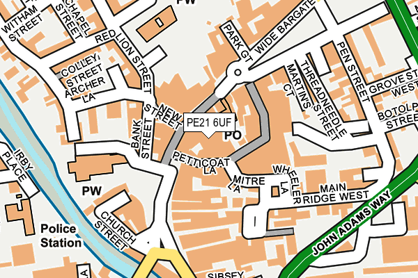
PE21 6UF is located in the Trinity electoral ward, within the local authority district of Boston and the English Parliamentary constituency of Boston and Skegness. The Sub Integrated Care Board (ICB) Location is NHS Lincolnshire ICB - 71E and the police force is Lincolnshire. This postcode has been in use since June 2000.


GetTheData
Source: OS OpenMap – Local (Ordnance Survey)
Source: OS VectorMap District (Ordnance Survey)
Licence: Open Government Licence (requires attribution)
| Easting | 532852 |
| Northing | 344218 |
| Latitude | 52.978851 |
| Longitude | -0.022761 |
GetTheData
Source: Open Postcode Geo
Licence: Open Government Licence
| Country | England |
| Postcode District | PE21 |
| ➜ PE21 open data dashboard ➜ See where PE21 is on a map ➜ Where is Boston? | |
GetTheData
Source: Land Registry Price Paid Data
Licence: Open Government Licence
Elevation or altitude of PE21 6UF as distance above sea level:
| Metres | Feet | |
|---|---|---|
| Elevation | 0m | 0ft |
Elevation is measured from the approximate centre of the postcode, to the nearest point on an OS contour line from OS Terrain 50, which has contour spacing of ten vertical metres.
➜ How high above sea level am I? Find the elevation of your current position using your device's GPS.
GetTheData
Source: Open Postcode Elevation
Licence: Open Government Licence
| Ward | Trinity |
| Constituency | Boston And Skegness |
GetTheData
Source: ONS Postcode Database
Licence: Open Government Licence
| January 2024 | Drugs | On or near Parking Area | 382m |
| December 2023 | Anti-social behaviour | On or near Parking Area | 382m |
| November 2023 | Other theft | On or near Parking Area | 282m |
| ➜ Get more crime data in our Crime section | |||
GetTheData
Source: data.police.uk
Licence: Open Government Licence
| Interchange (Wide Bargate) | Boston | 110m |
| Interchange (Wide Bargate) | Boston | 125m |
| Interchange (Wide Bargate) | Boston | 141m |
| Fish Hill (Market Place) | Boston | 148m |
| Fish Hill (Market Place) | Boston | 165m |
| Boston Station | 0.6km |
GetTheData
Source: NaPTAN
Licence: Open Government Licence
GetTheData
Source: ONS Postcode Database
Licence: Open Government Licence


➜ Get more ratings from the Food Standards Agency
GetTheData
Source: Food Standards Agency
Licence: FSA terms & conditions
| Last Collection | |||
|---|---|---|---|
| Location | Mon-Fri | Sat | Distance |
| Boston Post Office | 18:15 | 12:30 | 133m |
| Market Place | 18:00 | 12:45 | 144m |
| High Street | 18:00 | 12:45 | 241m |
GetTheData
Source: Dracos
Licence: Creative Commons Attribution-ShareAlike
| Facility | Distance |
|---|---|
| Central Park Boston Norfolk Street, Boston Outdoor Tennis Courts, Grass Pitches | 304m |
| York Street Stadium York Street, Boston Grass Pitches | 350m |
| The Workhouse Gymnasium Maud Street, Boston Health and Fitness Gym, Studio | 386m |
GetTheData
Source: Active Places
Licence: Open Government Licence
| School | Phase of Education | Distance |
|---|---|---|
| The Boston Grammar School South End, Boston, PE21 6JY | Secondary | 510m |
| Boston Pioneers Free School Academy Fydell Crescent, Boston, PE21 8SS | Primary | 510m |
| Carlton Road Academy Carlton Road, Boston, PE21 8QX | Primary | 746m |
GetTheData
Source: Edubase
Licence: Open Government Licence
| Risk of PE21 6UF flooding from rivers and sea | Low |
| ➜ PE21 6UF flood map | |
GetTheData
Source: Open Flood Risk by Postcode
Licence: Open Government Licence
The below table lists the International Territorial Level (ITL) codes (formerly Nomenclature of Territorial Units for Statistics (NUTS) codes) and Local Administrative Units (LAU) codes for PE21 6UF:
| ITL 1 Code | Name |
|---|---|
| TLF | East Midlands (England) |
| ITL 2 Code | Name |
| TLF3 | Lincolnshire |
| ITL 3 Code | Name |
| TLF30 | Lincolnshire CC |
| LAU 1 Code | Name |
| E07000136 | Boston |
GetTheData
Source: ONS Postcode Directory
Licence: Open Government Licence
The below table lists the Census Output Area (OA), Lower Layer Super Output Area (LSOA), and Middle Layer Super Output Area (MSOA) for PE21 6UF:
| Code | Name | |
|---|---|---|
| OA | E00132064 | |
| LSOA | E01026025 | Boston 003C |
| MSOA | E02005419 | Boston 003 |
GetTheData
Source: ONS Postcode Directory
Licence: Open Government Licence
| PE21 6EE | Strait Bargate | 30m |
| PE21 6EB | Mitre Lane | 46m |
| PE21 6QY | Wide Bargate | 64m |
| PE21 6LS | Market Place | 78m |
| PE21 6QX | Pescod Square | 85m |
| PE21 6DY | Market Place | 104m |
| PE21 6EU | Dolphin Lane | 107m |
| PE21 6NA | Church Close | 114m |
| PE21 6RA | Pump Square | 129m |
| PE21 6EH | Market Place | 140m |
GetTheData
Source: Open Postcode Geo; Land Registry Price Paid Data
Licence: Open Government Licence