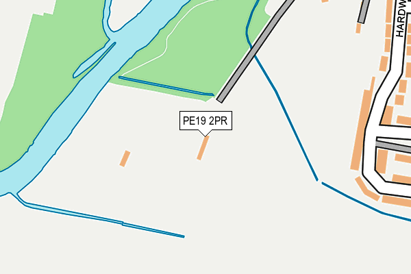
PE19 2PR is located in the St Neots Eynesbury electoral ward, within the local authority district of Huntingdonshire and the English Parliamentary constituency of Huntingdon. The Sub Integrated Care Board (ICB) Location is NHS Cambridgeshire and Peterborough ICB - 06H and the police force is Cambridgeshire. This postcode has been in use since June 2000.


GetTheData
Source: OS OpenMap – Local (Ordnance Survey)
Source: OS VectorMap District (Ordnance Survey)
Licence: Open Government Licence (requires attribution)
| Easting | 517971 |
| Northing | 259379 |
| Latitude | 52.219998 |
| Longitude | -0.274499 |
GetTheData
Source: Open Postcode Geo
Licence: Open Government Licence
| Country | England |
| Postcode District | PE19 |
| ➜ PE19 open data dashboard ➜ See where PE19 is on a map | |
GetTheData
Source: Land Registry Price Paid Data
Licence: Open Government Licence
Elevation or altitude of PE19 2PR as distance above sea level:
| Metres | Feet | |
|---|---|---|
| Elevation | 20m | 66ft |
Elevation is measured from the approximate centre of the postcode, to the nearest point on an OS contour line from OS Terrain 50, which has contour spacing of ten vertical metres.
➜ How high above sea level am I? Find the elevation of your current position using your device's GPS.
GetTheData
Source: Open Postcode Elevation
Licence: Open Government Licence
| Ward | St Neots Eynesbury |
| Constituency | Huntingdon |
GetTheData
Source: ONS Postcode Database
Licence: Open Government Licence
| October 2023 | Anti-social behaviour | On or near Parking Area | 242m |
| August 2023 | Other theft | On or near Parking Area | 242m |
| August 2023 | Bicycle theft | On or near Parking Area | 242m |
| ➜ Get more crime data in our Crime section | |||
GetTheData
Source: data.police.uk
Licence: Open Government Licence
| Ferrars Avenue (Hardwick Road) | Eynesbury | 309m |
| Ferrars Avenue (Hardwick Road) | Eynesbury | 322m |
| Hardwick Road | Eynesbury | 381m |
| Hardwick Road | Eynesbury | 389m |
| Church (Montagu Street) | Eynesbury | 576m |
| St Neots Station | 2.3km |
GetTheData
Source: NaPTAN
Licence: Open Government Licence
GetTheData
Source: ONS Postcode Database
Licence: Open Government Licence


➜ Get more ratings from the Food Standards Agency
GetTheData
Source: Food Standards Agency
Licence: FSA terms & conditions
| Last Collection | |||
|---|---|---|---|
| Location | Mon-Fri | Sat | Distance |
| Hardwick Road | 17:30 | 12:00 | 240m |
| Montague Square | 17:30 | 12:00 | 475m |
| Eynesbury Post Office | 17:30 | 12:00 | 657m |
GetTheData
Source: Dracos
Licence: Creative Commons Attribution-ShareAlike
| Facility | Distance |
|---|---|
| Eynesbury Rovers Football Club Hall Road, Eynesbury, St. Neots Grass Pitches | 422m |
| St. Neots & District Indoor Bowls Club River Road, Eaton Ford, St. Neots Indoor Bowls | 559m |
| Ernulf Academy Barford Road, Eynesbury, St. Neots Sports Hall, Grass Pitches, Outdoor Tennis Courts, Artificial Grass Pitch | 562m |
GetTheData
Source: Active Places
Licence: Open Government Licence
| School | Phase of Education | Distance |
|---|---|---|
| Ernulf Academy Barford Road, St. Neots, PE19 2SH | Secondary | 562m |
| Eynesbury CofE C Primary School Montagu Street, Eynesbury, St Neots, PE19 2TD | Primary | 598m |
| Middlefield Primary Academy Andrew Road, Eynesbury, St Neots, PE19 2QE | Primary | 968m |
GetTheData
Source: Edubase
Licence: Open Government Licence
| Risk of PE19 2PR flooding from rivers and sea | High |
| ➜ PE19 2PR flood map | |
GetTheData
Source: Open Flood Risk by Postcode
Licence: Open Government Licence
The below table lists the International Territorial Level (ITL) codes (formerly Nomenclature of Territorial Units for Statistics (NUTS) codes) and Local Administrative Units (LAU) codes for PE19 2PR:
| ITL 1 Code | Name |
|---|---|
| TLH | East |
| ITL 2 Code | Name |
| TLH1 | East Anglia |
| ITL 3 Code | Name |
| TLH12 | Cambridgeshire CC |
| LAU 1 Code | Name |
| E07000011 | Huntingdonshire |
GetTheData
Source: ONS Postcode Directory
Licence: Open Government Licence
The below table lists the Census Output Area (OA), Lower Layer Super Output Area (LSOA), and Middle Layer Super Output Area (MSOA) for PE19 2PR:
| Code | Name | |
|---|---|---|
| OA | E00091743 | |
| LSOA | E01018185 | Huntingdonshire 021E |
| MSOA | E02003773 | Huntingdonshire 021 |
GetTheData
Source: ONS Postcode Directory
Licence: Open Government Licence
| PE19 2UF | Hardwick Road | 218m |
| PE19 2UE | Hardwick Road | 283m |
| PE19 2UG | Hardwick Road | 304m |
| PE19 2UL | Coneygeare Court | 307m |
| PE19 2UD | Hardwick Road | 367m |
| PE19 2UJ | Linley Road | 372m |
| PE19 2SQ | The Broad Walk | 375m |
| PE19 2UH | Caldecote Road | 401m |
| PE19 2UA | Lansbury Close | 418m |
| PE19 2SG | The Broad Walk | 433m |
GetTheData
Source: Open Postcode Geo; Land Registry Price Paid Data
Licence: Open Government Licence