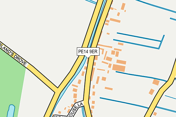
PE14 9ER is located in the Upwell & Delph electoral ward, within the local authority district of King's Lynn and West Norfolk and the English Parliamentary constituency of South West Norfolk. The Sub Integrated Care Board (ICB) Location is NHS Norfolk and Waveney ICB - 26A and the police force is Norfolk. This postcode has been in use since January 1980.


GetTheData
Source: OS OpenMap – Local (Ordnance Survey)
Source: OS VectorMap District (Ordnance Survey)
Licence: Open Government Licence (requires attribution)
| Easting | 549583 |
| Northing | 301668 |
| Latitude | 52.592231 |
| Longitude | 0.206807 |
GetTheData
Source: Open Postcode Geo
Licence: Open Government Licence
| Country | England |
| Postcode District | PE14 |
| ➜ PE14 open data dashboard ➜ See where PE14 is on a map ➜ Where is Upwell? | |
GetTheData
Source: Land Registry Price Paid Data
Licence: Open Government Licence
Elevation or altitude of PE14 9ER as distance above sea level:
| Metres | Feet | |
|---|---|---|
| Elevation | 0m | 0ft |
Elevation is measured from the approximate centre of the postcode, to the nearest point on an OS contour line from OS Terrain 50, which has contour spacing of ten vertical metres.
➜ How high above sea level am I? Find the elevation of your current position using your device's GPS.
GetTheData
Source: Open Postcode Elevation
Licence: Open Government Licence
| Ward | Upwell & Delph |
| Constituency | South West Norfolk |
GetTheData
Source: ONS Postcode Database
Licence: Open Government Licence
| May 2022 | Burglary | On or near School Road | 93m |
| May 2022 | Burglary | On or near School Road | 93m |
| April 2022 | Criminal damage and arson | On or near School Road | 93m |
| ➜ Get more crime data in our Crime section | |||
GetTheData
Source: data.police.uk
Licence: Open Government Licence
| School (School Road) | Upwell | 297m |
| School (School Road) | Upwell | 334m |
| Baptist Road (School Road) | Upwell | 452m |
| Baptist Road (Dovecote Road) | Upwell | 498m |
| New Bridge Road (Town Street) | Upwell | 716m |
GetTheData
Source: NaPTAN
Licence: Open Government Licence
GetTheData
Source: ONS Postcode Database
Licence: Open Government Licence


➜ Get more ratings from the Food Standards Agency
GetTheData
Source: Food Standards Agency
Licence: FSA terms & conditions
| Last Collection | |||
|---|---|---|---|
| Location | Mon-Fri | Sat | Distance |
| Shrewness Green Upwell | 17:00 | 09:30 | 30m |
| New Bridge Upwell | 17:00 | 09:30 | 643m |
| Bull Bridge Upwell | 17:00 | 09:30 | 1,149m |
GetTheData
Source: Dracos
Licence: Creative Commons Attribution-ShareAlike
| Facility | Distance |
|---|---|
| Upwell Playing Field New Road, Upwell, Wisbech Grass Pitches | 1.3km |
| Three Holes Playing Field Squires Drove, Squires Drove, Three Holes, Wisbech Grass Pitches | 2km |
| Outwell Playing Field Wisbech Road, Outwell Grass Pitches | 3km |
GetTheData
Source: Active Places
Licence: Open Government Licence
| School | Phase of Education | Distance |
|---|---|---|
| Upwell Academy School Road, Upwell, Wisbech, PE14 9EW | Primary | 304m |
| Beaupre Community Primary School Church Drove, Outwell, Wisbech, PE14 8RH | Primary | 2.6km |
| Friday Bridge Community Primary School Maltmas Drove, Friday Bridge, Wisbech, PE14 0HW | Primary | 4.3km |
GetTheData
Source: Edubase
Licence: Open Government Licence
| Risk of PE14 9ER flooding from rivers and sea | Medium |
| ➜ PE14 9ER flood map | |
GetTheData
Source: Open Flood Risk by Postcode
Licence: Open Government Licence
The below table lists the International Territorial Level (ITL) codes (formerly Nomenclature of Territorial Units for Statistics (NUTS) codes) and Local Administrative Units (LAU) codes for PE14 9ER:
| ITL 1 Code | Name |
|---|---|
| TLH | East |
| ITL 2 Code | Name |
| TLH1 | East Anglia |
| ITL 3 Code | Name |
| TLH16 | North and West Norfolk |
| LAU 1 Code | Name |
| E07000146 | King's Lynn and West Norfolk |
GetTheData
Source: ONS Postcode Directory
Licence: Open Government Licence
The below table lists the Census Output Area (OA), Lower Layer Super Output Area (LSOA), and Middle Layer Super Output Area (MSOA) for PE14 9ER:
| Code | Name | |
|---|---|---|
| OA | E00135787 | |
| LSOA | E01026715 | King's Lynn and West Norfolk 016D |
| MSOA | E02005566 | King's Lynn and West Norfolk 016 |
GetTheData
Source: ONS Postcode Directory
Licence: Open Government Licence
| PE14 9EW | School Road | 239m |
| PE14 9ET | Workhouse Lane | 274m |
| PE14 9ES | School Road | 291m |
| PE14 9EY | Baptist Road | 374m |
| PE14 9HA | Broad Drove | 468m |
| PE14 9DU | Baptist Road | 477m |
| PE14 9DR | March Riverside | 566m |
| PE14 9DW | New Bridge | 640m |
| PE14 9DP | Hall Bridge Road | 653m |
| PE14 9DT | New Bridge Road | 655m |
GetTheData
Source: Open Postcode Geo; Land Registry Price Paid Data
Licence: Open Government Licence