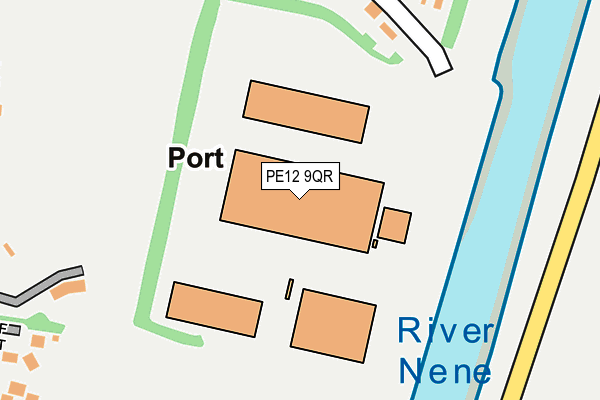
PE12 9QR is located in the Sutton Bridge electoral ward, within the local authority district of South Holland and the English Parliamentary constituency of South Holland and The Deepings. The Sub Integrated Care Board (ICB) Location is NHS Lincolnshire ICB - 71E and the police force is Lincolnshire. This postcode has been in use since December 1999.


GetTheData
Source: OS OpenMap – Local (Ordnance Survey)
Source: OS VectorMap District (Ordnance Survey)
Licence: Open Government Licence (requires attribution)
| Easting | 548381 |
| Northing | 322203 |
| Latitude | 52.777027 |
| Longitude | 0.198323 |
GetTheData
Source: Open Postcode Geo
Licence: Open Government Licence
| Country | England |
| Postcode District | PE12 |
| ➜ PE12 open data dashboard ➜ See where PE12 is on a map ➜ Where is Sutton Bridge? | |
GetTheData
Source: Land Registry Price Paid Data
Licence: Open Government Licence
Elevation or altitude of PE12 9QR as distance above sea level:
| Metres | Feet | |
|---|---|---|
| Elevation | 10m | 33ft |
Elevation is measured from the approximate centre of the postcode, to the nearest point on an OS contour line from OS Terrain 50, which has contour spacing of ten vertical metres.
➜ How high above sea level am I? Find the elevation of your current position using your device's GPS.
GetTheData
Source: Open Postcode Elevation
Licence: Open Government Licence
| Ward | Sutton Bridge |
| Constituency | South Holland And The Deepings |
GetTheData
Source: ONS Postcode Database
Licence: Open Government Licence
| June 2022 | Anti-social behaviour | On or near Golf Court | 339m |
| December 2021 | Other theft | On or near Golf Court | 339m |
| December 2021 | Other theft | On or near Golf Court | 339m |
| ➜ Get more crime data in our Crime section | |||
GetTheData
Source: data.police.uk
Licence: Open Government Licence
| Bridge Hotel (Bridge Road) | Sutton Bridge | 1,076m |
| Village Hall (Bridge Road) | Sutton Bridge | 1,089m |
| Demand Responsive Area | Sutton Bridge | 1,099m |
| Village Hall (Bridge Road) | Sutton Bridge | 1,105m |
| Bridge Hotel (Bridge Road) | Sutton Bridge | 1,122m |
GetTheData
Source: NaPTAN
Licence: Open Government Licence
GetTheData
Source: ONS Postcode Database
Licence: Open Government Licence


➜ Get more ratings from the Food Standards Agency
GetTheData
Source: Food Standards Agency
Licence: FSA terms & conditions
| Last Collection | |||
|---|---|---|---|
| Location | Mon-Fri | Sat | Distance |
| Wrights Lane | 15:45 | 09:30 | 859m |
| Allenbys Chase | 15:45 | 09:45 | 1,133m |
| Sutton Bridge Post Office | 17:00 | 12:00 | 1,168m |
GetTheData
Source: Dracos
Licence: Creative Commons Attribution-ShareAlike
| Facility | Distance |
|---|---|
| Sutton Bridge Golf Club New Road, Sutton Bridge, Spalding Golf | 248m |
| Sutton Bridge Memorial Park Bridge Road, Sutton Bridge, Spalding Grass Pitches | 1.2km |
| Peele Leisure Centre Little London, Long Sutton, Spalding Sports Hall, Health and Fitness Gym, Studio | 4.9km |
GetTheData
Source: Active Places
Licence: Open Government Licence
| School | Phase of Education | Distance |
|---|---|---|
| Sutton Bridge Westmere Community Primary School Anne Road, Sutton Bridge, Spalding, PE12 9TB | Primary | 1.1km |
| Walpole Cross Keys Primary School 28 Sutton Road, Walpole Cross Keys, King's Lynn, PE34 4HD | Primary | 4.4km |
| University Academy Long Sutton 84 Little London, Long Sutton, Spalding, PE12 9LF | Secondary | 5km |
GetTheData
Source: Edubase
Licence: Open Government Licence
| Risk of PE12 9QR flooding from rivers and sea | Low |
| ➜ PE12 9QR flood map | |
GetTheData
Source: Open Flood Risk by Postcode
Licence: Open Government Licence
The below table lists the International Territorial Level (ITL) codes (formerly Nomenclature of Territorial Units for Statistics (NUTS) codes) and Local Administrative Units (LAU) codes for PE12 9QR:
| ITL 1 Code | Name |
|---|---|
| TLF | East Midlands (England) |
| ITL 2 Code | Name |
| TLF3 | Lincolnshire |
| ITL 3 Code | Name |
| TLF30 | Lincolnshire CC |
| LAU 1 Code | Name |
| E07000140 | South Holland |
GetTheData
Source: ONS Postcode Directory
Licence: Open Government Licence
The below table lists the Census Output Area (OA), Lower Layer Super Output Area (LSOA), and Middle Layer Super Output Area (MSOA) for PE12 9QR:
| Code | Name | |
|---|---|---|
| OA | E00133465 | |
| LSOA | E01026278 | South Holland 008E |
| MSOA | E02005472 | South Holland 008 |
GetTheData
Source: ONS Postcode Directory
Licence: Open Government Licence
| PE12 9QB | Petts Lane | 288m |
| PE12 9QN | Golf Court | 332m |
| PE12 9QP | Carnoustie Court | 391m |
| PE12 9QA | New Road | 397m |
| PE12 9QH | West Bank | 609m |
| PE12 9RQ | New Road | 648m |
| PE12 9RH | Wrights Lane | 697m |
| PE12 9QE | New Road | 784m |
| PE12 9TZ | Nene Meadows | 802m |
| PE12 9TY | Nene Meadows | 883m |
GetTheData
Source: Open Postcode Geo; Land Registry Price Paid Data
Licence: Open Government Licence