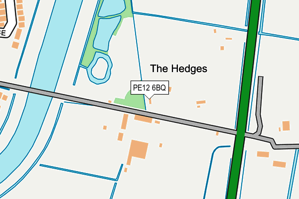
PE12 6BQ is located in the Spalding St Mary's electoral ward, within the local authority district of South Holland and the English Parliamentary constituency of South Holland and The Deepings. The Sub Integrated Care Board (ICB) Location is NHS Lincolnshire ICB - 71E and the police force is Lincolnshire. This postcode has been in use since March 2008.


GetTheData
Source: OS OpenMap – Local (Ordnance Survey)
Source: OS VectorMap District (Ordnance Survey)
Licence: Open Government Licence (requires attribution)
| Easting | 526314 |
| Northing | 321631 |
| Latitude | 52.777517 |
| Longitude | -0.128824 |
GetTheData
Source: Open Postcode Geo
Licence: Open Government Licence
| Country | England |
| Postcode District | PE12 |
| ➜ PE12 open data dashboard ➜ See where PE12 is on a map | |
GetTheData
Source: Land Registry Price Paid Data
Licence: Open Government Licence
Elevation or altitude of PE12 6BQ as distance above sea level:
| Metres | Feet | |
|---|---|---|
| Elevation | 0m | 0ft |
Elevation is measured from the approximate centre of the postcode, to the nearest point on an OS contour line from OS Terrain 50, which has contour spacing of ten vertical metres.
➜ How high above sea level am I? Find the elevation of your current position using your device's GPS.
GetTheData
Source: Open Postcode Elevation
Licence: Open Government Licence
| Ward | Spalding St Mary's |
| Constituency | South Holland And The Deepings |
GetTheData
Source: ONS Postcode Database
Licence: Open Government Licence
| April 2022 | Violence and sexual offences | On or near Childers' North Drove | 455m |
| April 2022 | Other theft | On or near Childers' North Drove | 455m |
| March 2022 | Violence and sexual offences | On or near Childers' North Drove | 455m |
| ➜ Get more crime data in our Crime section | |||
GetTheData
Source: data.police.uk
Licence: Open Government Licence
| Clarence Gardens (Holyrood Walk) | Spalding | 967m |
| Clay Lake Lane School (Clay Lake Lane) | Spalding | 1,013m |
| Clay Lake Lane School (Clay Lake Lane) | Spalding | 1,028m |
| Balmoral Avenue (Holyrood Walk) | Spalding | 1,050m |
| Mallard Road (Weston Hills Road) | Low Fulney | 1,197m |
| Spalding Station | 2.3km |
GetTheData
Source: NaPTAN
Licence: Open Government Licence
GetTheData
Source: ONS Postcode Database
Licence: Open Government Licence


➜ Get more ratings from the Food Standards Agency
GetTheData
Source: Food Standards Agency
Licence: FSA terms & conditions
| Last Collection | |||
|---|---|---|---|
| Location | Mon-Fri | Sat | Distance |
| Horseshoe Road Bridge | 16:00 | 11:00 | 1,553m |
| Westlode Street | 17:45 | 12:00 | 2,000m |
| Springfields | 17:40 | 12:00 | 2,400m |
GetTheData
Source: Dracos
Licence: Creative Commons Attribution-ShareAlike
| Facility | Distance |
|---|---|
| Tyrell's Yard Fulney Drove, Spalding Grass Pitches | 999m |
| Spalding & District Squash Club Holyrood Walk, Spalding Squash Courts | 1km |
| Spalding Town Tennis Club Holyrood Walk, Spalding Outdoor Tennis Courts | 1km |
GetTheData
Source: Active Places
Licence: Open Government Licence
| School | Phase of Education | Distance |
|---|---|---|
| Springwell Alternative Academy Spalding Matmore Gate, Spalding, PE11 2PN | Not applicable | 970m |
| Spalding Academy Neville Avenue, Spalding, PE11 2EJ | Secondary | 1.1km |
| Spalding Parish Church of England Day School Clay Lake, Spalding, PE11 2QG | Primary | 1.1km |
GetTheData
Source: Edubase
Licence: Open Government Licence
| Risk of PE12 6BQ flooding from rivers and sea | Low |
| ➜ PE12 6BQ flood map | |
GetTheData
Source: Open Flood Risk by Postcode
Licence: Open Government Licence
The below table lists the International Territorial Level (ITL) codes (formerly Nomenclature of Territorial Units for Statistics (NUTS) codes) and Local Administrative Units (LAU) codes for PE12 6BQ:
| ITL 1 Code | Name |
|---|---|
| TLF | East Midlands (England) |
| ITL 2 Code | Name |
| TLF3 | Lincolnshire |
| ITL 3 Code | Name |
| TLF30 | Lincolnshire CC |
| LAU 1 Code | Name |
| E07000140 | South Holland |
GetTheData
Source: ONS Postcode Directory
Licence: Open Government Licence
The below table lists the Census Output Area (OA), Lower Layer Super Output Area (LSOA), and Middle Layer Super Output Area (MSOA) for PE12 6BQ:
| Code | Name | |
|---|---|---|
| OA | E00133423 | |
| LSOA | E01026268 | South Holland 007A |
| MSOA | E02005471 | South Holland 007 |
GetTheData
Source: ONS Postcode Directory
Licence: Open Government Licence
| PE12 6EW | Rangell Gate | 461m |
| PE11 2PT | Heathfield Avenue | 657m |
| PE11 2FZ | Swift Court | 712m |
| PE11 2FQ | Riverside Park | 715m |
| PE12 6AY | Saxon Close | 732m |
| PE11 2PS | Thornton Road | 741m |
| PE12 6BH | Pecks Drove West | 748m |
| PE12 6UY | Hutton Close | 758m |
| PE12 6AX | Saxon Close | 758m |
| PE11 2FX | Kingfisher Court | 761m |
GetTheData
Source: Open Postcode Geo; Land Registry Price Paid Data
Licence: Open Government Licence