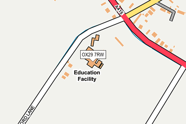
OX29 7RW is located in the Standlake, Aston and Stanton Harcourt electoral ward, within the local authority district of West Oxfordshire and the English Parliamentary constituency of Witney. The Sub Integrated Care Board (ICB) Location is NHS Buckinghamshire, Oxfordshire and Berkshire West ICB - 10Q and the police force is Thames Valley. This postcode has been in use since June 2001.


GetTheData
Source: OS OpenMap – Local (Ordnance Survey)
Source: OS VectorMap District (Ordnance Survey)
Licence: Open Government Licence (requires attribution)
| Easting | 439192 |
| Northing | 202626 |
| Latitude | 51.720995 |
| Longitude | -1.434044 |
GetTheData
Source: Open Postcode Geo
Licence: Open Government Licence
| Country | England |
| Postcode District | OX29 |
| ➜ OX29 open data dashboard ➜ See where OX29 is on a map ➜ Where is Standlake? | |
GetTheData
Source: Land Registry Price Paid Data
Licence: Open Government Licence
Elevation or altitude of OX29 7RW as distance above sea level:
| Metres | Feet | |
|---|---|---|
| Elevation | 70m | 230ft |
Elevation is measured from the approximate centre of the postcode, to the nearest point on an OS contour line from OS Terrain 50, which has contour spacing of ten vertical metres.
➜ How high above sea level am I? Find the elevation of your current position using your device's GPS.
GetTheData
Source: Open Postcode Elevation
Licence: Open Government Licence
| Ward | Standlake, Aston And Stanton Harcourt |
| Constituency | Witney |
GetTheData
Source: ONS Postcode Database
Licence: Open Government Licence
| October 2023 | Violence and sexual offences | On or near Petrol Station | 216m |
| August 2023 | Violence and sexual offences | On or near Petrol Station | 216m |
| August 2023 | Violence and sexual offences | On or near Petrol Station | 216m |
| ➜ Get more crime data in our Crime section | |||
GetTheData
Source: data.police.uk
Licence: Open Government Licence
| Garage (Abingdon Road) | Standlake | 229m |
| Garage (Abingdon Road) | Standlake | 231m |
| The Black Horse Ph (High Street) | Standlake | 403m |
| The Black Horse Ph (High Street) | Standlake | 413m |
| Martins Lane (Abingdon Road) | Standlake | 668m |
GetTheData
Source: NaPTAN
Licence: Open Government Licence
GetTheData
Source: ONS Postcode Database
Licence: Open Government Licence


➜ Get more ratings from the Food Standards Agency
GetTheData
Source: Food Standards Agency
Licence: FSA terms & conditions
| Last Collection | |||
|---|---|---|---|
| Location | Mon-Fri | Sat | Distance |
| High Street | 16:30 | 08:45 | 490m |
| Standlake Post Office | 16:45 | 08:45 | 806m |
| Abingdon Road Brighthampton | 16:20 | 08:45 | 1,142m |
GetTheData
Source: Dracos
Licence: Creative Commons Attribution-ShareAlike
| Facility | Distance |
|---|---|
| Oxford Downs Cricket Club Abingdon Road, Standlake, Witney Grass Pitches | 814m |
| Standlake C Of E Primary School Church Green, Standlake, Witney Grass Pitches | 1km |
| Lower Windrush Tennis Club Rack End, Standlake Outdoor Tennis Courts | 1.1km |
GetTheData
Source: Active Places
Licence: Open Government Licence
| School | Phase of Education | Distance |
|---|---|---|
| Mulberry Bush School Abingdon Road, Standlake, Witney, OX29 7RW | Not applicable | 4m |
| Standlake Church of England Primary School Standlake, Witney, OX29 7SQ | Primary | 1.1km |
| Longworth Primary School School Close, Longworth, Abingdon, OX13 5EU | Primary | 3.2km |
GetTheData
Source: Edubase
Licence: Open Government Licence
The below table lists the International Territorial Level (ITL) codes (formerly Nomenclature of Territorial Units for Statistics (NUTS) codes) and Local Administrative Units (LAU) codes for OX29 7RW:
| ITL 1 Code | Name |
|---|---|
| TLJ | South East (England) |
| ITL 2 Code | Name |
| TLJ1 | Berkshire, Buckinghamshire and Oxfordshire |
| ITL 3 Code | Name |
| TLJ14 | Oxfordshire CC |
| LAU 1 Code | Name |
| E07000181 | West Oxfordshire |
GetTheData
Source: ONS Postcode Directory
Licence: Open Government Licence
The below table lists the Census Output Area (OA), Lower Layer Super Output Area (LSOA), and Middle Layer Super Output Area (MSOA) for OX29 7RW:
| Code | Name | |
|---|---|---|
| OA | E00146695 | |
| LSOA | E01028802 | West Oxfordshire 015D |
| MSOA | E02006007 | West Oxfordshire 015 |
GetTheData
Source: ONS Postcode Directory
Licence: Open Government Licence
| OX29 7RP | Shifford Lane | 74m |
| OX29 7RL | Abingdon Road | 215m |
| OX29 7RN | Abingdon Road | 427m |
| OX29 7QN | Abingdon Road | 451m |
| OX29 7RT | High Street | 467m |
| OX29 7TJ | Lincoln Farm Park | 493m |
| OX29 7RH | High Street | 519m |
| OX29 7RX | Manor Crescent | 721m |
| OX29 7QB | 771m | |
| OX29 7RY | High Street | 772m |
GetTheData
Source: Open Postcode Geo; Land Registry Price Paid Data
Licence: Open Government Licence