Lower Windrush Tennis Club - Standlake
Lower Windrush Tennis Club is located in Standlake (OX29), and offers Outdoor Tennis Courts.
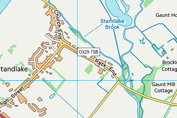
| Address | TENNIS COURTS, Rack End, Standlake, OX29 7SB |
| Car Park | Yes |
| Car Park Capacity | 50 |
| Management Type | Sport Club |
| Management Group | Others |
| Owner Type | Sports Club |
| Owner Group | Sports Club |
| Education Phase | Not applicable |
Facilities
| Status Notes | I court was resurfaced in 2018 |
| Accessibility | Pay and Play |
| Management Type | Sport Club |
| Year Built | 2000 |
| Year Refurbished | 2017 |
| Changing Rooms | No |
| Date Record Created | 28th Dec 2017 |
| Date Record Checked | 18th Sep 2023 |
Opening times
| Access description | Pay and Play |
|---|
| Opening time | 18:00 |
| Closing time | 20:00 |
| Period open for | Thursday |
| |
| Access description | Pay and Play |
|---|
| Opening time | 14:00 |
| Closing time | 16:00 |
| Period open for | Monday |
| |
| Access description | Pay and Play |
|---|
| Opening time | 18:00 |
| Closing time | 20:00 |
| Period open for | Monday |
| |
| Access description | Pay and Play |
|---|
| Opening time | 16:00 |
| Closing time | 18:00 |
| Period open for | Tuesday |
| |
| Access description | Pay and Play |
|---|
| Opening time | 10:00 |
| Closing time | 12:00 |
| Period open for | Wednesday |
| |
| Access description | Pay and Play |
|---|
| Opening time | 16:00 |
| Closing time | 18:00 |
| Period open for | Wednesday |
| |
| Access description | Pay and Play |
|---|
| Opening time | 14:00 |
| Closing time | 16:00 |
| Period open for | Thursday |
| |
| Access description | Pay and Play |
|---|
| Opening time | 16:00 |
| Closing time | 18:00 |
| Period open for | Friday |
| |
| Access description | Pay and Play |
|---|
| Opening time | 13:00 |
| Closing time | 14:00 |
| Period open for | Sunday |
| |
| Access description | Pay and Play |
|---|
| Opening time | 09:00 |
| Closing time | 10:00 |
| Period open for | Saturday |
| |
| Access description | Pay and Play |
|---|
| Opening time | 19:00 |
| Closing time | 21:00 |
| Period open for | Saturday |
Facility specifics
| Floodlit | Yes |
| Overmarked | No |
| Surface Type | Macadam |
Contact
Where is Lower Windrush Tennis Club?
| Sub Building Name | |
| Building Name | TENNIS COURTS |
| Building Number | 0 |
| Dependent Thoroughfare | |
| Thoroughfare Name | RACK END |
| Double Dependent Locality | |
| Dependent Locality | |
| PostTown | STANDLAKE |
| Postcode | OX29 7SB |
Lower Windrush Tennis Club on a map

Lower Windrush Tennis Club geodata
| Easting | 440227 |
| Northing | 203001 |
| Latitude | 51.724293 |
| Longitude | -1.419018 |
| Local Authority Name | West Oxfordshire |
| Local Authority Code | E07000181 |
| Parliamentary Constituency Name | Witney |
| Parliamentary Constituency Code | E14001046 |
| Region Name | South East |
| Region Code | E15000008 |
| Ward Name | Standlake, Aston and Stanton Harcourt |
| Ward Code | E05006645 |
| Output Area Code | E00146698 |
About this data
This data is open data sourced from Active Places Power and licenced under the Active Places Open Data Licence.
| toid | osgb1000000135297694 |
| Created On | 28th Dec 2017 |
| Audited On | 18th Sep 2023 |
| Checked On | 18th Sep 2023 |
