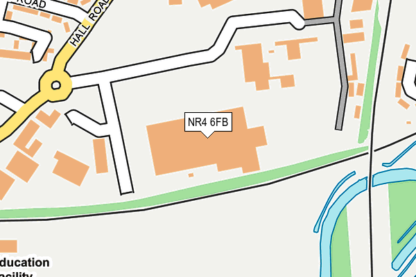
NR4 6FB is located in the Lakenham electoral ward, within the local authority district of Norwich and the English Parliamentary constituency of Norwich South. The Sub Integrated Care Board (ICB) Location is NHS Norfolk and Waveney ICB - 26A and the police force is Norfolk. This postcode has been in use since February 2014.


GetTheData
Source: OS OpenMap – Local (Ordnance Survey)
Source: OS VectorMap District (Ordnance Survey)
Licence: Open Government Licence (requires attribution)
| Easting | 622505 |
| Northing | 305345 |
| Latitude | 52.600331 |
| Longitude | 1.284214 |
GetTheData
Source: Open Postcode Geo
Licence: Open Government Licence
| Country | England |
| Postcode District | NR4 |
| ➜ NR4 open data dashboard ➜ See where NR4 is on a map ➜ Where is Norwich? | |
GetTheData
Source: Land Registry Price Paid Data
Licence: Open Government Licence
Elevation or altitude of NR4 6FB as distance above sea level:
| Metres | Feet | |
|---|---|---|
| Elevation | 10m | 33ft |
Elevation is measured from the approximate centre of the postcode, to the nearest point on an OS contour line from OS Terrain 50, which has contour spacing of ten vertical metres.
➜ How high above sea level am I? Find the elevation of your current position using your device's GPS.
GetTheData
Source: Open Postcode Elevation
Licence: Open Government Licence
| Ward | Lakenham |
| Constituency | Norwich South |
GetTheData
Source: ONS Postcode Database
Licence: Open Government Licence
| June 2022 | Violence and sexual offences | On or near Kirklees | 322m |
| June 2022 | Violence and sexual offences | On or near Kirklees | 322m |
| June 2022 | Violence and sexual offences | On or near Kirklees | 322m |
| ➜ Get more crime data in our Crime section | |||
GetTheData
Source: data.police.uk
Licence: Open Government Licence
| Fountains Road (Hall Road) | Tuckswood | 194m |
| Fountains Road (Hall Road) | Tuckswood | 209m |
| Hall Road | Tuckswood | 275m |
| University Technical College Norfolk (Old Hall Road) | Tuckswood | 327m |
| Bessemer Road (Hall Road) | Tuckswood | 409m |
| Norwich Station | 3.4km |
GetTheData
Source: NaPTAN
Licence: Open Government Licence
GetTheData
Source: ONS Postcode Database
Licence: Open Government Licence


➜ Get more ratings from the Food Standards Agency
GetTheData
Source: Food Standards Agency
Licence: FSA terms & conditions
| Last Collection | |||
|---|---|---|---|
| Location | Mon-Fri | Sat | Distance |
| Fountains Road | 17:30 | 11:00 | 354m |
| Locksley Road | 17:30 | 11:00 | 388m |
| Tesco Harford Bridge | 17:45 | 11:00 | 727m |
GetTheData
Source: Dracos
Licence: Creative Commons Attribution-ShareAlike
| Facility | Distance |
|---|---|
| Youfit (Norwich) Ipswich Road, Norwich Health and Fitness Gym, Swimming Pool, Studio | 369m |
| Harford Park Peterkin Road, Norwich Outdoor Tennis Courts, Grass Pitches, Cycling | 657m |
| The Gym Group (Norwich Hall Road) Hall Road, Norwich Health and Fitness Gym | 863m |
GetTheData
Source: Active Places
Licence: Open Government Licence
| School | Phase of Education | Distance |
|---|---|---|
| University Technical College Norfolk Old Hall Road, Norwich, NR4 6FF | Secondary | 330m |
| Tuckswood Academy and Nursery Tuckswood Centre, Tuckswood, Norwich, NR4 6BP | Primary | 887m |
| Visiting Teacher Service Central Greenwood Centre, Allandale Road, Norwich, NR4 6BP | Not applicable | 935m |
GetTheData
Source: Edubase
Licence: Open Government Licence
The below table lists the International Territorial Level (ITL) codes (formerly Nomenclature of Territorial Units for Statistics (NUTS) codes) and Local Administrative Units (LAU) codes for NR4 6FB:
| ITL 1 Code | Name |
|---|---|
| TLH | East |
| ITL 2 Code | Name |
| TLH1 | East Anglia |
| ITL 3 Code | Name |
| TLH15 | Norwich and East Norfolk |
| LAU 1 Code | Name |
| E07000148 | Norwich |
GetTheData
Source: ONS Postcode Directory
Licence: Open Government Licence
The below table lists the Census Output Area (OA), Lower Layer Super Output Area (LSOA), and Middle Layer Super Output Area (MSOA) for NR4 6FB:
| Code | Name | |
|---|---|---|
| OA | E00136370 | |
| LSOA | E01026821 | Norwich 013F |
| MSOA | E02005596 | Norwich 013 |
GetTheData
Source: ONS Postcode Directory
Licence: Open Government Licence
| NR4 6LN | Fountains Road | 297m |
| NR4 6FF | Yarefield Park | 304m |
| NR4 6LP | Kirklees | 305m |
| NR4 6NQ | Hall Road | 307m |
| NR4 6LL | Barnesdale Road | 341m |
| NR4 6EP | Ipswich Road | 369m |
| NR1 2NY | Theobald Road | 403m |
| NR4 6LW | Fountains Road | 408m |
| NR4 6LF | Locksley Road | 412m |
| NR4 6LS | Bowman Road | 426m |
GetTheData
Source: Open Postcode Geo; Land Registry Price Paid Data
Licence: Open Government Licence