Harford Park - Norwich
Harford Park is located in Norwich (NR4), and offers Outdoor Tennis Courts, Grass Pitches, and Cycling.
| Address | Peterkin Road, Norwich, NR4 6LQ |
| Car Park | Yes |
| Car Park Capacity | 10 |
| Management Type | Local Authority (in house) |
| Management Group | Local Authority |
| Owner Type | Local Authority |
| Owner Group | Local Authority |
| Education Phase | Not applicable |
Facilities
| Accessibility | Pay and Play |
| Management Type | Local Authority (in house) |
| Year Built | 2023 |
| Changing Rooms | No |
| Date Record Created | 26th Jan 2017 |
| Date Record Checked | 18th Aug 2023 |
Opening times
| Access description | Pay and Play |
|---|
| Opening time | 08:00 |
| Closing time | 22:00 |
| Period open for | Every day |
Facility specifics
| Floodlit | Yes |
| Overmarked | No |
| Surface Type | Macadam |
Disabled access
| Disabled Access | Yes |
| Disabled Parking | Yes |
| Finding/Reaching Entrance | Yes |
| Accessibility | Free Public Access |
| Management Type | Local Authority (in house) |
| Changing Rooms | No |
| Date Record Created | 26th Jan 2017 |
| Date Record Checked | 15th Jun 2023 |
| Opening Times | Dawn To Dusk |
Facility specifics
Disabled access
| Disabled Access | Yes |
| Disabled Parking | Yes |
| Finding/Reaching Entrance | Yes |
| Accessibility | Free Public Access |
| Management Type | Local Authority (in house) |
| Year Built | 1999 |
| Changing Rooms | No |
| Date Record Created | 14th Feb 2017 |
| Date Record Checked | 15th Jun 2023 |
| Opening Times | Dawn To Dusk |
Facility specifics
| Degree Of Banking At Middle Of Bends | 1° |
| Degree Of Banking At Middle Of Straights | 1° |
| Floodlit | Yes |
| Overall Width | 6m |
| Surface | Shale |
| Total Length | 73m |
Disabled access
| Disabled Access | Yes |
| Disabled Parking | Yes |
| Finding/Reaching Entrance | Yes |
Contact
Disabled access
Disabled access for Harford Park
| Disabled Access | Yes |
| Disabled Parking | Yes |
| Finding/Reaching Entrance | Yes |
Where is Harford Park?
| Sub Building Name | |
| Building Name | |
| Building Number | 0 |
| Dependent Thoroughfare | |
| Thoroughfare Name | PETERKIN ROAD |
| Double Dependent Locality | |
| Dependent Locality | |
| PostTown | NORWICH |
| Postcode | NR4 6LQ |
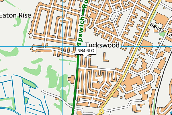
Harford Park on a map

Harford Park geodata
| Easting | 622318.76 |
| Northing | 305975.03 |
| Latitude | 52.606037 |
| Longitude | 1.281869 |
| Local Authority Name | Norwich |
| Local Authority Code | E07000148 |
| Parliamentary Constituency Name | Norwich South |
| Parliamentary Constituency Code | E14000864 |
| Region Name | Eastern |
| Region Code | E15000006 |
| Ward Name | Lakenham |
| Ward Code | E05012905 |
| Output Area Code | E00136363 |
About this data
This data is open data sourced from Active Places Power and licenced under the Active Places Open Data Licence.
| toid | osgb1000008511143 |
| Created On | 26th Jan 2017 |
| Audited On | 15th Jun 2023 |
| Checked On | 18th Aug 2023 |
