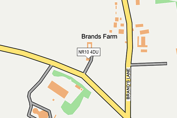
NR10 4DU lies on Reepham Road in Felthorpe, Norwich. NR10 4DU is located in the Horsford and Felthorpe electoral ward, within the local authority district of Broadland and the English Parliamentary constituency of Broadland. The Sub Integrated Care Board (ICB) Location is NHS Norfolk and Waveney ICB - 26A and the police force is Norfolk. This postcode has been in use since January 1980.


GetTheData
Source: OS OpenMap – Local (Ordnance Survey)
Source: OS VectorMap District (Ordnance Survey)
Licence: Open Government Licence (requires attribution)
| Easting | 616545 |
| Northing | 316400 |
| Latitude | 52.701963 |
| Longitude | 1.203606 |
GetTheData
Source: Open Postcode Geo
Licence: Open Government Licence
| Street | Reepham Road |
| Locality | Felthorpe |
| Town/City | Norwich |
| Country | England |
| Postcode District | NR10 |
| ➜ NR10 open data dashboard ➜ See where NR10 is on a map | |
GetTheData
Source: Land Registry Price Paid Data
Licence: Open Government Licence
Elevation or altitude of NR10 4DU as distance above sea level:
| Metres | Feet | |
|---|---|---|
| Elevation | 40m | 131ft |
Elevation is measured from the approximate centre of the postcode, to the nearest point on an OS contour line from OS Terrain 50, which has contour spacing of ten vertical metres.
➜ How high above sea level am I? Find the elevation of your current position using your device's GPS.
GetTheData
Source: Open Postcode Elevation
Licence: Open Government Licence
| Ward | Horsford And Felthorpe |
| Constituency | Broadland |
GetTheData
Source: ONS Postcode Database
Licence: Open Government Licence
| June 2021 | Other theft | On or near Brand'S Lane | 381m |
| ➜ Get more crime data in our Crime section | |||
GetTheData
Source: data.police.uk
Licence: Open Government Licence
| Nash Road (The Street) | Felthorpe | 1,355m |
| Freeland Close (Drewray Drive) | Thorpe Marriott | 1,363m |
| Nash Road (The Street) | Felthorpe | 1,371m |
| Hinks Close (Kingswood Avenue) | Thorpe Marriott | 1,395m |
| Bill Todd Way (Kingswood Avenue) | Thorpe Marriott | 1,446m |
GetTheData
Source: NaPTAN
Licence: Open Government Licence
| Percentage of properties with Next Generation Access | 100.0% |
| Percentage of properties with Superfast Broadband | 66.7% |
| Percentage of properties with Ultrafast Broadband | 0.0% |
| Percentage of properties with Full Fibre Broadband | 0.0% |
Superfast Broadband is between 30Mbps and 300Mbps
Ultrafast Broadband is > 300Mbps
| Percentage of properties unable to receive 2Mbps | 0.0% |
| Percentage of properties unable to receive 5Mbps | 33.3% |
| Percentage of properties unable to receive 10Mbps | 33.3% |
| Percentage of properties unable to receive 30Mbps | 33.3% |
GetTheData
Source: Ofcom
Licence: Ofcom Terms of Use (requires attribution)
GetTheData
Source: ONS Postcode Database
Licence: Open Government Licence


➜ Get more ratings from the Food Standards Agency
GetTheData
Source: Food Standards Agency
Licence: FSA terms & conditions
| Last Collection | |||
|---|---|---|---|
| Location | Mon-Fri | Sat | Distance |
| The Street Former P.o. | 16:00 | 09:15 | 1,611m |
| Pendlesham Rise / Castle Rise | 16:00 | 10:00 | 1,669m |
| Silver Fox Ph / Fakenham Road | 17:15 | 10:20 | 1,769m |
GetTheData
Source: Dracos
Licence: Creative Commons Attribution-ShareAlike
| Facility | Distance |
|---|---|
| Hinks Meadow Kingswood Avenue, Taverham, Norwich Grass Pitches | 1.5km |
| Felthorpe Recreation Ground The Street, Felthorpe, Norwich Grass Pitches, Sports Hall | 1.7km |
| Longdale Drayton, Norwich Grass Pitches, Artificial Grass Pitch | 1.7km |
GetTheData
Source: Active Places
Licence: Open Government Licence
| School | Phase of Education | Distance |
|---|---|---|
| Taverham High School Beech Avenue, Taverham, Norwich, NR8 6HP | Secondary | 2.1km |
| Nightingale Infant & Nursery School Nightingale Drive, Taverham, Norwich, NR8 6LA | Primary | 2.2km |
| Drayton Community Infant School School Road, Drayton, Norwich, NR8 6EP | Primary | 2.3km |
GetTheData
Source: Edubase
Licence: Open Government Licence
The below table lists the International Territorial Level (ITL) codes (formerly Nomenclature of Territorial Units for Statistics (NUTS) codes) and Local Administrative Units (LAU) codes for NR10 4DU:
| ITL 1 Code | Name |
|---|---|
| TLH | East |
| ITL 2 Code | Name |
| TLH1 | East Anglia |
| ITL 3 Code | Name |
| TLH15 | Norwich and East Norfolk |
| LAU 1 Code | Name |
| E07000144 | Broadland |
GetTheData
Source: ONS Postcode Directory
Licence: Open Government Licence
The below table lists the Census Output Area (OA), Lower Layer Super Output Area (LSOA), and Middle Layer Super Output Area (MSOA) for NR10 4DU:
| Code | Name | |
|---|---|---|
| OA | E00134836 | |
| LSOA | E01026535 | Broadland 004C |
| MSOA | E02005523 | Broadland 004 |
GetTheData
Source: ONS Postcode Directory
Licence: Open Government Licence
| NR10 4EA | Brands Lane | 162m |
| NR10 4DX | Reepham Road | 374m |
| NR10 4DY | Furze Lane | 495m |
| NR10 4DT | Fir Covert Road | 605m |
| NR10 4DZ | Brands Lane | 915m |
| NR10 4DR | Taverham Road | 1077m |
| NR10 4EB | Bilney Lane | 1103m |
| NR8 6QS | Jordan Close | 1144m |
| NR8 6HL | Breck Farm Lane | 1145m |
| NR10 4DP | Church Lane | 1162m |
GetTheData
Source: Open Postcode Geo; Land Registry Price Paid Data
Licence: Open Government Licence