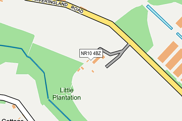
NR10 4BZ is located in the Horsford and Felthorpe electoral ward, within the local authority district of Broadland and the English Parliamentary constituency of Broadland. The Sub Integrated Care Board (ICB) Location is NHS Norfolk and Waveney ICB - 26A and the police force is Norfolk. This postcode has been in use since March 2003.


GetTheData
Source: OS OpenMap – Local (Ordnance Survey)
Source: OS VectorMap District (Ordnance Survey)
Licence: Open Government Licence (requires attribution)
| Easting | 617736 |
| Northing | 317904 |
| Latitude | 52.714985 |
| Longitude | 1.222199 |
GetTheData
Source: Open Postcode Geo
Licence: Open Government Licence
| Country | England |
| Postcode District | NR10 |
| ➜ NR10 open data dashboard ➜ See where NR10 is on a map | |
GetTheData
Source: Land Registry Price Paid Data
Licence: Open Government Licence
Elevation or altitude of NR10 4BZ as distance above sea level:
| Metres | Feet | |
|---|---|---|
| Elevation | 30m | 98ft |
Elevation is measured from the approximate centre of the postcode, to the nearest point on an OS contour line from OS Terrain 50, which has contour spacing of ten vertical metres.
➜ How high above sea level am I? Find the elevation of your current position using your device's GPS.
GetTheData
Source: Open Postcode Elevation
Licence: Open Government Licence
| Ward | Horsford And Felthorpe |
| Constituency | Broadland |
GetTheData
Source: ONS Postcode Database
Licence: Open Government Licence
| Bilney Lane (Short Thorn Road) | Felthorpe | 617m |
| Bilney Lane (Short Thorn Road) | Felthorpe | 618m |
| Short-thorn Road (Holt Road) | Hevingham | 758m |
| Short-thorn Road (Holt Road) | Hevingham | 764m |
| The Mariners (The Street) | Felthorpe | 1,057m |
GetTheData
Source: NaPTAN
Licence: Open Government Licence
| Percentage of properties with Next Generation Access | 100.0% |
| Percentage of properties with Superfast Broadband | 66.7% |
| Percentage of properties with Ultrafast Broadband | 0.0% |
| Percentage of properties with Full Fibre Broadband | 0.0% |
Superfast Broadband is between 30Mbps and 300Mbps
Ultrafast Broadband is > 300Mbps
| Percentage of properties unable to receive 2Mbps | 0.0% |
| Percentage of properties unable to receive 5Mbps | 0.0% |
| Percentage of properties unable to receive 10Mbps | 0.0% |
| Percentage of properties unable to receive 30Mbps | 33.3% |
GetTheData
Source: Ofcom
Licence: Ofcom Terms of Use (requires attribution)
GetTheData
Source: ONS Postcode Database
Licence: Open Government Licence


➜ Get more ratings from the Food Standards Agency
GetTheData
Source: Food Standards Agency
Licence: FSA terms & conditions
| Last Collection | |||
|---|---|---|---|
| Location | Mon-Fri | Sat | Distance |
| The Street Former P.o. | 16:00 | 09:15 | 1,024m |
| Marsham Lodge Holt Road | 16:00 | 10:00 | 1,617m |
| Mill Lane | 16:00 | 10:00 | 1,772m |
GetTheData
Source: Dracos
Licence: Creative Commons Attribution-ShareAlike
| Facility | Distance |
|---|---|
| Felthorpe Recreation Ground The Street, Felthorpe, Norwich Grass Pitches, Sports Hall | 869m |
| Watling Park Hall Lane, Felthorpe, Norwich Grass Pitches | 1km |
| Horsford Ce Primary School Mill Lane, Horsford, Norwich Grass Pitches, Sports Hall | 1.8km |
GetTheData
Source: Active Places
Licence: Open Government Licence
| School | Phase of Education | Distance |
|---|---|---|
| Horsford CofE VA Primary School Mill Lane, Horsford, Norwich, NR10 3ES | Primary | 1.8km |
| Drayton Community Infant School School Road, Drayton, Norwich, NR8 6EP | Primary | 3.4km |
| Hevingham Primary School New Road, Westgate, Hevingham, Norwich, NR10 5NH | Primary | 3.7km |
GetTheData
Source: Edubase
Licence: Open Government Licence
The below table lists the International Territorial Level (ITL) codes (formerly Nomenclature of Territorial Units for Statistics (NUTS) codes) and Local Administrative Units (LAU) codes for NR10 4BZ:
| ITL 1 Code | Name |
|---|---|
| TLH | East |
| ITL 2 Code | Name |
| TLH1 | East Anglia |
| ITL 3 Code | Name |
| TLH15 | Norwich and East Norfolk |
| LAU 1 Code | Name |
| E07000144 | Broadland |
GetTheData
Source: ONS Postcode Directory
Licence: Open Government Licence
The below table lists the Census Output Area (OA), Lower Layer Super Output Area (LSOA), and Middle Layer Super Output Area (MSOA) for NR10 4BZ:
| Code | Name | |
|---|---|---|
| OA | E00134836 | |
| LSOA | E01026535 | Broadland 004C |
| MSOA | E02005523 | Broadland 004 |
GetTheData
Source: ONS Postcode Directory
Licence: Open Government Licence
| NR10 4ED | Bilney Lane | 526m |
| NR10 4BY | The Street | 666m |
| NR10 4DH | The Street | 688m |
| NR10 4EB | Bilney Lane | 898m |
| NR10 4DE | Short Thorn Road | 913m |
| NR10 4DQ | The Street | 932m |
| NR10 4BX | Hall Lane | 946m |
| NR10 4AB | The Street | 1009m |
| NR10 3EE | Holt Road | 1021m |
| NR10 4DZ | Brands Lane | 1073m |
GetTheData
Source: Open Postcode Geo; Land Registry Price Paid Data
Licence: Open Government Licence