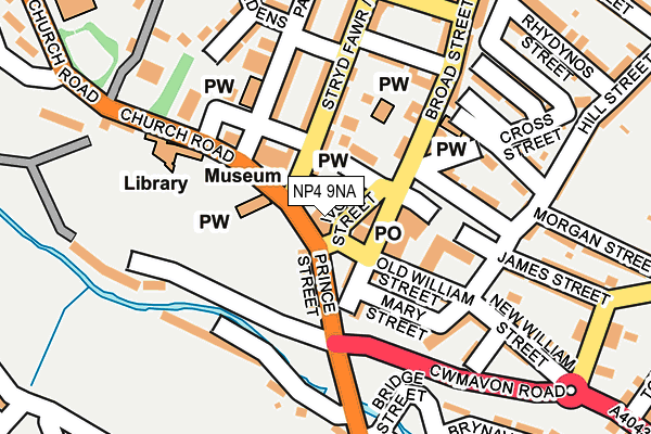
NP4 9NA is located in the Blaenavon electoral ward, within the unitary authority of Torfaen and the Welsh Parliamentary constituency of Torfaen. The Local Health Board is Aneurin Bevan University and the police force is Gwent. This postcode has been in use since January 1980.


GetTheData
Source: OS OpenMap – Local (Ordnance Survey)
Source: OS VectorMap District (Ordnance Survey)
Licence: Open Government Licence (requires attribution)
| Easting | 325200 |
| Northing | 208762 |
| Latitude | 51.772516 |
| Longitude | -3.085482 |
GetTheData
Source: Open Postcode Geo
Licence: Open Government Licence
| Country | Wales |
| Postcode District | NP4 |
| ➜ NP4 open data dashboard ➜ See where NP4 is on a map ➜ Where is Blaenavon? | |
GetTheData
Source: Land Registry Price Paid Data
Licence: Open Government Licence
Elevation or altitude of NP4 9NA as distance above sea level:
| Metres | Feet | |
|---|---|---|
| Elevation | 320m | 1,050ft |
Elevation is measured from the approximate centre of the postcode, to the nearest point on an OS contour line from OS Terrain 50, which has contour spacing of ten vertical metres.
➜ How high above sea level am I? Find the elevation of your current position using your device's GPS.
GetTheData
Source: Open Postcode Elevation
Licence: Open Government Licence
| Ward | Blaenavon |
| Constituency | Torfaen |
GetTheData
Source: ONS Postcode Database
Licence: Open Government Licence
| January 2024 | Violence and sexual offences | On or near Cross Street | 166m |
| December 2023 | Anti-social behaviour | On or near Parking Area | 94m |
| October 2023 | Drugs | On or near Parking Area | 94m |
| ➜ Get more crime data in our Crime section | |||
GetTheData
Source: data.police.uk
Licence: Open Government Licence
| Curwood (Varteg Road) | Blaenavon | 130m |
| Lower Hill Street Steps (Church Road) | Blaenavon | 144m |
| Market Street | Blaenavon | 150m |
| Curwood (Varteg Road) | Blaenavon | 153m |
| Burford Street (High Street) | Blaenavon | 154m |
GetTheData
Source: NaPTAN
Licence: Open Government Licence
| Percentage of properties with Next Generation Access | 100.0% |
| Percentage of properties with Superfast Broadband | 100.0% |
| Percentage of properties with Ultrafast Broadband | 0.0% |
| Percentage of properties with Full Fibre Broadband | 0.0% |
Superfast Broadband is between 30Mbps and 300Mbps
Ultrafast Broadband is > 300Mbps
| Percentage of properties unable to receive 2Mbps | 0.0% |
| Percentage of properties unable to receive 5Mbps | 0.0% |
| Percentage of properties unable to receive 10Mbps | 0.0% |
| Percentage of properties unable to receive 30Mbps | 0.0% |
GetTheData
Source: Ofcom
Licence: Ofcom Terms of Use (requires attribution)
Estimated total energy consumption in NP4 9NA by fuel type, 2015.
| Consumption (kWh) | 87,262 |
|---|---|
| Meter count | 13 |
| Mean (kWh/meter) | 6,712 |
| Median (kWh/meter) | 5,279 |
| Consumption (kWh) | 9,742 |
|---|---|
| Meter count | 10 |
| Mean (kWh/meter) | 974 |
| Median (kWh/meter) | 921 |
GetTheData
Source: Postcode level gas estimates: 2015 (experimental)
Source: Postcode level electricity estimates: 2015 (experimental)
Licence: Open Government Licence
GetTheData
Source: ONS Postcode Database
Licence: Open Government Licence


➜ Get more ratings from the Food Standards Agency
GetTheData
Source: Food Standards Agency
Licence: FSA terms & conditions
| Last Collection | |||
|---|---|---|---|
| Location | Mon-Fri | Sat | Distance |
| Bryn Terrace | 16:15 | 11:30 | 380m |
| King Street Post Office | 16:45 | 12:00 | 5,512m |
GetTheData
Source: Dracos
Licence: Creative Commons Attribution-ShareAlike
| School | Phase of Education | Distance |
|---|---|---|
| Ysgol Bryn Onnen Varteg Road, Pontypool, Torfaen, NP4 7RT | Not applicable | 3.8km |
| Garnteg Primary School Hillcrest, Garndiffaith, Pontypool, Torfaen, NP4 7SJ | Not applicable | 4.1km |
| ST Illtyd's Llanhilleth, Abertillery, Blaenau Gwent, NP13 3JT | Not applicable | 4.4km |
GetTheData
Source: Edubase
Licence: Open Government Licence
The below table lists the International Territorial Level (ITL) codes (formerly Nomenclature of Territorial Units for Statistics (NUTS) codes) and Local Administrative Units (LAU) codes for NP4 9NA:
| ITL 1 Code | Name |
|---|---|
| TLL | Wales |
| ITL 2 Code | Name |
| TLL1 | West Wales and The Valleys |
| ITL 3 Code | Name |
| TLL16 | Gwent Valleys |
| LAU 1 Code | Name |
| W06000020 | Torfaen |
GetTheData
Source: ONS Postcode Directory
Licence: Open Government Licence
The below table lists the Census Output Area (OA), Lower Layer Super Output Area (LSOA), and Middle Layer Super Output Area (MSOA) for NP4 9NA:
| Code | Name | |
|---|---|---|
| OA | W00007769 | |
| LSOA | W01001489 | Torfaen 001C |
| MSOA | W02000323 | Torfaen 001 |
GetTheData
Source: ONS Postcode Directory
Licence: Open Government Licence
| NP4 9ND | Broad Street | 33m |
| NP4 9XA | Prince Street | 48m |
| NP4 9PT | High Street | 82m |
| NP4 9AN | Old William Street | 92m |
| NP4 9EH | Old James Street | 95m |
| NP4 9AP | Mary Street | 112m |
| NP4 9NE | Broad Street | 122m |
| NP4 9AA | Park Street | 134m |
| NP4 9PU | High Street | 135m |
| NP4 9ET | Market Street | 137m |
GetTheData
Source: Open Postcode Geo; Land Registry Price Paid Data
Licence: Open Government Licence