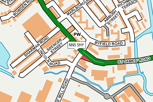
NN5 5HY is located in the Sixfields electoral ward, within the unitary authority of West Northamptonshire and the English Parliamentary constituency of Northampton South. The Sub Integrated Care Board (ICB) Location is NHS Northamptonshire ICB - 78H and the police force is Northamptonshire. This postcode has been in use since January 1980.


GetTheData
Source: OS OpenMap – Local (Ordnance Survey)
Source: OS VectorMap District (Ordnance Survey)
Licence: Open Government Licence (requires attribution)
| Easting | 474386 |
| Northing | 260414 |
| Latitude | 52.236902 |
| Longitude | -0.912130 |
GetTheData
Source: Open Postcode Geo
Licence: Open Government Licence
| Country | England |
| Postcode District | NN5 |
| ➜ NN5 open data dashboard ➜ See where NN5 is on a map ➜ Where is Northampton? | |
GetTheData
Source: Land Registry Price Paid Data
Licence: Open Government Licence
Elevation or altitude of NN5 5HY as distance above sea level:
| Metres | Feet | |
|---|---|---|
| Elevation | 60m | 197ft |
Elevation is measured from the approximate centre of the postcode, to the nearest point on an OS contour line from OS Terrain 50, which has contour spacing of ten vertical metres.
➜ How high above sea level am I? Find the elevation of your current position using your device's GPS.
GetTheData
Source: Open Postcode Elevation
Licence: Open Government Licence
| Ward | Sixfields |
| Constituency | Northampton South |
GetTheData
Source: ONS Postcode Database
Licence: Open Government Licence
| January 2024 | Anti-social behaviour | On or near Byfield Road | 74m |
| January 2024 | Bicycle theft | On or near Spencer Street | 127m |
| January 2024 | Criminal damage and arson | On or near Spencer Street | 127m |
| ➜ Get more crime data in our Crime section | |||
GetTheData
Source: data.police.uk
Licence: Open Government Licence
| Byfield Road (St James Road) | St James End | 42m |
| Byfield Road (St James Road) | St James End | 65m |
| Bus Depot (St James Road) | St James End | 116m |
| Borough Council Depot (St James Mill Road) | St James End | 138m |
| Bus Depot (St James Road) | St James End | 220m |
| Northampton Station | 0.4km |
GetTheData
Source: NaPTAN
Licence: Open Government Licence
GetTheData
Source: ONS Postcode Database
Licence: Open Government Licence


➜ Get more ratings from the Food Standards Agency
GetTheData
Source: Food Standards Agency
Licence: FSA terms & conditions
| Last Collection | |||
|---|---|---|---|
| Location | Mon-Fri | Sat | Distance |
| St James Mill Road | 18:30 | 11:30 | 210m |
| St James Mill Road | 18:30 | 215m | |
| Stanley Road | 17:45 | 11:30 | 234m |
GetTheData
Source: Dracos
Licence: Creative Commons Attribution-ShareAlike
| Facility | Distance |
|---|---|
| Victoria Park (Northampton) Spencer Bridge Road, Northampton Grass Pitches | 478m |
| Northampton Saints (Franklins Gardens) Weedon Road, Northampton Grass Pitches | 606m |
| Dw Fitness First (Northampton) (Closed) St. James Retail Park, Towcester Road, Northampton Health and Fitness Gym, Swimming Pool, Studio | 608m |
GetTheData
Source: Active Places
Licence: Open Government Licence
| School | Phase of Education | Distance |
|---|---|---|
| St James Church of England Primary School Harlestone Road, St James, Northampton, NN5 7AG | Primary | 640m |
| Spring Lane Primary School Spring Lane, Northampton, NN1 2JW | Primary | 746m |
| Hospital and Outreach Education Delapre Learning Centre, Alton St, Off Main Rd, Far Cotton, Northampton, NN4 8EN | Not applicable | 1.1km |
GetTheData
Source: Edubase
Licence: Open Government Licence
| Risk of NN5 5HY flooding from rivers and sea | Low |
| ➜ NN5 5HY flood map | |
GetTheData
Source: Open Flood Risk by Postcode
Licence: Open Government Licence
The below table lists the International Territorial Level (ITL) codes (formerly Nomenclature of Territorial Units for Statistics (NUTS) codes) and Local Administrative Units (LAU) codes for NN5 5HY:
| ITL 1 Code | Name |
|---|---|
| TLF | East Midlands (England) |
| ITL 2 Code | Name |
| TLF2 | Leicestershire, Rutland and Northamptonshire |
| ITL 3 Code | Name |
| TLF24 | West Northamptonshire |
| LAU 1 Code | Name |
| E07000154 | Northampton |
GetTheData
Source: ONS Postcode Directory
Licence: Open Government Licence
The below table lists the Census Output Area (OA), Lower Layer Super Output Area (LSOA), and Middle Layer Super Output Area (MSOA) for NN5 5HY:
| Code | Name | |
|---|---|---|
| OA | E00138562 | |
| LSOA | E01027238 | Northampton 024D |
| MSOA | E02005673 | Northampton 024 |
GetTheData
Source: ONS Postcode Directory
Licence: Open Government Licence
| NN5 5HF | Byfield Road | 50m |
| NN5 5JS | Lincoln Road | 65m |
| NN5 5JU | Spencer Street | 95m |
| NN5 5HR | Byfield Road | 121m |
| NN5 5HG | Byfield Road | 124m |
| NN5 5LB | Sharman Road | 151m |
| NN5 5DX | Ambush Street | 160m |
| NN5 5EA | Greenwood Road | 172m |
| NN5 5DZ | Marlborough Road | 175m |
| NN5 5HQ | Byfield Road | 176m |
GetTheData
Source: Open Postcode Geo; Land Registry Price Paid Data
Licence: Open Government Licence