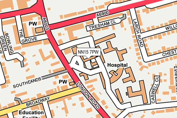
NN15 7PW is located in the Windmill electoral ward, within the unitary authority of North Northamptonshire and the English Parliamentary constituency of Kettering. The Sub Integrated Care Board (ICB) Location is NHS Northamptonshire ICB - 78H and the police force is Northamptonshire. This postcode has been in use since November 2013.


GetTheData
Source: OS OpenMap – Local (Ordnance Survey)
Source: OS VectorMap District (Ordnance Survey)
Licence: Open Government Licence (requires attribution)
| Easting | 487047 |
| Northing | 278110 |
| Latitude | 52.394100 |
| Longitude | -0.722200 |
GetTheData
Source: Open Postcode Geo
Licence: Open Government Licence
| Country | England |
| Postcode District | NN15 |
| ➜ NN15 open data dashboard ➜ See where NN15 is on a map ➜ Where is Kettering? | |
GetTheData
Source: Land Registry Price Paid Data
Licence: Open Government Licence
Elevation or altitude of NN15 7PW as distance above sea level:
| Metres | Feet | |
|---|---|---|
| Elevation | 90m | 295ft |
Elevation is measured from the approximate centre of the postcode, to the nearest point on an OS contour line from OS Terrain 50, which has contour spacing of ten vertical metres.
➜ How high above sea level am I? Find the elevation of your current position using your device's GPS.
GetTheData
Source: Open Postcode Elevation
Licence: Open Government Licence
| Ward | Windmill |
| Constituency | Kettering |
GetTheData
Source: ONS Postcode Database
Licence: Open Government Licence
| November 2023 | Anti-social behaviour | On or near Seagrave Street | 376m |
| October 2023 | Criminal damage and arson | On or near Seagrave Street | 376m |
| October 2023 | Violence and sexual offences | On or near Seagrave Street | 376m |
| ➜ Get more crime data in our Crime section | |||
GetTheData
Source: data.police.uk
Licence: Open Government Licence
| St Mary's Hospital (London Road) | Kettering | 86m |
| St Mary's Hospital (London Road) | Kettering | 99m |
| Tresham College (St Marys Road) | Kettering | 132m |
| Tresham College (St Marys Road) | Kettering | 158m |
| Sunley Court (Pipers Hill Road) | Kettering | 219m |
| Kettering Station | 0.6km |
GetTheData
Source: NaPTAN
Licence: Open Government Licence
GetTheData
Source: ONS Postcode Database
Licence: Open Government Licence


➜ Get more ratings from the Food Standards Agency
GetTheData
Source: Food Standards Agency
Licence: FSA terms & conditions
| Last Collection | |||
|---|---|---|---|
| Location | Mon-Fri | Sat | Distance |
| Green Lane | 17:15 | 12:15 | 495m |
| Headlands | 17:15 | 11:30 | 516m |
| St Marys Road | 17:15 | 11:30 | 710m |
GetTheData
Source: Dracos
Licence: Creative Commons Attribution-ShareAlike
| Facility | Distance |
|---|---|
| Kettering Swimming Pool London Road, Kettering Swimming Pool, Health and Fitness Gym | 300m |
| St Peter's School Headlands, Kettering Grass Pitches | 545m |
| Kettering Lodge Bowling Club Northampton Road, Kettering Indoor Bowls | 572m |
GetTheData
Source: Active Places
Licence: Open Government Licence
| School | Phase of Education | Distance |
|---|---|---|
| Hawthorn Community Primary School Hawthorn Road, Kettering, NN15 7HT | Primary | 294m |
| St Peter's School 52 Headlands, Kettering, Northamptonshire, NN15 6DJ | Not applicable | 545m |
| Compass Primary Academy Windmill Avenue, Kettering, NN15 7EA | Primary | 796m |
GetTheData
Source: Edubase
Licence: Open Government Licence
The below table lists the International Territorial Level (ITL) codes (formerly Nomenclature of Territorial Units for Statistics (NUTS) codes) and Local Administrative Units (LAU) codes for NN15 7PW:
| ITL 1 Code | Name |
|---|---|
| TLF | East Midlands (England) |
| ITL 2 Code | Name |
| TLF2 | Leicestershire, Rutland and Northamptonshire |
| ITL 3 Code | Name |
| TLF25 | North Northamptonshire |
| LAU 1 Code | Name |
| E07000153 | Kettering |
GetTheData
Source: ONS Postcode Directory
Licence: Open Government Licence
The below table lists the Census Output Area (OA), Lower Layer Super Output Area (LSOA), and Middle Layer Super Output Area (MSOA) for NN15 7PW:
| Code | Name | |
|---|---|---|
| OA | E00137852 | |
| LSOA | E01027100 | Kettering 009A |
| MSOA | E02005647 | Kettering 009 |
GetTheData
Source: ONS Postcode Directory
Licence: Open Government Licence
| NN15 7BX | Tresham Close | 114m |
| NN15 7PH | London Road | 117m |
| NN15 7BT | Tresham Close | 121m |
| NN15 7QG | Southlands | 137m |
| NN15 7QE | London Road | 158m |
| NN15 7BH | Larch Road | 168m |
| NN15 6DD | Broadway | 184m |
| NN15 7RJ | Pipers Hill Road | 199m |
| NN15 7BQ | Larch Road | 213m |
| NN15 7QH | St Pauls Court | 221m |
GetTheData
Source: Open Postcode Geo; Land Registry Price Paid Data
Licence: Open Government Licence