St Peter's School - Kettering
St Peter's School is located in Kettering (NN15).
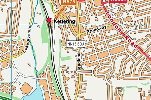
| Address | 52, Headlands, Kettering, NN15 6DJ |
| Management Type | School/College/University (in house) |
| Management Group | Education |
| Owner Type | Other Independent School |
| Owner Group | Education |
| Education Phase | Primary |
Facilities
| Accessibility | Private Use |
| Management Type | School/College/University (in house) |
| Changing Rooms | Yes |
| Date Record Created | 2nd Apr 2019 |
| Date Record Checked | 24th Jul 2023 |
Opening times
| Access description | Private Use |
|---|
| Opening time | 08:30 |
| Closing time | 15:30 |
| Period open for | Every day |
Facility specifics
Disabled access
| Disabled Access | Yes |
| Activity Areas | Yes |
Contact
Disabled access
Disabled access for St Peter's School
| Disabled Access | Yes |
| Activity Areas | Yes |
Where is St Peter's School?
| Sub Building Name | |
| Building Name | |
| Building Number | 52 |
| Dependent Thoroughfare | |
| Thoroughfare Name | HEADLANDS |
| Double Dependent Locality | |
| Dependent Locality | |
| PostTown | KETTERING |
| Postcode | NN15 6DJ |
St Peter's School on a map

St Peter's School geodata
| Easting | 486641 |
| Northing | 277747 |
| Latitude | 52.390902 |
| Longitude | -0.728258 |
| Local Authority Name | North Northamptonshire |
| Local Authority Code | E06000061 |
| Parliamentary Constituency Name | Kettering |
| Parliamentary Constituency Code | E14000769 |
| Region Name | East Midlands |
| Region Code | E15000004 |
| Ward Name | Wicksteed |
| Ward Code | E05013237 |
| Output Area Code | E00137927 |
About this data
This data is open data sourced from Active Places Power and licenced under the Active Places Open Data Licence.
| toid | osgb1000018295977 |
| Created On | 2nd Apr 2019 |
| Audited On | 24th Jul 2023 |
| Checked On | 24th Jul 2023 |
