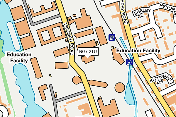
NG7 2TU is located in the Lenton & Wollaton East electoral ward, within the unitary authority of Nottingham and the English Parliamentary constituency of Nottingham South. The Sub Integrated Care Board (ICB) Location is NHS Nottingham and Nottinghamshire ICB - 52R and the police force is Nottinghamshire. This postcode has been in use since August 2008.


GetTheData
Source: OS OpenMap – Local (Ordnance Survey)
Source: OS VectorMap District (Ordnance Survey)
Licence: Open Government Licence (requires attribution)
| Easting | 454934 |
| Northing | 339703 |
| Latitude | 52.951902 |
| Longitude | -1.183810 |
GetTheData
Source: Open Postcode Geo
Licence: Open Government Licence
| Country | England |
| Postcode District | NG7 |
| ➜ NG7 open data dashboard ➜ See where NG7 is on a map ➜ Where is Nottingham? | |
GetTheData
Source: Land Registry Price Paid Data
Licence: Open Government Licence
Elevation or altitude of NG7 2TU as distance above sea level:
| Metres | Feet | |
|---|---|---|
| Elevation | 30m | 98ft |
Elevation is measured from the approximate centre of the postcode, to the nearest point on an OS contour line from OS Terrain 50, which has contour spacing of ten vertical metres.
➜ How high above sea level am I? Find the elevation of your current position using your device's GPS.
GetTheData
Source: Open Postcode Elevation
Licence: Open Government Licence
| Ward | Lenton & Wollaton East |
| Constituency | Nottingham South |
GetTheData
Source: ONS Postcode Database
Licence: Open Government Licence
| June 2022 | Public order | On or near Further/Higher Educational Building | 246m |
| June 2022 | Shoplifting | On or near Further/Higher Educational Building | 246m |
| June 2022 | Violence and sexual offences | On or near Further/Higher Educational Building | 246m |
| ➜ Get more crime data in our Crime section | |||
GetTheData
Source: data.police.uk
Licence: Open Government Licence
| Jubilee Campus (Triumph Road) | Nottingham University Jubilee Campus | 118m |
| Newark Hall (Unnamed) | Nottingham University Jubilee Campus | 194m |
| Jubilee Campus (Triumph Road) | Nottingham University Jubilee Campus | 202m |
| Triumph Road | Radford | 288m |
| Orston Drive Hr (Orston Drive) | Wollaton | 342m |
| Gregory Street Tram Stop (Lenton Lane) | Lenton | 1,002m |
| Queens Medical Centre Tram Stop (South Road) | Queens Medical Centre | 1,042m |
| Ng2 Tram Stop (Enterprise Way) | Lenton Lane Industrial Estate | 1,677m |
| The Forest Tram Stop (Noel Street) | The Forest | 1,843m |
| High School Tram Stop (Waverley Street) | Arboretum | 1,896m |
| Nottingham Station | 2.6km |
| Beeston Station | 3.8km |
GetTheData
Source: NaPTAN
Licence: Open Government Licence
GetTheData
Source: ONS Postcode Database
Licence: Open Government Licence


➜ Get more ratings from the Food Standards Agency
GetTheData
Source: Food Standards Agency
Licence: FSA terms & conditions
| Last Collection | |||
|---|---|---|---|
| Location | Mon-Fri | Sat | Distance |
| Faraday Road | 17:30 | 11:00 | 220m |
| Kennington Road | 16:30 | 12:30 | 454m |
| Old Radford | 17:00 | 11:00 | 457m |
GetTheData
Source: Dracos
Licence: Creative Commons Attribution-ShareAlike
| Facility | Distance |
|---|---|
| University Of Nottingham (Jubilee Campus Sports Centre) Triumph Road, Nottingham Sports Hall, Health and Fitness Gym, Squash Courts, Artificial Grass Pitch, Studio | 125m |
| Jd Gyms (Nottingham) Chettles Trade Park, Midland Way, Nottingham Health and Fitness Gym, Studio | 607m |
| The Lenton Centre Willoughby Street, Nottingham Swimming Pool, Health and Fitness Gym | 873m |
GetTheData
Source: Active Places
Licence: Open Government Licence
| School | Phase of Education | Distance |
|---|---|---|
| Southwold Primary School and Early Years' Centre Kennington Road, Radford, Nottingham, NG8 1QD | Primary | 624m |
| The Nottingham Nursery School and Training Centre Denman Street West, Radford, Nottingham, NG7 3AB | Nursery | 738m |
| Radford Primary School Academy Denman Street West, Radford, Nottingham, NG7 3FL | Primary | 746m |
GetTheData
Source: Edubase
Licence: Open Government Licence
| Risk of NG7 2TU flooding from rivers and sea | Low |
| ➜ NG7 2TU flood map | |
GetTheData
Source: Open Flood Risk by Postcode
Licence: Open Government Licence
The below table lists the International Territorial Level (ITL) codes (formerly Nomenclature of Territorial Units for Statistics (NUTS) codes) and Local Administrative Units (LAU) codes for NG7 2TU:
| ITL 1 Code | Name |
|---|---|
| TLF | East Midlands (England) |
| ITL 2 Code | Name |
| TLF1 | Derbyshire and Nottinghamshire |
| ITL 3 Code | Name |
| TLF14 | Nottingham |
| LAU 1 Code | Name |
| E06000018 | Nottingham |
GetTheData
Source: ONS Postcode Directory
Licence: Open Government Licence
The below table lists the Census Output Area (OA), Lower Layer Super Output Area (LSOA), and Middle Layer Super Output Area (MSOA) for NG7 2TU:
| Code | Name | |
|---|---|---|
| OA | E00173540 | |
| LSOA | E01013974 | Nottingham 032B |
| MSOA | E02002899 | Nottingham 032 |
GetTheData
Source: ONS Postcode Directory
Licence: Open Government Licence
| NG7 2DU | Faraday Road | 175m |
| NG7 2FS | Wicket Grove | 201m |
| NG7 2FL | Shelby Close | 235m |
| NG7 2FN | Braddock Close | 244m |
| NG7 2DE | Heron Drive | 246m |
| NG7 2DH | Kittiwake Mews | 268m |
| NG7 2DG | Heron Drive | 272m |
| NG7 2EH | Hazelmere Grove | 292m |
| NG7 2BE | Salisbury Street | 298m |
| NG7 2DY | Peregrine Close | 324m |
GetTheData
Source: Open Postcode Geo; Land Registry Price Paid Data
Licence: Open Government Licence