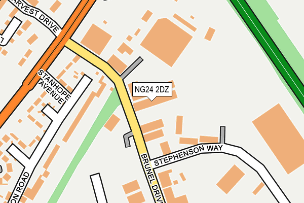
NG24 2DZ is located in the Bridge electoral ward, within the local authority district of Newark and Sherwood and the English Parliamentary constituency of Newark. The Sub Integrated Care Board (ICB) Location is NHS Nottingham and Nottinghamshire ICB - 52R and the police force is Nottinghamshire. This postcode has been in use since January 1983.


GetTheData
Source: OS OpenMap – Local (Ordnance Survey)
Source: OS VectorMap District (Ordnance Survey)
Licence: Open Government Licence (requires attribution)
| Easting | 481321 |
| Northing | 355461 |
| Latitude | 53.090197 |
| Longitude | -0.787178 |
GetTheData
Source: Open Postcode Geo
Licence: Open Government Licence
| Country | England |
| Postcode District | NG24 |
| ➜ NG24 open data dashboard ➜ See where NG24 is on a map ➜ Where is Newark-on-Trent? | |
GetTheData
Source: Land Registry Price Paid Data
Licence: Open Government Licence
Elevation or altitude of NG24 2DZ as distance above sea level:
| Metres | Feet | |
|---|---|---|
| Elevation | 10m | 33ft |
Elevation is measured from the approximate centre of the postcode, to the nearest point on an OS contour line from OS Terrain 50, which has contour spacing of ten vertical metres.
➜ How high above sea level am I? Find the elevation of your current position using your device's GPS.
GetTheData
Source: Open Postcode Elevation
Licence: Open Government Licence
| Ward | Bridge |
| Constituency | Newark |
GetTheData
Source: ONS Postcode Database
Licence: Open Government Licence
| June 2022 | Vehicle crime | On or near Stephenson Way | 144m |
| June 2022 | Burglary | On or near Telford Drive | 236m |
| June 2022 | Burglary | On or near Telford Drive | 236m |
| ➜ Get more crime data in our Crime section | |||
GetTheData
Source: data.police.uk
Licence: Open Government Licence
| Gainsborough Drive (Lincoln Road) | Newark | 367m |
| Gainsborough Drive (Lincoln Road) | Newark | 369m |
| Park Crescent (Winthorpe Road) | Winthorpe Road Estate | 594m |
| Winthorpe Road (Stephen Road) | Winthorpe Road Estate | 611m |
| Brunel Drive | Newark | 637m |
| Newark North Gate Station | 1.3km |
| Newark Castle Station | 2.1km |
GetTheData
Source: NaPTAN
Licence: Open Government Licence
| Median download speed | 69.4Mbps |
| Average download speed | 46.8Mbps |
| Maximum download speed | 80.00Mbps |
| Median upload speed | 20.0Mbps |
| Average upload speed | 12.3Mbps |
| Maximum upload speed | 20.00Mbps |
GetTheData
Source: Ofcom
Licence: Ofcom Terms of Use (requires attribution)
GetTheData
Source: ONS Postcode Database
Licence: Open Government Licence


➜ Get more ratings from the Food Standards Agency
GetTheData
Source: Food Standards Agency
Licence: FSA terms & conditions
| Last Collection | |||
|---|---|---|---|
| Location | Mon-Fri | Sat | Distance |
| Lincoln Road Post Office | 17:30 | 11:30 | 436m |
| Yorke Drive | 17:30 | 11:45 | 743m |
| Northgate Station | 18:30 | 11:30 | 1,262m |
GetTheData
Source: Dracos
Licence: Creative Commons Attribution-ShareAlike
| Facility | Distance |
|---|---|
| Lincoln Road Sports Facility Lincoln Road, Newark On Trent Grass Pitches | 539m |
| Bishop Alexander L.e.a.d. Academy Wolsey Road, Newark Grass Pitches, Artificial Grass Pitch | 676m |
| Industrial Gym And Fitness (Newark Ltd) (Closed) Brunel Drive, Newark Health and Fitness Gym, Studio | 803m |
GetTheData
Source: Active Places
Licence: Open Government Licence
| School | Phase of Education | Distance |
|---|---|---|
| Bishop Alexander L.E.A.D. Academy Wolsey Road, Newark, NG24 2BQ | Primary | 676m |
| Lovers Lane Primary and Nursery School Warburton Street, Newark, NG24 1LT | Primary | 1.5km |
| Winthorpe Primary School Thoroughfare Lane, Winthorpe, Newark, NG24 2NN | Primary | 1.7km |
GetTheData
Source: Edubase
Licence: Open Government Licence
The below table lists the International Territorial Level (ITL) codes (formerly Nomenclature of Territorial Units for Statistics (NUTS) codes) and Local Administrative Units (LAU) codes for NG24 2DZ:
| ITL 1 Code | Name |
|---|---|
| TLF | East Midlands (England) |
| ITL 2 Code | Name |
| TLF1 | Derbyshire and Nottinghamshire |
| ITL 3 Code | Name |
| TLF15 | North Nottinghamshire |
| LAU 1 Code | Name |
| E07000175 | Newark and Sherwood |
GetTheData
Source: ONS Postcode Directory
Licence: Open Government Licence
The below table lists the Census Output Area (OA), Lower Layer Super Output Area (LSOA), and Middle Layer Super Output Area (MSOA) for NG24 2DZ:
| Code | Name | |
|---|---|---|
| OA | E00144215 | |
| LSOA | E01028304 | Newark and Sherwood 007B |
| MSOA | E02005899 | Newark and Sherwood 007 |
GetTheData
Source: ONS Postcode Directory
Licence: Open Government Licence
| NG24 2DE | Brunel Drive | 171m |
| NG24 2DG | Stanhope Avenue | 198m |
| NG24 2DF | Lincoln Road | 219m |
| NG24 2DH | Pembroke Crescent | 238m |
| NG24 2DN | Middleton Road | 263m |
| NG24 2DJ | Clifton Crescent | 307m |
| NG24 2DX | Telford Drive | 332m |
| NG24 2FJ | Linseed Avenue | 343m |
| NG24 2FN | Farmers Walk | 344m |
| NG24 2DL | Middleton Road | 369m |
GetTheData
Source: Open Postcode Geo; Land Registry Price Paid Data
Licence: Open Government Licence