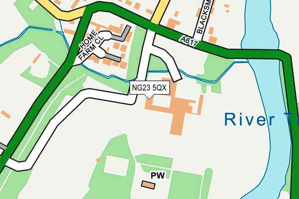
NG23 5QX is located in the Trent electoral ward, within the local authority district of Newark and Sherwood and the English Parliamentary constituency of Newark. The Sub Integrated Care Board (ICB) Location is NHS Nottingham and Nottinghamshire ICB - 52R and the police force is Nottinghamshire. This postcode has been in use since January 1980.


GetTheData
Source: OS OpenMap – Local (Ordnance Survey)
Source: OS VectorMap District (Ordnance Survey)
Licence: Open Government Licence (requires attribution)
| Easting | 477439 |
| Northing | 355547 |
| Latitude | 53.091547 |
| Longitude | -0.845110 |
GetTheData
Source: Open Postcode Geo
Licence: Open Government Licence
| Country | England |
| Postcode District | NG23 |
| ➜ NG23 open data dashboard ➜ See where NG23 is on a map ➜ Where is Kelham? | |
GetTheData
Source: Land Registry Price Paid Data
Licence: Open Government Licence
Elevation or altitude of NG23 5QX as distance above sea level:
| Metres | Feet | |
|---|---|---|
| Elevation | 10m | 33ft |
Elevation is measured from the approximate centre of the postcode, to the nearest point on an OS contour line from OS Terrain 50, which has contour spacing of ten vertical metres.
➜ How high above sea level am I? Find the elevation of your current position using your device's GPS.
GetTheData
Source: Open Postcode Elevation
Licence: Open Government Licence
| Ward | Trent |
| Constituency | Newark |
GetTheData
Source: ONS Postcode Database
Licence: Open Government Licence
| May 2022 | Other theft | On or near Home Farm Close | 214m |
| April 2022 | Other crime | On or near Blacksmith Lane | 200m |
| March 2022 | Other theft | On or near Blacksmith Lane | 200m |
| ➜ Get more crime data in our Crime section | |||
GetTheData
Source: data.police.uk
Licence: Open Government Licence
| Ollerton Road (Main Road) | Kelham | 163m |
| Ollerton Road (Main Road) | Kelham | 172m |
| District Council (Main Road) | Kelham | 397m |
| District Council (Main Road) | Kelham | 401m |
| Primary School (Staythorpe Road) | Averham | 1,345m |
| Newark Castle Station | 2.5km |
| Newark North Gate Station | 3.2km |
| Rolleston Station | 4.7km |
GetTheData
Source: NaPTAN
Licence: Open Government Licence
GetTheData
Source: ONS Postcode Database
Licence: Open Government Licence


➜ Get more ratings from the Food Standards Agency
GetTheData
Source: Food Standards Agency
Licence: FSA terms & conditions
| Last Collection | |||
|---|---|---|---|
| Location | Mon-Fri | Sat | Distance |
| Averham | 16:00 | 09:00 | 1,460m |
| Little Carlton | 16:00 | 09:00 | 1,777m |
| Main Road | 17:15 | 12:30 | 2,198m |
GetTheData
Source: Dracos
Licence: Creative Commons Attribution-ShareAlike
| Facility | Distance |
|---|---|
| Kelham Hall Main Road, Kelham Grass Pitches, Outdoor Tennis Courts | 61m |
| Newark Rugby Football Club Kelham Road, Newark Grass Pitches | 1.5km |
| Newark Ransome And Marles Cricket Club Kelham Road, Newark On Trent Grass Pitches | 1.9km |
GetTheData
Source: Active Places
Licence: Open Government Licence
| School | Phase of Education | Distance |
|---|---|---|
| Christ Church C of E Primary School Flaxley Lane, Middlebeck, Newark-on-Trent, NG24 3XB | Primary | 2.9km |
| Mount CofE Primary School Kings Road, Newark, NG24 1EW | Primary | 2.9km |
| Lovers Lane Primary and Nursery School Warburton Street, Newark, NG24 1LT | Primary | 3km |
GetTheData
Source: Edubase
Licence: Open Government Licence
| Risk of NG23 5QX flooding from rivers and sea | Low |
| ➜ NG23 5QX flood map | |
GetTheData
Source: Open Flood Risk by Postcode
Licence: Open Government Licence
The below table lists the International Territorial Level (ITL) codes (formerly Nomenclature of Territorial Units for Statistics (NUTS) codes) and Local Administrative Units (LAU) codes for NG23 5QX:
| ITL 1 Code | Name |
|---|---|
| TLF | East Midlands (England) |
| ITL 2 Code | Name |
| TLF1 | Derbyshire and Nottinghamshire |
| ITL 3 Code | Name |
| TLF15 | North Nottinghamshire |
| LAU 1 Code | Name |
| E07000175 | Newark and Sherwood |
GetTheData
Source: ONS Postcode Directory
Licence: Open Government Licence
The below table lists the Census Output Area (OA), Lower Layer Super Output Area (LSOA), and Middle Layer Super Output Area (MSOA) for NG23 5QX:
| Code | Name | |
|---|---|---|
| OA | E00144385 | |
| LSOA | E01028336 | Newark and Sherwood 012D |
| MSOA | E02005904 | Newark and Sherwood 012 |
GetTheData
Source: ONS Postcode Directory
Licence: Open Government Licence
| NG23 5QB | Home Farm Close | 184m |
| NG23 5QT | Blacksmiths Lane | 231m |
| NG23 5QP | Main Street | 246m |
| NG23 5QR | Trent Cottages | 296m |
| NG23 5QU | The Rutlands | 377m |
| NG23 5RZ | Broadgate Lane | 490m |
| NG23 5QZ | Staythorpe Road | 1355m |
| NG23 5RB | Church Lane | 1412m |
| NG23 5RP | The Close | 1470m |
| NG23 5FW | Ayrshire Way | 1511m |
GetTheData
Source: Open Postcode Geo; Land Registry Price Paid Data
Licence: Open Government Licence