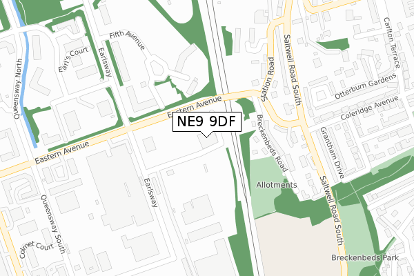
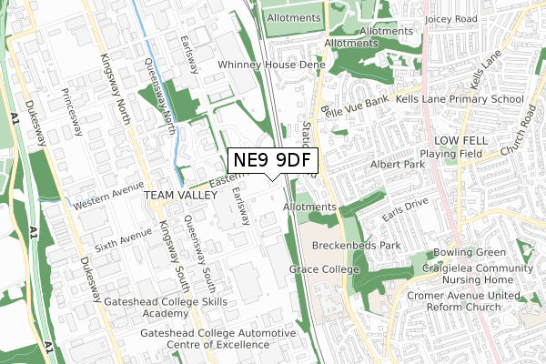
NE9 9DF is located in the Lamesley electoral ward, within the metropolitan district of Gateshead and the English Parliamentary constituency of Blaydon. The Sub Integrated Care Board (ICB) Location is NHS North East and North Cumbria ICB - 13T and the police force is Northumbria. This postcode has been in use since July 2019.


GetTheData
Source: OS Open Zoomstack (Ordnance Survey)
Licence: Open Government Licence (requires attribution)
Attribution: Contains OS data © Crown copyright and database right 2024
Source: Open Postcode Geo
Licence: Open Government Licence (requires attribution)
Attribution: Contains OS data © Crown copyright and database right 2024; Contains Royal Mail data © Royal Mail copyright and database right 2024; Source: Office for National Statistics licensed under the Open Government Licence v.3.0
| Easting | 425051 |
| Northing | 559904 |
| Latitude | 54.933196 |
| Longitude | -1.610588 |
GetTheData
Source: Open Postcode Geo
Licence: Open Government Licence
| Country | England |
| Postcode District | NE9 |
| ➜ NE9 open data dashboard ➜ See where NE9 is on a map ➜ Where is Gateshead? | |
GetTheData
Source: Land Registry Price Paid Data
Licence: Open Government Licence
Elevation or altitude of NE9 9DF as distance above sea level:
| Metres | Feet | |
|---|---|---|
| Elevation | 20m | 66ft |
Elevation is measured from the approximate centre of the postcode, to the nearest point on an OS contour line from OS Terrain 50, which has contour spacing of ten vertical metres.
➜ How high above sea level am I? Find the elevation of your current position using your device's GPS.
GetTheData
Source: Open Postcode Elevation
Licence: Open Government Licence
| Ward | Lamesley |
| Constituency | Blaydon |
GetTheData
Source: ONS Postcode Database
Licence: Open Government Licence
| January 2024 | Drugs | On or near Fifth Avenue | 356m |
| January 2024 | Criminal damage and arson | On or near Fifth Avenue | 356m |
| January 2024 | Anti-social behaviour | On or near Parking Area | 496m |
| ➜ Get more crime data in our Crime section | |||
GetTheData
Source: data.police.uk
Licence: Open Government Licence
| Eastern Avenue-earlsway (Eastern Avenue) | Team Valley | 179m |
| Saltwell Road South-crook Foot (Saltwell Road South) | Low Fell | 237m |
| Saltwell Road South-crook Foot (Saltwell Road South) | Low Fell | 254m |
| Eastern Avenue-earlsway (Eastern Avenue) | Team Valley | 285m |
| Earlsway-fifth Avenue (Earlsway) | Team Valley | 299m |
| Dunston Station | 2.8km |
| Newcastle Station | 3.9km |
| Heworth Station | 4.1km |
GetTheData
Source: NaPTAN
Licence: Open Government Licence
GetTheData
Source: ONS Postcode Database
Licence: Open Government Licence


➜ Get more ratings from the Food Standards Agency
GetTheData
Source: Food Standards Agency
Licence: FSA terms & conditions
| Last Collection | |||
|---|---|---|---|
| Location | Mon-Fri | Sat | Distance |
| Eastern Avenue | 18:30 | 97m | |
| Saltwell Road South | 17:30 | 12:00 | 348m |
| Killowen Street | 17:30 | 12:00 | 492m |
GetTheData
Source: Dracos
Licence: Creative Commons Attribution-ShareAlike
| Facility | Distance |
|---|---|
| Grace College Saltwell Road South, Gateshead Sports Hall, Grass Pitches, Outdoor Tennis Courts | 647m |
| Oakfield Infant School Chowdene Bank, Gateshead Grass Pitches | 779m |
| Springslite (Low Fell) (Closed) Joicey Road, Gateshead Health and Fitness Gym, Swimming Pool, Studio, Squash Courts | 949m |
GetTheData
Source: Active Places
Licence: Open Government Licence
| School | Phase of Education | Distance |
|---|---|---|
| Grace College Saltwell Road South, Gateshead, NE9 6LE | Secondary | 562m |
| Oakfield Junior School Chowdene Bank, Gateshead, NE9 6JH | Primary | 703m |
| Oakfield Infant School Chowdene Bank, Low Fell, Gateshead, NE9 6JH | Primary | 790m |
GetTheData
Source: Edubase
Licence: Open Government Licence
The below table lists the International Territorial Level (ITL) codes (formerly Nomenclature of Territorial Units for Statistics (NUTS) codes) and Local Administrative Units (LAU) codes for NE9 9DF:
| ITL 1 Code | Name |
|---|---|
| TLC | North East (England) |
| ITL 2 Code | Name |
| TLC2 | Northumberland, and Tyne and Wear |
| ITL 3 Code | Name |
| TLC22 | Tyneside |
| LAU 1 Code | Name |
| E08000037 | Gateshead |
GetTheData
Source: ONS Postcode Directory
Licence: Open Government Licence
The below table lists the Census Output Area (OA), Lower Layer Super Output Area (LSOA), and Middle Layer Super Output Area (MSOA) for NE9 9DF:
| Code | Name | |
|---|---|---|
| OA | E00041888 | |
| LSOA | E01008259 | Gateshead 007D |
| MSOA | E02001688 | Gateshead 007 |
GetTheData
Source: ONS Postcode Directory
Licence: Open Government Licence
| NE9 6HB | Breckenbeds Road | 155m |
| NE9 6HD | Station Road | 208m |
| NE9 6DR | Station Road | 210m |
| NE9 6HW | Breckenbeds Road | 211m |
| NE9 6EE | Pullman Court | 247m |
| NE9 6HA | Saltwell Road South | 255m |
| NE11 0XA | Fifth Avenue | 258m |
| NE11 0HF | Fifth Avenue | 265m |
| NE9 6DZ | Pullman Court | 269m |
| NE9 6EY | Saltwell Road South | 273m |
GetTheData
Source: Open Postcode Geo; Land Registry Price Paid Data
Licence: Open Government Licence