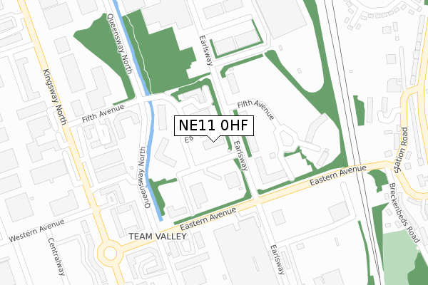
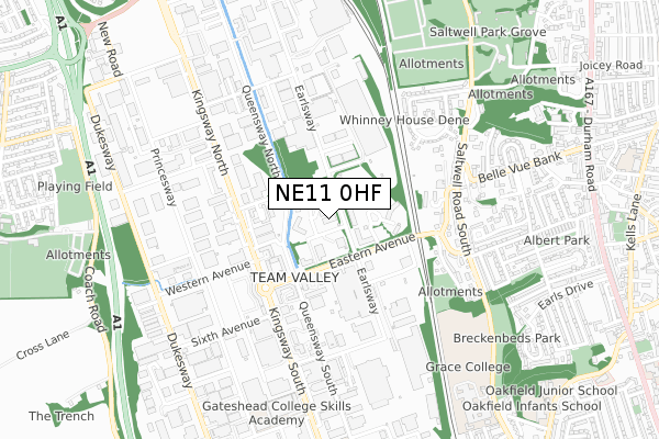
NE11 0HF lies on Fifth Avenue in Team Valley Trading Estate, Gateshead. NE11 0HF is located in the Lobley Hill and Bensham electoral ward, within the metropolitan district of Gateshead and the English Parliamentary constituency of Gateshead. The Sub Integrated Care Board (ICB) Location is NHS North East and North Cumbria ICB - 13T and the police force is Northumbria. This postcode has been in use since July 1990.


GetTheData
Source: OS Open Zoomstack (Ordnance Survey)
Licence: Open Government Licence (requires attribution)
Attribution: Contains OS data © Crown copyright and database right 2025
Source: Open Postcode Geo
Licence: Open Government Licence (requires attribution)
Attribution: Contains OS data © Crown copyright and database right 2025; Contains Royal Mail data © Royal Mail copyright and database right 2025; Source: Office for National Statistics licensed under the Open Government Licence v.3.0
| Easting | 424844 |
| Northing | 560070 |
| Latitude | 54.934698 |
| Longitude | -1.613804 |
GetTheData
Source: Open Postcode Geo
Licence: Open Government Licence
| Street | Fifth Avenue |
| Locality | Team Valley Trading Estate |
| Town/City | Gateshead |
| Country | England |
| Postcode District | NE11 |
➜ See where NE11 is on a map ➜ Where is Gateshead? | |
GetTheData
Source: Land Registry Price Paid Data
Licence: Open Government Licence
Elevation or altitude of NE11 0HF as distance above sea level:
| Metres | Feet | |
|---|---|---|
| Elevation | 10m | 33ft |
Elevation is measured from the approximate centre of the postcode, to the nearest point on an OS contour line from OS Terrain 50, which has contour spacing of ten vertical metres.
➜ How high above sea level am I? Find the elevation of your current position using your device's GPS.
GetTheData
Source: Open Postcode Elevation
Licence: Open Government Licence
| Ward | Lobley Hill And Bensham |
| Constituency | Gateshead |
GetTheData
Source: ONS Postcode Database
Licence: Open Government Licence
| Earlsway-fifth Avenue (Earlsway) | Team Valley | 34m |
| Eastern Avenue-earlsway (Eastern Avenue) | Team Valley | 136m |
| Eastern Avenue-earlsway (Eastern Avenue) | Team Valley | 199m |
| Eastern Avenue-kingsway (Eastern Avenue) | Team Valley | 344m |
| Eastern Avenue - Queensway South (Eastern Avenue) | Team Valley | 358m |
| Dunston Station | 2.5km |
| Newcastle Station | 3.8km |
| Heworth Station | 4.2km |
GetTheData
Source: NaPTAN
Licence: Open Government Licence
Estimated total energy consumption in NE11 0HF by fuel type, 2015.
| Consumption (kWh) | 322,212 |
|---|---|
| Meter count | 9 |
| Mean (kWh/meter) | 35,801 |
| Median (kWh/meter) | 39,207 |
GetTheData
Source: Postcode level gas estimates: 2015 (experimental)
Source: Postcode level electricity estimates: 2015 (experimental)
Licence: Open Government Licence
GetTheData
Source: ONS Postcode Database
Licence: Open Government Licence

➜ Get more ratings from the Food Standards Agency
GetTheData
Source: Food Standards Agency
Licence: FSA terms & conditions
| Last Collection | |||
|---|---|---|---|
| Location | Mon-Fri | Sat | Distance |
| Eastern Avenue | 18:30 | 209m | |
| Team Valley Shopping Village | 375m | ||
| Team Valley Shopping Village | 18:45 | 12:15 | 378m |
GetTheData
Source: Dracos
Licence: Creative Commons Attribution-ShareAlike
The below table lists the International Territorial Level (ITL) codes (formerly Nomenclature of Territorial Units for Statistics (NUTS) codes) and Local Administrative Units (LAU) codes for NE11 0HF:
| ITL 1 Code | Name |
|---|---|
| TLC | North East (England) |
| ITL 2 Code | Name |
| TLC2 | Northumberland, and Tyne and Wear |
| ITL 3 Code | Name |
| TLC22 | Tyneside |
| LAU 1 Code | Name |
| E08000037 | Gateshead |
GetTheData
Source: ONS Postcode Directory
Licence: Open Government Licence
The below table lists the Census Output Area (OA), Lower Layer Super Output Area (LSOA), and Middle Layer Super Output Area (MSOA) for NE11 0HF:
| Code | Name | |
|---|---|---|
| OA | E00041888 | |
| LSOA | E01008259 | Gateshead 007D |
| MSOA | E02001688 | Gateshead 007 |
GetTheData
Source: ONS Postcode Directory
Licence: Open Government Licence
| NE11 0XA | Fifth Avenue | 103m |
| NE11 0NB | Fifth Avenue | 240m |
| NE9 6EE | Pullman Court | 290m |
| NE9 6DZ | Pullman Court | 326m |
| NE9 6DR | Station Road | 373m |
| NE9 6DQ | Derwent Crook Drive | 378m |
| NE9 6HA | Saltwell Road South | 390m |
| NE9 6HB | Breckenbeds Road | 399m |
| NE11 0QY | North East Fruit & Vegetable Market | 420m |
| NE9 6DX | Ventnor Crescent | 426m |
GetTheData
Source: Open Postcode Geo; Land Registry Price Paid Data
Licence: Open Government Licence