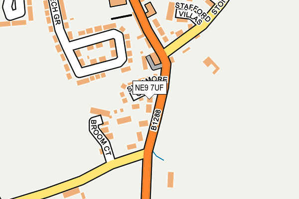
NE9 7UF is located in the Washington West electoral ward, within the metropolitan district of Sunderland and the English Parliamentary constituency of Washington and Sunderland West. The Sub Integrated Care Board (ICB) Location is NHS North East and North Cumbria ICB - 00P and the police force is Northumbria. This postcode has been in use since October 2002.


GetTheData
Source: OS OpenMap – Local (Ordnance Survey)
Source: OS VectorMap District (Ordnance Survey)
Licence: Open Government Licence (requires attribution)
| Easting | 428830 |
| Northing | 558039 |
| Latitude | 54.916227 |
| Longitude | -1.551787 |
GetTheData
Source: Open Postcode Geo
Licence: Open Government Licence
| Country | England |
| Postcode District | NE9 |
| ➜ NE9 open data dashboard ➜ See where NE9 is on a map ➜ Where is Springwell? | |
GetTheData
Source: Land Registry Price Paid Data
Licence: Open Government Licence
Elevation or altitude of NE9 7UF as distance above sea level:
| Metres | Feet | |
|---|---|---|
| Elevation | 130m | 427ft |
Elevation is measured from the approximate centre of the postcode, to the nearest point on an OS contour line from OS Terrain 50, which has contour spacing of ten vertical metres.
➜ How high above sea level am I? Find the elevation of your current position using your device's GPS.
GetTheData
Source: Open Postcode Elevation
Licence: Open Government Licence
| Ward | Washington West |
| Constituency | Washington And Sunderland West |
GetTheData
Source: ONS Postcode Database
Licence: Open Government Licence
| September 2023 | Burglary | On or near Winston Court | 244m |
| September 2023 | Burglary | On or near Winston Court | 244m |
| July 2023 | Other theft | On or near Stoney Lane | 241m |
| ➜ Get more crime data in our Crime section | |||
GetTheData
Source: data.police.uk
Licence: Open Government Licence
| Mount Lane-springwell Lane (Mount Lane) | Springwell | 126m |
| Springwell Road-primary School (Springwell Road) | Springwell | 191m |
| Stoney Lane | Springwell | 211m |
| Springwell Village School (Springwell Road) | Springwell | 242m |
| Springwell Road-primary School (Springwell Road) | Springwell | 292m |
| Heworth Station | 3.9km |
GetTheData
Source: NaPTAN
Licence: Open Government Licence
| Percentage of properties with Next Generation Access | 100.0% |
| Percentage of properties with Superfast Broadband | 100.0% |
| Percentage of properties with Ultrafast Broadband | 0.0% |
| Percentage of properties with Full Fibre Broadband | 0.0% |
Superfast Broadband is between 30Mbps and 300Mbps
Ultrafast Broadband is > 300Mbps
| Percentage of properties unable to receive 2Mbps | 0.0% |
| Percentage of properties unable to receive 5Mbps | 0.0% |
| Percentage of properties unable to receive 10Mbps | 0.0% |
| Percentage of properties unable to receive 30Mbps | 0.0% |
GetTheData
Source: Ofcom
Licence: Ofcom Terms of Use (requires attribution)
GetTheData
Source: ONS Postcode Database
Licence: Open Government Licence


➜ Get more ratings from the Food Standards Agency
GetTheData
Source: Food Standards Agency
Licence: FSA terms & conditions
| Last Collection | |||
|---|---|---|---|
| Location | Mon-Fri | Sat | Distance |
| Springwell Post Office | 16:30 | 10:30 | 338m |
| Peareth Hall Road | 17:30 | 10:30 | 631m |
| Donvale Road | 17:15 | 10:00 | 670m |
GetTheData
Source: Dracos
Licence: Creative Commons Attribution-ShareAlike
| Facility | Distance |
|---|---|
| George Washington Primary School Well Bank Road, Washington Swimming Pool, Sports Hall, Grass Pitches | 1.2km |
| Wrekenton Nou Camp Yfc Springwell Road, Wrekenton, Gateshead Grass Pitches | 1.3km |
| George Washington Leisure Club Stone Cellar Road, Washington Health and Fitness Gym, Swimming Pool, Golf, Squash Courts | 1.4km |
GetTheData
Source: Active Places
Licence: Open Government Licence
| School | Phase of Education | Distance |
|---|---|---|
| Springwell Village Primary School Westfield Crescent, Springwell, Gateshead, NE9 7RX | Primary | 222m |
| George Washington Primary School Well Bank Road, Washington, NE37 1NL | Primary | 1.1km |
| Blackfell Primary School Knoulberry, Blackfell, Washington, NE37 1HA | Primary | 1.4km |
GetTheData
Source: Edubase
Licence: Open Government Licence
The below table lists the International Territorial Level (ITL) codes (formerly Nomenclature of Territorial Units for Statistics (NUTS) codes) and Local Administrative Units (LAU) codes for NE9 7UF:
| ITL 1 Code | Name |
|---|---|
| TLC | North East (England) |
| ITL 2 Code | Name |
| TLC2 | Northumberland, and Tyne and Wear |
| ITL 3 Code | Name |
| TLC23 | Sunderland |
| LAU 1 Code | Name |
| E08000024 | Sunderland |
GetTheData
Source: ONS Postcode Directory
Licence: Open Government Licence
The below table lists the Census Output Area (OA), Lower Layer Super Output Area (LSOA), and Middle Layer Super Output Area (MSOA) for NE9 7UF:
| Code | Name | |
|---|---|---|
| OA | E00045048 | |
| LSOA | E01008873 | Sunderland 010A |
| MSOA | E02001800 | Sunderland 010 |
GetTheData
Source: ONS Postcode Directory
Licence: Open Government Licence
| NE9 7SE | Sycamore Grove | 42m |
| NE9 7SD | Kings Terrace | 76m |
| NE9 7SB | Carlton Terrace | 83m |
| NE9 7SZ | Broom Court | 99m |
| NE9 7UQ | Mount Lane | 144m |
| NE9 7SA | Coronation Terrace | 149m |
| NE9 7RY | The Bungalows | 151m |
| NE9 7SJ | Stoney Lane | 165m |
| NE9 7RE | Beech Grove | 190m |
| NE9 7SL | Stafford Villas | 200m |
GetTheData
Source: Open Postcode Geo; Land Registry Price Paid Data
Licence: Open Government Licence