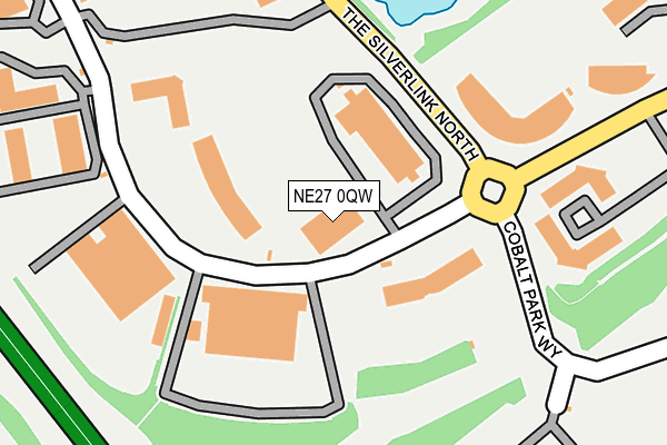
NE27 0QW is located in the Valley electoral ward, within the metropolitan district of North Tyneside and the English Parliamentary constituency of Tynemouth. The Sub Integrated Care Board (ICB) Location is NHS North East and North Cumbria ICB - 99C and the police force is Northumbria. This postcode has been in use since June 2002.


GetTheData
Source: OS OpenMap – Local (Ordnance Survey)
Source: OS VectorMap District (Ordnance Survey)
Licence: Open Government Licence (requires attribution)
| Easting | 431544 |
| Northing | 569658 |
| Latitude | 55.020470 |
| Longitude | -1.508178 |
GetTheData
Source: Open Postcode Geo
Licence: Open Government Licence
| Country | England |
| Postcode District | NE27 |
| ➜ NE27 open data dashboard ➜ See where NE27 is on a map ➜ Where is Tynemouth? | |
GetTheData
Source: Land Registry Price Paid Data
Licence: Open Government Licence
Elevation or altitude of NE27 0QW as distance above sea level:
| Metres | Feet | |
|---|---|---|
| Elevation | 70m | 230ft |
Elevation is measured from the approximate centre of the postcode, to the nearest point on an OS contour line from OS Terrain 50, which has contour spacing of ten vertical metres.
➜ How high above sea level am I? Find the elevation of your current position using your device's GPS.
GetTheData
Source: Open Postcode Elevation
Licence: Open Government Licence
| Ward | Valley |
| Constituency | Tynemouth |
GetTheData
Source: ONS Postcode Database
Licence: Open Government Licence
| June 2022 | Criminal damage and arson | On or near The Silverlink North | 137m |
| June 2022 | Public order | On or near The Silverlink North | 137m |
| June 2022 | Shoplifting | On or near Silver Fox Way | 167m |
| ➜ Get more crime data in our Crime section | |||
GetTheData
Source: data.police.uk
Licence: Open Government Licence
| Silver Fox Way-procter & Gamble (Silver Fox Way) | Cobalt | 33m |
| Silver Fox Way-procter & Gamble (Silver Fox Way) | Cobalt | 43m |
| Silver Fox Way - Procter & Gamble (Silverlink North) | Cobalt | 129m |
| Cobalt Link Road - North (Cobalt Link Road) | Cobalt | 179m |
| Silverlink North-procter & Gamble (Silverlink North) | Cobalt | 191m |
| Northumberland Park (Tyne & Wear Metro Station) (Station Road) | Northumberland Park | 1,596m |
GetTheData
Source: NaPTAN
Licence: Open Government Licence
GetTheData
Source: ONS Postcode Database
Licence: Open Government Licence


➜ Get more ratings from the Food Standards Agency
GetTheData
Source: Food Standards Agency
Licence: FSA terms & conditions
| Last Collection | |||
|---|---|---|---|
| Location | Mon-Fri | Sat | Distance |
| Silverlink Industrial Estate | 18:45 | 10:30 | 1,304m |
| North Tyneside Delivery Office | 18:45 | 12:45 | 1,340m |
| Whitley Road | 16:15 | 12:15 | 1,502m |
GetTheData
Source: Dracos
Licence: Creative Commons Attribution-ShareAlike
| Facility | Distance |
|---|---|
| Village Gym (Newcastle) The Silverlink North, Newcastle Upon Tyne Swimming Pool, Health and Fitness Gym, Studio | 588m |
| Hadrian Park Primary School Addington Drive, Wallsend Grass Pitches | 682m |
| Hilltop Park Norham Road North, North Shields Grass Pitches | 1.2km |
GetTheData
Source: Active Places
Licence: Open Government Licence
| School | Phase of Education | Distance |
|---|---|---|
| Hadrian Park Primary School Addington Drive, Wallsend, NE28 9RT | Primary | 669m |
| Shiremoor Primary School Stanton Road, Shiremoor, Newcastle-upon-Tyne, NE27 0PW | Primary | 1.4km |
| Battle Hill Primary School Berwick Drive, Battle Hill Estate, Wallsend, NE28 9DH | Primary | 1.5km |
GetTheData
Source: Edubase
Licence: Open Government Licence
The below table lists the International Territorial Level (ITL) codes (formerly Nomenclature of Territorial Units for Statistics (NUTS) codes) and Local Administrative Units (LAU) codes for NE27 0QW:
| ITL 1 Code | Name |
|---|---|
| TLC | North East (England) |
| ITL 2 Code | Name |
| TLC2 | Northumberland, and Tyne and Wear |
| ITL 3 Code | Name |
| TLC22 | Tyneside |
| LAU 1 Code | Name |
| E08000022 | North Tyneside |
GetTheData
Source: ONS Postcode Directory
Licence: Open Government Licence
The below table lists the Census Output Area (OA), Lower Layer Super Output Area (LSOA), and Middle Layer Super Output Area (MSOA) for NE27 0QW:
| Code | Name | |
|---|---|---|
| OA | E00043074 | |
| LSOA | E01008488 | North Tyneside 015A |
| MSOA | E02001752 | North Tyneside 015 |
GetTheData
Source: ONS Postcode Directory
Licence: Open Government Licence
| NE27 0QJ | Silver Fox Way | 111m |
| NE27 9TD | The Silverlink North | 260m |
| NE27 0QQ | Quick Silver Way | 380m |
| NE28 9YH | Burlington Court | 401m |
| NE28 9YQ | The Swallows | 451m |
| NE28 9YL | Hickstead Close | 455m |
| NE28 9YD | Chelford Close | 472m |
| NE28 9YF | Camerton Place | 498m |
| NE28 9YE | Chelford Close | 554m |
| NE28 9XR | Blackhill Avenue | 641m |
GetTheData
Source: Open Postcode Geo; Land Registry Price Paid Data
Licence: Open Government Licence