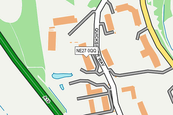
NE27 0QQ lies on Quick Silver Way in Cobalt Business Park, Newcastle Upon Tyne. NE27 0QQ is located in the Valley electoral ward, within the metropolitan district of North Tyneside and the English Parliamentary constituency of Tynemouth. The Sub Integrated Care Board (ICB) Location is NHS North East and North Cumbria ICB - 99C and the police force is Northumbria. This postcode has been in use since July 2005.


GetTheData
Source: OS OpenMap – Local (Ordnance Survey)
Source: OS VectorMap District (Ordnance Survey)
Licence: Open Government Licence (requires attribution)
| Easting | 431241 |
| Northing | 569888 |
| Latitude | 55.022556 |
| Longitude | -1.512891 |
GetTheData
Source: Open Postcode Geo
Licence: Open Government Licence
| Street | Quick Silver Way |
| Locality | Cobalt Business Park |
| Town/City | Newcastle Upon Tyne |
| Country | England |
| Postcode District | NE27 |
| ➜ NE27 open data dashboard ➜ See where NE27 is on a map ➜ Where is Tynemouth? | |
GetTheData
Source: Land Registry Price Paid Data
Licence: Open Government Licence
Elevation or altitude of NE27 0QQ as distance above sea level:
| Metres | Feet | |
|---|---|---|
| Elevation | 70m | 230ft |
Elevation is measured from the approximate centre of the postcode, to the nearest point on an OS contour line from OS Terrain 50, which has contour spacing of ten vertical metres.
➜ How high above sea level am I? Find the elevation of your current position using your device's GPS.
GetTheData
Source: Open Postcode Elevation
Licence: Open Government Licence
| Ward | Valley |
| Constituency | Tynemouth |
GetTheData
Source: ONS Postcode Database
Licence: Open Government Licence
| June 2022 | Shoplifting | On or near Silver Fox Way | 265m |
| June 2022 | Criminal damage and arson | On or near The Silverlink North | 422m |
| June 2022 | Public order | On or near The Silverlink North | 422m |
| ➜ Get more crime data in our Crime section | |||
GetTheData
Source: data.police.uk
Licence: Open Government Licence
| Cobalt Business Park (Quick Silver Way) | Cobalt | 110m |
| Cobalt Business Park-orange (Silver Fox Way) | Cobalt | 186m |
| Quicksilver Way - Orange (Silver Fox Way) | Cobalt | 188m |
| Quicksilver Way (Quick Silver Way) | Cobalt | 241m |
| The Silverlink North - Country Park (Cobalt Business Park) | Cobalt | 277m |
| Northumberland Park (Tyne & Wear Metro Station) (Station Road) | Northumberland Park | 1,262m |
GetTheData
Source: NaPTAN
Licence: Open Government Licence
GetTheData
Source: ONS Postcode Database
Licence: Open Government Licence


➜ Get more ratings from the Food Standards Agency
GetTheData
Source: Food Standards Agency
Licence: FSA terms & conditions
| Last Collection | |||
|---|---|---|---|
| Location | Mon-Fri | Sat | Distance |
| Whitley Road | 16:15 | 12:15 | 1,138m |
| Cartington Avenue | 16:15 | 11:00 | 1,460m |
| West Allotment Post Office | 16:30 | 11:30 | 1,472m |
GetTheData
Source: Dracos
Licence: Creative Commons Attribution-ShareAlike
| Facility | Distance |
|---|---|
| Village Gym (Newcastle) The Silverlink North, Newcastle Upon Tyne Swimming Pool, Health and Fitness Gym, Studio | 331m |
| Hadrian Park Primary School Addington Drive, Wallsend Grass Pitches | 854m |
| Holystone Primary School Whitley Road, Holystone, Newcastle Upon Tyne Grass Pitches | 1.1km |
GetTheData
Source: Active Places
Licence: Open Government Licence
| School | Phase of Education | Distance |
|---|---|---|
| Hadrian Park Primary School Addington Drive, Wallsend, NE28 9RT | Primary | 850m |
| Holystone Primary School Whitley Road, Holystone, Newcastle-upon-Tyne, NE27 0DA | Primary | 1.1km |
| Shiremoor Primary School Stanton Road, Shiremoor, Newcastle-upon-Tyne, NE27 0PW | Primary | 1.2km |
GetTheData
Source: Edubase
Licence: Open Government Licence
The below table lists the International Territorial Level (ITL) codes (formerly Nomenclature of Territorial Units for Statistics (NUTS) codes) and Local Administrative Units (LAU) codes for NE27 0QQ:
| ITL 1 Code | Name |
|---|---|
| TLC | North East (England) |
| ITL 2 Code | Name |
| TLC2 | Northumberland, and Tyne and Wear |
| ITL 3 Code | Name |
| TLC22 | Tyneside |
| LAU 1 Code | Name |
| E08000022 | North Tyneside |
GetTheData
Source: ONS Postcode Directory
Licence: Open Government Licence
The below table lists the Census Output Area (OA), Lower Layer Super Output Area (LSOA), and Middle Layer Super Output Area (MSOA) for NE27 0QQ:
| Code | Name | |
|---|---|---|
| OA | E00043509 | |
| LSOA | E01008570 | North Tyneside 011D |
| MSOA | E02001748 | North Tyneside 011 |
GetTheData
Source: ONS Postcode Directory
Licence: Open Government Licence
| NE27 9TD | The Silverlink North | 223m |
| NE27 0DT | Preston Terrace | 353m |
| NE27 0DU | Cooperative Terrace | 377m |
| NE27 0DX | Cramlington Terrace | 413m |
| NE27 0EF | Taylor Terrace | 428m |
| NE27 0DY | Earsdon Terrace | 434m |
| NE27 0EE | Taylor Terrace | 466m |
| NE28 9YQ | The Swallows | 466m |
| NE27 0DZ | Ryton Terrace | 469m |
| NE27 0DW | Turner Street | 479m |
GetTheData
Source: Open Postcode Geo; Land Registry Price Paid Data
Licence: Open Government Licence