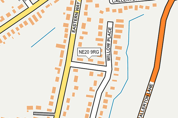
NE20 9RG lies on Willow Way in Ponteland, Newcastle Upon Tyne. NE20 9RG is located in the Ponteland East and Stannington electoral ward, within the unitary authority of Northumberland and the English Parliamentary constituency of Hexham. The Sub Integrated Care Board (ICB) Location is NHS North East and North Cumbria ICB - 00L and the police force is Northumbria. This postcode has been in use since January 1980.


GetTheData
Source: OS OpenMap – Local (Ordnance Survey)
Source: OS VectorMap District (Ordnance Survey)
Licence: Open Government Licence (requires attribution)
| Easting | 416077 |
| Northing | 571511 |
| Latitude | 55.037858 |
| Longitude | -1.749978 |
GetTheData
Source: Open Postcode Geo
Licence: Open Government Licence
| Street | Willow Way |
| Locality | Ponteland |
| Town/City | Newcastle Upon Tyne |
| Country | England |
| Postcode District | NE20 |
➜ See where NE20 is on a map ➜ Where is Ponteland? | |
GetTheData
Source: Land Registry Price Paid Data
Licence: Open Government Licence
Elevation or altitude of NE20 9RG as distance above sea level:
| Metres | Feet | |
|---|---|---|
| Elevation | 80m | 262ft |
Elevation is measured from the approximate centre of the postcode, to the nearest point on an OS contour line from OS Terrain 50, which has contour spacing of ten vertical metres.
➜ How high above sea level am I? Find the elevation of your current position using your device's GPS.
GetTheData
Source: Open Postcode Elevation
Licence: Open Government Licence
| Ward | Ponteland East And Stannington |
| Constituency | Hexham |
GetTheData
Source: ONS Postcode Database
Licence: Open Government Licence
2022 18 JUL £585,000 |
2021 5 MAR £385,000 |
68, WILLOW WAY, PONTELAND, NEWCASTLE UPON TYNE, NE20 9RG 2019 29 NOV £415,000 |
2017 14 JUL £608,000 |
59, WILLOW WAY, PONTELAND, NEWCASTLE UPON TYNE, NE20 9RG 2010 9 JUN £346,500 |
2009 11 DEC £575,000 |
57, WILLOW WAY, PONTELAND, NEWCASTLE UPON TYNE, NE20 9RG 2007 23 AUG £412,000 |
59, WILLOW WAY, PONTELAND, NEWCASTLE UPON TYNE, NE20 9RG 2006 5 MAY £355,000 |
2003 12 DEC £322,500 |
59, WILLOW WAY, PONTELAND, NEWCASTLE UPON TYNE, NE20 9RG 2002 25 OCT £235,000 |
GetTheData
Source: HM Land Registry Price Paid Data
Licence: Contains HM Land Registry data © Crown copyright and database right 2025. This data is licensed under the Open Government Licence v3.0.
| Middle Drive Sycamore Ave (Middle Drive) | Darras Hall | 267m |
| Middle Drive Sycamore Ave (Middle Drive) | Darras Hall | 272m |
| Eastern Way Middle Drive (Eastern Way) | Ponteland | 338m |
| Middle Drive No 22 (Middle Drive) | Darras Hall | 341m |
| Eastern Way Middle Drive (Eastern Way) | Ponteland | 347m |
| Newcastle Airport Metro | 2.5km |
GetTheData
Source: NaPTAN
Licence: Open Government Licence
| Percentage of properties with Next Generation Access | 100.0% |
| Percentage of properties with Superfast Broadband | 100.0% |
| Percentage of properties with Ultrafast Broadband | 0.0% |
| Percentage of properties with Full Fibre Broadband | 0.0% |
Superfast Broadband is between 30Mbps and 300Mbps
Ultrafast Broadband is > 300Mbps
| Percentage of properties unable to receive 2Mbps | 0.0% |
| Percentage of properties unable to receive 5Mbps | 0.0% |
| Percentage of properties unable to receive 10Mbps | 0.0% |
| Percentage of properties unable to receive 30Mbps | 0.0% |
GetTheData
Source: Ofcom
Licence: Ofcom Terms of Use (requires attribution)
GetTheData
Source: ONS Postcode Database
Licence: Open Government Licence


➜ Get more ratings from the Food Standards Agency
GetTheData
Source: Food Standards Agency
Licence: FSA terms & conditions
| Last Collection | |||
|---|---|---|---|
| Location | Mon-Fri | Sat | Distance |
| Dunsgreen | 16:00 | 08:00 | 847m |
| Darras Hall Post Office | 17:00 | 11:30 | 947m |
| Ponteland Post Office | 17:15 | 12:00 | 1,403m |
GetTheData
Source: Dracos
Licence: Creative Commons Attribution-ShareAlike
The below table lists the International Territorial Level (ITL) codes (formerly Nomenclature of Territorial Units for Statistics (NUTS) codes) and Local Administrative Units (LAU) codes for NE20 9RG:
| ITL 1 Code | Name |
|---|---|
| TLC | North East (England) |
| ITL 2 Code | Name |
| TLC2 | Northumberland, and Tyne and Wear |
| ITL 3 Code | Name |
| TLC21 | Northumberland |
| LAU 1 Code | Name |
| E06000057 | Northumberland |
GetTheData
Source: ONS Postcode Directory
Licence: Open Government Licence
The below table lists the Census Output Area (OA), Lower Layer Super Output Area (LSOA), and Middle Layer Super Output Area (MSOA) for NE20 9RG:
| Code | Name | |
|---|---|---|
| OA | E00139785 | |
| LSOA | E01027464 | Northumberland 033A |
| MSOA | E02005725 | Northumberland 033 |
GetTheData
Source: ONS Postcode Directory
Licence: Open Government Licence
| NE20 9RL | Willow Place | 106m |
| NE20 9RE | Eastern Way | 160m |
| NE20 9RQ | Eastern Way | 247m |
| NE20 9RF | Willow Way | 255m |
| NE20 9EN | Callerton Court | 277m |
| NE20 9DN | Middle Drive | 283m |
| NE20 9DJ | Sycamore Avenue | 353m |
| NE20 9RU | Hawthorn Way | 384m |
| NE20 9DH | Middle Drive | 387m |
| NE20 9DZ | Collingwood Crescent | 420m |
GetTheData
Source: Open Postcode Geo; Land Registry Price Paid Data
Licence: Open Government Licence