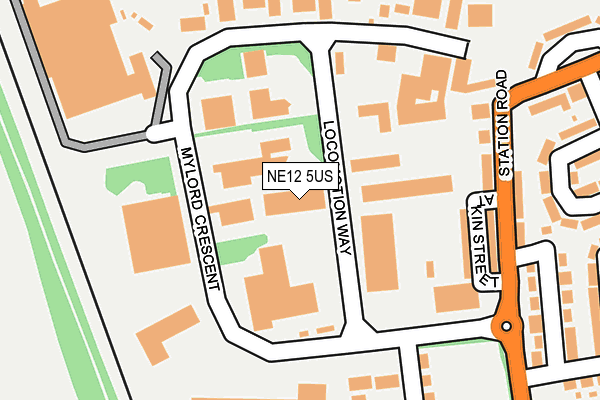
NE12 5US lies on Locomotion Way in Camperdown Industrial Estate, Newcastle Upon Tyne. NE12 5US is located in the Camperdown electoral ward, within the metropolitan district of North Tyneside and the English Parliamentary constituency of North Tyneside. The Sub Integrated Care Board (ICB) Location is NHS North East and North Cumbria ICB - 99C and the police force is Northumbria. This postcode has been in use since June 1999.


GetTheData
Source: OS OpenMap – Local (Ordnance Survey)
Source: OS VectorMap District (Ordnance Survey)
Licence: Open Government Licence (requires attribution)
| Easting | 426656 |
| Northing | 572022 |
| Latitude | 55.041997 |
| Longitude | -1.584405 |
GetTheData
Source: Open Postcode Geo
Licence: Open Government Licence
| Street | Locomotion Way |
| Locality | Camperdown Industrial Estate |
| Town/City | Newcastle Upon Tyne |
| Country | England |
| Postcode District | NE12 |
| ➜ NE12 open data dashboard ➜ See where NE12 is on a map ➜ Where is Killingworth? | |
GetTheData
Source: Land Registry Price Paid Data
Licence: Open Government Licence
Elevation or altitude of NE12 5US as distance above sea level:
| Metres | Feet | |
|---|---|---|
| Elevation | 60m | 197ft |
Elevation is measured from the approximate centre of the postcode, to the nearest point on an OS contour line from OS Terrain 50, which has contour spacing of ten vertical metres.
➜ How high above sea level am I? Find the elevation of your current position using your device's GPS.
GetTheData
Source: Open Postcode Elevation
Licence: Open Government Licence
| Ward | Camperdown |
| Constituency | North Tyneside |
GetTheData
Source: ONS Postcode Database
Licence: Open Government Licence
UNIT 1, LOCOMOTION WAY, CAMPERDOWN INDUSTRIAL ESTATE, NEWCASTLE UPON TYNE, NE12 5US 2007 30 MAR £288,500 |
UNIT 1, LOCOMOTION WAY, CAMPERDOWN INDUSTRIAL ESTATE, NEWCASTLE UPON TYNE, NE12 5US 2000 28 JUN £137,000 |
GetTheData
Source: HM Land Registry Price Paid Data
Licence: Contains HM Land Registry data © Crown copyright and database right 2024. This data is licensed under the Open Government Licence v3.0.
| January 2024 | Public order | On or near Allanville | 395m |
| December 2023 | Anti-social behaviour | On or near Allanville | 395m |
| December 2023 | Violence and sexual offences | On or near Allanville | 395m |
| ➜ Locomotion Way crime map and outcomes | |||
GetTheData
Source: data.police.uk
Licence: Open Government Licence
| Camperdown (Station Rd) | Burradon | 204m |
| Camperdown (Station Road) | Burradon | 225m |
| Burradon (Front Street) | Burradon | 357m |
| Burradon (Front St) | Burradon | 377m |
| Burradon Road - Camperdown Hotel (Burradon Rd) | Burradon | 524m |
GetTheData
Source: NaPTAN
Licence: Open Government Licence
GetTheData
Source: ONS Postcode Database
Licence: Open Government Licence


➜ Get more ratings from the Food Standards Agency
GetTheData
Source: Food Standards Agency
Licence: FSA terms & conditions
| Last Collection | |||
|---|---|---|---|
| Location | Mon-Fri | Sat | Distance |
| Camperdown Industrial Estate | 188m | ||
| Front Street | 18:30 | 12:00 | 336m |
| Allanville | 16:00 | 12:00 | 535m |
GetTheData
Source: Dracos
Licence: Creative Commons Attribution-ShareAlike
| Facility | Distance |
|---|---|
| Newcastle Field Packaging (Closed) Station Road, Newcastle Upon Tyne Grass Pitches | 446m |
| Burradon Community Primary School Burradon Road, Burradon, Cramlington Grass Pitches | 718m |
| Bailey Green Primary School West Bailey, Killingworth, Newcastle Upon Tyne Grass Pitches | 795m |
GetTheData
Source: Active Places
Licence: Open Government Licence
| School | Phase of Education | Distance |
|---|---|---|
| Burradon Community Primary School Burradon Road, Burradon, Cramlington, NE23 7NG | Primary | 550m |
| Bailey Green Primary School West Bailey, Killingworth, NE12 6QL | Primary | 816m |
| Grasmere Academy Grasmere Court, Killingworth, Newcastle-upon-Tyne, NE12 6TS | Primary | 860m |
GetTheData
Source: Edubase
Licence: Open Government Licence
The below table lists the International Territorial Level (ITL) codes (formerly Nomenclature of Territorial Units for Statistics (NUTS) codes) and Local Administrative Units (LAU) codes for NE12 5US:
| ITL 1 Code | Name |
|---|---|
| TLC | North East (England) |
| ITL 2 Code | Name |
| TLC2 | Northumberland, and Tyne and Wear |
| ITL 3 Code | Name |
| TLC22 | Tyneside |
| LAU 1 Code | Name |
| E08000022 | North Tyneside |
GetTheData
Source: ONS Postcode Directory
Licence: Open Government Licence
The below table lists the Census Output Area (OA), Lower Layer Super Output Area (LSOA), and Middle Layer Super Output Area (MSOA) for NE12 5US:
| Code | Name | |
|---|---|---|
| OA | E00043017 | |
| LSOA | E01008476 | North Tyneside 008B |
| MSOA | E02001745 | North Tyneside 008 |
GetTheData
Source: ONS Postcode Directory
Licence: Open Government Licence
| NE12 5UJ | Mylord Crescent | 54m |
| NE12 5UZ | Atkin Street | 171m |
| NE12 5UX | Station Road | 188m |
| NE12 5UY | Station Road | 216m |
| NE12 5XA | Station Road | 262m |
| NE12 5XS | Allanville | 302m |
| NE12 5XD | Camperdown Avenue | 312m |
| NE12 5UT | Front Street | 330m |
| NE23 7NU | Means Drive | 361m |
| NE12 5XE | Bell Grove | 361m |
GetTheData
Source: Open Postcode Geo; Land Registry Price Paid Data
Licence: Open Government Licence