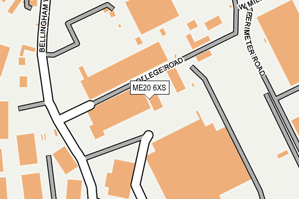
ME20 6XS is located in the Aylesford South & Ditton electoral ward, within the local authority district of Tonbridge and Malling and the English Parliamentary constituency of Chatham and Aylesford. The Sub Integrated Care Board (ICB) Location is NHS Kent and Medway ICB - 91Q and the police force is Kent. This postcode has been in use since January 1995.


GetTheData
Source: OS OpenMap – Local (Ordnance Survey)
Source: OS VectorMap District (Ordnance Survey)
Licence: Open Government Licence (requires attribution)
| Easting | 570921 |
| Northing | 159284 |
| Latitude | 51.307009 |
| Longitude | 0.450750 |
GetTheData
Source: Open Postcode Geo
Licence: Open Government Licence
| Country | England |
| Postcode District | ME20 |
| ➜ ME20 open data dashboard ➜ See where ME20 is on a map ➜ Where is New Hythe? | |
GetTheData
Source: Land Registry Price Paid Data
Licence: Open Government Licence
Elevation or altitude of ME20 6XS as distance above sea level:
| Metres | Feet | |
|---|---|---|
| Elevation | 10m | 33ft |
Elevation is measured from the approximate centre of the postcode, to the nearest point on an OS contour line from OS Terrain 50, which has contour spacing of ten vertical metres.
➜ How high above sea level am I? Find the elevation of your current position using your device's GPS.
GetTheData
Source: Open Postcode Elevation
Licence: Open Government Licence
| Ward | Aylesford South & Ditton |
| Constituency | Chatham And Aylesford |
GetTheData
Source: ONS Postcode Database
Licence: Open Government Licence
| June 2022 | Anti-social behaviour | On or near College Road | 72m |
| June 2022 | Anti-social behaviour | On or near College Road | 72m |
| June 2022 | Anti-social behaviour | On or near Bellingham Way | 328m |
| ➜ Get more crime data in our Crime section | |||
GetTheData
Source: data.police.uk
Licence: Open Government Licence
| Mercer Close (New Hythe Lane) | Larkfield | 389m |
| Mercer Close (New Hythe Lane) | Larkfield | 404m |
| Leisure Centre (New Hythe Lane) | Larkfield | 433m |
| Leisure Centre (New Hythe Lane) | Larkfield | 453m |
| Bricklayers Arms (New Hythe Lane) | Larkfield | 478m |
| New Hythe Station | 0.7km |
| Aylesford Station | 1.2km |
| East Malling Station | 2.5km |
GetTheData
Source: NaPTAN
Licence: Open Government Licence
GetTheData
Source: ONS Postcode Database
Licence: Open Government Licence


➜ Get more ratings from the Food Standards Agency
GetTheData
Source: Food Standards Agency
Licence: FSA terms & conditions
| Last Collection | |||
|---|---|---|---|
| Location | Mon-Fri | Sat | Distance |
| Brookland Estate | 16:00 | 09:00 | 427m |
| Lunsford Lane Lower | 16:15 | 09:00 | 461m |
| Chocolate Box | 16:00 | 10:45 | 821m |
GetTheData
Source: Dracos
Licence: Creative Commons Attribution-ShareAlike
| Facility | Distance |
|---|---|
| Larkfield Leisure Centre New Hythe Lane, Larkfield, Aylesford Sports Hall, Swimming Pool, Health and Fitness Gym, Studio, Squash Courts | 556m |
| Larkfield Village Hall New Hythe Lane, Larkfield, Aylesford Sports Hall | 568m |
| Larkfield Playing Field New Hythe Lane, Larkfield, Aylesford Grass Pitches | 658m |
GetTheData
Source: Active Places
Licence: Open Government Licence
| School | Phase of Education | Distance |
|---|---|---|
| Brookfield Junior School Brookfield Junior School, Swallow Road, Larkfield, Aylesford, ME20 6PY | Primary | 913m |
| Lunsford Primary School Swallow Road, Larkfield, Aylesford, ME20 6PY | Primary | 988m |
| Brookfield Infant School Swallow Road, Larkfield, Aylesford, ME20 6PY | Primary | 995m |
GetTheData
Source: Edubase
Licence: Open Government Licence
| Risk of ME20 6XS flooding from rivers and sea | Low |
| ➜ ME20 6XS flood map | |
GetTheData
Source: Open Flood Risk by Postcode
Licence: Open Government Licence
The below table lists the International Territorial Level (ITL) codes (formerly Nomenclature of Territorial Units for Statistics (NUTS) codes) and Local Administrative Units (LAU) codes for ME20 6XS:
| ITL 1 Code | Name |
|---|---|
| TLJ | South East (England) |
| ITL 2 Code | Name |
| TLJ4 | Kent |
| ITL 3 Code | Name |
| TLJ46 | West Kent |
| LAU 1 Code | Name |
| E07000115 | Tonbridge and Malling |
GetTheData
Source: ONS Postcode Directory
Licence: Open Government Licence
The below table lists the Census Output Area (OA), Lower Layer Super Output Area (LSOA), and Middle Layer Super Output Area (MSOA) for ME20 6XS:
| Code | Name | |
|---|---|---|
| OA | E00125564 | |
| LSOA | E01024735 | Tonbridge and Malling 005C |
| MSOA | E02005153 | Tonbridge and Malling 005 |
GetTheData
Source: ONS Postcode Directory
Licence: Open Government Licence
| ME20 7GD | Abery Drive | 277m |
| ME20 7GE | Abery Drive | 301m |
| ME20 6QY | Mercer Close | 328m |
| ME20 7GF | Eaton Place | 341m |
| ME20 7HP | New Hythe Business Park | 347m |
| ME20 7GP | Ingram Close | 350m |
| ME20 6FG | Albion Drive | 363m |
| ME20 7GQ | Ingram Close | 376m |
| ME20 6RZ | New Hythe Lane | 383m |
| ME20 7GN | Sherwood Avenue | 399m |
GetTheData
Source: Open Postcode Geo; Land Registry Price Paid Data
Licence: Open Government Licence