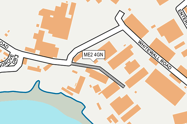
ME2 4GN is located in the Strood Rural electoral ward, within the unitary authority of Medway and the English Parliamentary constituency of Rochester and Strood. The Sub Integrated Care Board (ICB) Location is NHS Kent and Medway ICB - 91Q and the police force is Kent. This postcode has been in use since August 2009.


GetTheData
Source: OS OpenMap – Local (Ordnance Survey)
Source: OS VectorMap District (Ordnance Survey)
Licence: Open Government Licence (requires attribution)
| Easting | 574656 |
| Northing | 169504 |
| Latitude | 51.397683 |
| Longitude | 0.509293 |
GetTheData
Source: Open Postcode Geo
Licence: Open Government Licence
| Country | England |
| Postcode District | ME2 |
| ➜ ME2 open data dashboard ➜ See where ME2 is on a map ➜ Where is Rochester? | |
GetTheData
Source: Land Registry Price Paid Data
Licence: Open Government Licence
Elevation or altitude of ME2 4GN as distance above sea level:
| Metres | Feet | |
|---|---|---|
| Elevation | 10m | 33ft |
Elevation is measured from the approximate centre of the postcode, to the nearest point on an OS contour line from OS Terrain 50, which has contour spacing of ten vertical metres.
➜ How high above sea level am I? Find the elevation of your current position using your device's GPS.
GetTheData
Source: Open Postcode Elevation
Licence: Open Government Licence
| Ward | Strood Rural |
| Constituency | Rochester And Strood |
GetTheData
Source: ONS Postcode Database
Licence: Open Government Licence
| June 2022 | Criminal damage and arson | On or near Commissioner'S Road | 30m |
| June 2022 | Criminal damage and arson | On or near Whitewall Road | 248m |
| June 2022 | Burglary | On or near Whitewall Road | 248m |
| ➜ Get more crime data in our Crime section | |||
GetTheData
Source: data.police.uk
Licence: Open Government Licence
| Whitewall Road (Commissioners Road) | Strood | 108m |
| Whitewall Road (Commissioners Road) | Strood | 114m |
| Cliffe Construction (Whitewall Road) | Medway City Estate | 147m |
| Cliffe Construction (Whitewall Road) | Medway City Estate | 245m |
| Whitewall Way (Whitewall Road) | Medway City Estate | 364m |
| Strood Station | 0.6km |
| Rochester Station | 1.4km |
| Chatham Station | 2.1km |
GetTheData
Source: NaPTAN
Licence: Open Government Licence
GetTheData
Source: ONS Postcode Database
Licence: Open Government Licence


➜ Get more ratings from the Food Standards Agency
GetTheData
Source: Food Standards Agency
Licence: FSA terms & conditions
| Last Collection | |||
|---|---|---|---|
| Location | Mon-Fri | Sat | Distance |
| Commissioners Road | 18:15 | 11:30 | 330m |
| St Anthonys Way | 18:30 | 11:00 | 462m |
| Centre Court Meter Box | 18:30 | 571m | |
GetTheData
Source: Dracos
Licence: Creative Commons Attribution-ShareAlike
| Facility | Distance |
|---|---|
| Hollands Strength & Conditioning (Closed) Victory Park, Trident Close, Medway City Estate, Rochester Health and Fitness Gym | 464m |
| Hilltop Primary Academy Hilltop Road, Rochester Grass Pitches, Swimming Pool | 1km |
| The Gym Group (Strood) Commercial Road, Rochester Health and Fitness Gym | 1.1km |
GetTheData
Source: Active Places
Licence: Open Government Licence
| School | Phase of Education | Distance |
|---|---|---|
| Rochester Riverside Church of England Primary School Gas House Road, Rochester, ME1 1US | Primary | 772m |
| English Martyrs' Catholic Primary School Frindsbury Road, Strood, Rochester, ME2 4JA | Primary | 774m |
| Hilltop Primary Academy Hilltop Road, Frindsbury, Rochester, ME2 4QN | Primary | 1km |
GetTheData
Source: Edubase
Licence: Open Government Licence
| Risk of ME2 4GN flooding from rivers and sea | High |
| ➜ ME2 4GN flood map | |
GetTheData
Source: Open Flood Risk by Postcode
Licence: Open Government Licence
The below table lists the International Territorial Level (ITL) codes (formerly Nomenclature of Territorial Units for Statistics (NUTS) codes) and Local Administrative Units (LAU) codes for ME2 4GN:
| ITL 1 Code | Name |
|---|---|
| TLJ | South East (England) |
| ITL 2 Code | Name |
| TLJ4 | Kent |
| ITL 3 Code | Name |
| TLJ41 | Medway |
| LAU 1 Code | Name |
| E06000035 | Medway |
GetTheData
Source: ONS Postcode Directory
Licence: Open Government Licence
The below table lists the Census Output Area (OA), Lower Layer Super Output Area (LSOA), and Middle Layer Super Output Area (MSOA) for ME2 4GN:
| Code | Name | |
|---|---|---|
| OA | E00081615 | |
| LSOA | E01016147 | Medway 004B |
| MSOA | E02003317 | Medway 004 |
GetTheData
Source: ONS Postcode Directory
Licence: Open Government Licence
| ME2 4DZ | Whitewall Road | 180m |
| ME2 4EW | Whitewall Road | 194m |
| ME2 4HQ | Shamel Business Centre | 207m |
| ME2 4QT | Wingrove Drive | 324m |
| ME2 4LY | Enterprise Close | 324m |
| ME2 4UR | Parsonage Lane | 373m |
| ME2 4LX | Northpoint Business Estate | 381m |
| ME2 4DJ | Maritime Close | 396m |
| ME2 4FR | Henley Business Park | 396m |
| ME2 4NW | Anthonys Way | 416m |
GetTheData
Source: Open Postcode Geo; Land Registry Price Paid Data
Licence: Open Government Licence