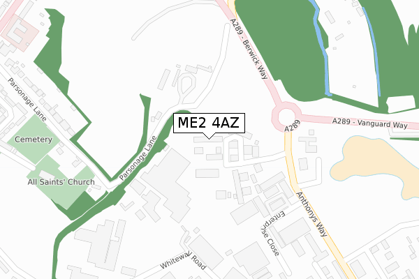
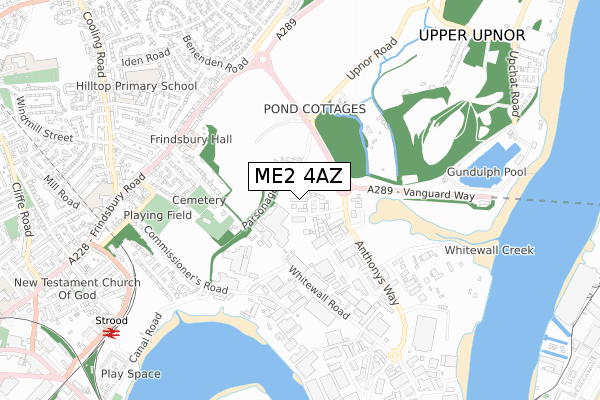
ME2 4AZ is located in the Strood Rural electoral ward, within the unitary authority of Medway and the English Parliamentary constituency of Rochester and Strood. The Sub Integrated Care Board (ICB) Location is NHS Kent and Medway ICB - 91Q and the police force is Kent. This postcode has been in use since July 1990.


GetTheData
Source: OS Open Zoomstack (Ordnance Survey)
Licence: Open Government Licence (requires attribution)
Attribution: Contains OS data © Crown copyright and database right 2024
Source: Open Postcode Geo
Licence: Open Government Licence (requires attribution)
Attribution: Contains OS data © Crown copyright and database right 2024; Contains Royal Mail data © Royal Mail copyright and database right 2024; Source: Office for National Statistics licensed under the Open Government Licence v.3.0
| Easting | 574800 |
| Northing | 169890 |
| Latitude | 51.401106 |
| Longitude | 0.511579 |
GetTheData
Source: Open Postcode Geo
Licence: Open Government Licence
| Country | England |
| Postcode District | ME2 |
| ➜ ME2 open data dashboard ➜ See where ME2 is on a map ➜ Where is Rochester? | |
GetTheData
Source: Land Registry Price Paid Data
Licence: Open Government Licence
Elevation or altitude of ME2 4AZ as distance above sea level:
| Metres | Feet | |
|---|---|---|
| Elevation | 10m | 33ft |
Elevation is measured from the approximate centre of the postcode, to the nearest point on an OS contour line from OS Terrain 50, which has contour spacing of ten vertical metres.
➜ How high above sea level am I? Find the elevation of your current position using your device's GPS.
GetTheData
Source: Open Postcode Elevation
Licence: Open Government Licence
| Ward | Strood Rural |
| Constituency | Rochester And Strood |
GetTheData
Source: ONS Postcode Database
Licence: Open Government Licence
| June 2022 | Shoplifting | On or near Petrol Station | 244m |
| June 2022 | Criminal damage and arson | On or near Petrol Station | 244m |
| June 2022 | Other theft | On or near Petrol Station | 244m |
| ➜ Get more crime data in our Crime section | |||
GetTheData
Source: data.police.uk
Licence: Open Government Licence
| Enterprise Close (Anthony Way) | Medway City Estate | 302m |
| Cliffe Construction (Whitewall Road) | Medway City Estate | 325m |
| Enterprise Close (Anthony Way) | Medway City Estate | 325m |
| Cliffe Construction (Whitewall Road) | Medway City Estate | 411m |
| Whitewall Road (Commissioners Road) | Strood | 454m |
| Strood Station | 0.9km |
| Rochester Station | 1.7km |
| Chatham Station | 2.4km |
GetTheData
Source: NaPTAN
Licence: Open Government Licence
Estimated total energy consumption in ME2 4AZ by fuel type, 2015.
| Consumption (kWh) | 166,486 |
|---|---|
| Meter count | 8 |
| Mean (kWh/meter) | 20,811 |
| Median (kWh/meter) | 24,128 |
GetTheData
Source: Postcode level gas estimates: 2015 (experimental)
Source: Postcode level electricity estimates: 2015 (experimental)
Licence: Open Government Licence
GetTheData
Source: ONS Postcode Database
Licence: Open Government Licence


➜ Get more ratings from the Food Standards Agency
GetTheData
Source: Food Standards Agency
Licence: FSA terms & conditions
| Last Collection | |||
|---|---|---|---|
| Location | Mon-Fri | Sat | Distance |
| St Anthonys Way | 18:30 | 11:00 | 415m |
| Commissioners Road | 18:15 | 11:30 | 558m |
| Bingham Road Post Office | 17:30 | 11:30 | 576m |
GetTheData
Source: Dracos
Licence: Creative Commons Attribution-ShareAlike
| Facility | Distance |
|---|---|
| Hollands Strength & Conditioning (Closed) Victory Park, Trident Close, Medway City Estate, Rochester Health and Fitness Gym | 673m |
| Hilltop Primary Academy Hilltop Road, Rochester Grass Pitches, Swimming Pool | 857m |
| Frindsbury Lawn Tennis Club Upnor Road, Upnor, Rochester Outdoor Tennis Courts, Indoor Tennis Centre | 993m |
GetTheData
Source: Active Places
Licence: Open Government Licence
| School | Phase of Education | Distance |
|---|---|---|
| Wainscott Primary School Wainscott Road, Wainscott, Rochester, ME2 4JX | Primary | 789m |
| English Martyrs' Catholic Primary School Frindsbury Road, Strood, Rochester, ME2 4JA | Primary | 813m |
| Hilltop Primary Academy Hilltop Road, Frindsbury, Rochester, ME2 4QN | Primary | 877m |
GetTheData
Source: Edubase
Licence: Open Government Licence
| Risk of ME2 4AZ flooding from rivers and sea | Medium |
| ➜ ME2 4AZ flood map | |
GetTheData
Source: Open Flood Risk by Postcode
Licence: Open Government Licence
The below table lists the International Territorial Level (ITL) codes (formerly Nomenclature of Territorial Units for Statistics (NUTS) codes) and Local Administrative Units (LAU) codes for ME2 4AZ:
| ITL 1 Code | Name |
|---|---|
| TLJ | South East (England) |
| ITL 2 Code | Name |
| TLJ4 | Kent |
| ITL 3 Code | Name |
| TLJ41 | Medway |
| LAU 1 Code | Name |
| E06000035 | Medway |
GetTheData
Source: ONS Postcode Directory
Licence: Open Government Licence
The below table lists the Census Output Area (OA), Lower Layer Super Output Area (LSOA), and Middle Layer Super Output Area (MSOA) for ME2 4AZ:
| Code | Name | |
|---|---|---|
| OA | E00081615 | |
| LSOA | E01016147 | Medway 004B |
| MSOA | E02003317 | Medway 004 |
GetTheData
Source: ONS Postcode Directory
Licence: Open Government Licence
| ME2 4DJ | Maritime Close | 35m |
| ME2 4UT | Parsonage Lane | 178m |
| ME2 4LX | Northpoint Business Estate | 191m |
| ME2 4DZ | Whitewall Road | 270m |
| ME2 4UR | Parsonage Lane | 331m |
| ME2 4LY | Enterprise Close | 370m |
| ME2 4NW | Anthonys Way | 370m |
| ME2 4EW | Whitewall Road | 388m |
| ME2 4HP | Parsonage Lane | 423m |
| ME2 4UZ | Upnor Road | 448m |
GetTheData
Source: Open Postcode Geo; Land Registry Price Paid Data
Licence: Open Government Licence