M7 1JF maps, stats, and open data
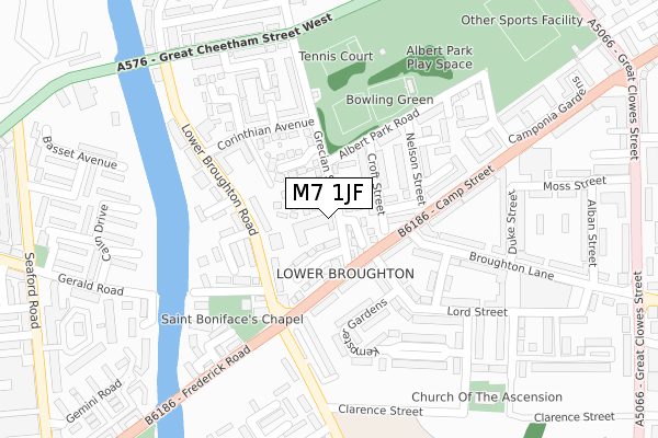
M7 1JF lies on Grecian Street in Salford. M7 1JF is located in the Broughton electoral ward, within the metropolitan district of Salford and the English Parliamentary constituency of Blackley and Broughton. The Sub Integrated Care Board (ICB) Location is NHS Greater Manchester ICB - 01G and the police force is Greater Manchester. This postcode has been in use since May 1994.
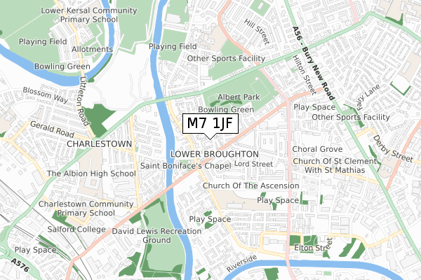
M7 1JF maps


Licence: Open Government Licence (requires attribution)
Attribution: Contains OS data © Crown copyright and database right 2025
Source: Open Postcode Geo
Licence: Open Government Licence (requires attribution)
Attribution: Contains OS data © Crown copyright and database right 2025; Contains Royal Mail data © Royal Mail copyright and database right 2025; Source: Office for National Statistics licensed under the Open Government Licence v.3.0
M7 1JF geodata
| Easting | 382420 |
| Northing | 400084 |
| Latitude | 53.497175 |
| Longitude | -2.266470 |
Where is M7 1JF?
| Street | Grecian Street |
| Town/City | Salford |
| Country | England |
| Postcode District | M7 |
M7 1JF Elevation
Elevation or altitude of M7 1JF as distance above sea level:
| Metres | Feet | |
|---|---|---|
| Elevation | 30m | 98ft |
Elevation is measured from the approximate centre of the postcode, to the nearest point on an OS contour line from OS Terrain 50, which has contour spacing of ten vertical metres.
➜ How high above sea level am I? Find the elevation of your current position using your device's GPS.
Politics
| Ward | Broughton |
|---|---|
| Constituency | Blackley And Broughton |
House Prices
Sales of detached houses in M7 1JF
2013 3 DEC £90,000 |
2010 12 FEB £103,000 |
2008 19 SEP £95,000 |
Licence: Contains HM Land Registry data © Crown copyright and database right 2025. This data is licensed under the Open Government Licence v3.0.
Transport
Nearest bus stops to M7 1JF
| Lower Broughton Rd/Frederick Rd (Lr Broughton Rd) | Lower Broughton | 139m |
| Lower Broughton Rd/Victoria Lodge (Lr Broughton Rd) | Lower Broughton | 141m |
| Camp St/Nelson St (Camp St) | Lower Broughton | 142m |
| Camp St/Nelson St (Camp Street) | Lower Broughton | 157m |
| Frederick Rd/Lower Broughton Rd (Frederick Rd) | Lower Broughton | 235m |
Nearest railway stations to M7 1JF
| Salford Crescent Station | 1.3km |
| Salford Central Station | 1.7km |
| Manchester Victoria Station | 1.9km |
Broadband
Broadband access in M7 1JF (2020 data)
| Percentage of properties with Next Generation Access | 100.0% |
| Percentage of properties with Superfast Broadband | 100.0% |
| Percentage of properties with Ultrafast Broadband | 100.0% |
| Percentage of properties with Full Fibre Broadband | 0.0% |
Superfast Broadband is between 30Mbps and 300Mbps
Ultrafast Broadband is > 300Mbps
Broadband speed in M7 1JF (2019 data)
Download
| Median download speed | 40.0Mbps |
| Average download speed | 59.0Mbps |
| Maximum download speed | 200.00Mbps |
Upload
| Median upload speed | 4.2Mbps |
| Average upload speed | 4.5Mbps |
| Maximum upload speed | 8.41Mbps |
Broadband limitations in M7 1JF (2020 data)
| Percentage of properties unable to receive 2Mbps | 0.0% |
| Percentage of properties unable to receive 5Mbps | 0.0% |
| Percentage of properties unable to receive 10Mbps | 0.0% |
| Percentage of properties unable to receive 30Mbps | 0.0% |
M7 1JF gas and electricity consumption
Estimated total energy consumption in M7 1JF by fuel type, 2015.
Gas
| Consumption (kWh) | 63,688 |
|---|---|
| Meter count | 10 |
| Mean (kWh/meter) | 6,369 |
| Median (kWh/meter) | 6,321 |
Electricity
| Consumption (kWh) | 23,279 |
|---|---|
| Meter count | 7 |
| Mean (kWh/meter) | 3,326 |
| Median (kWh/meter) | 2,262 |
- Consumption: The estimated total energy consumption, in kWh, across all meters in M7 1JF, for 2015.
- Meter count: The total number of meters in M7 1JF.
- Mean: The mean average consumption per meter, in kWh.
- Median: The median average consumption per meter, in kWh.
Source: Postcode level electricity estimates: 2015 (experimental)
Licence: Open Government Licence
Deprivation
95.7% of English postcodes are less deprived than M7 1JF:Food Standards Agency
Three nearest food hygiene ratings to M7 1JF (metres)


➜ Get more ratings from the Food Standards Agency
Nearest post box to M7 1JF
| Last Collection | |||
|---|---|---|---|
| Location | Mon-Fri | Sat | Distance |
| Grecian Street | 17:30 | 11:45 | 66m |
| Po | 17:30 | 12:00 | 583m |
| St John Street | 17:30 | 11:45 | 931m |
Environment
| Risk of M7 1JF flooding from rivers and sea | Low |
M7 1JF ITL and M7 1JF LAU
The below table lists the International Territorial Level (ITL) codes (formerly Nomenclature of Territorial Units for Statistics (NUTS) codes) and Local Administrative Units (LAU) codes for M7 1JF:
| ITL 1 Code | Name |
|---|---|
| TLD | North West (England) |
| ITL 2 Code | Name |
| TLD3 | Greater Manchester |
| ITL 3 Code | Name |
| TLD34 | Greater Manchester South West |
| LAU 1 Code | Name |
| E08000006 | Salford |
M7 1JF census areas
The below table lists the Census Output Area (OA), Lower Layer Super Output Area (LSOA), and Middle Layer Super Output Area (MSOA) for M7 1JF:
| Code | Name | |
|---|---|---|
| OA | E00028421 | |
| LSOA | E01005611 | Salford 016B |
| MSOA | E02001172 | Salford 016 |
Nearest postcodes to M7 1JF
| M7 2JL | Minoan Gardens | 40m |
| M7 1JR | Athenian Gardens | 56m |
| M7 1JA | Grecian Terrace | 83m |
| M7 1LR | Croft Street | 85m |
| M7 2JX | Lower Broughton Road | 103m |
| M7 1LZ | Gosport Square | 105m |
| M7 1LG | Camp Street | 109m |
| M7 2JP | Trojan Gardens | 116m |
| M7 2JS | Lower Broughton Road | 120m |
| M7 1NB | Nelson Street | 136m |