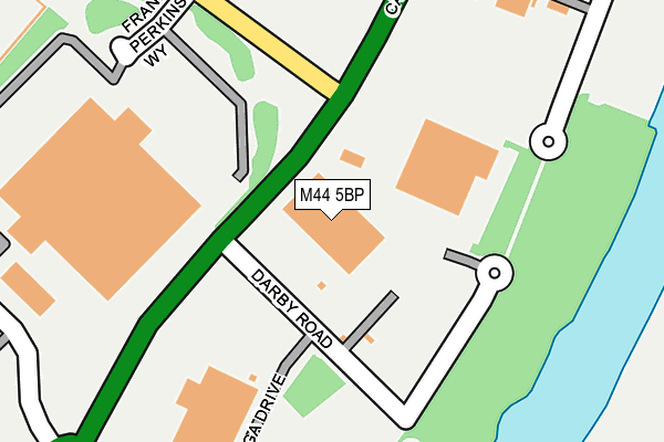
M44 5BP is located in the Cadishead & Lower Irlam electoral ward, within the metropolitan district of Salford and the English Parliamentary constituency of Worsley and Eccles South. The Sub Integrated Care Board (ICB) Location is NHS Greater Manchester ICB - 01G and the police force is Greater Manchester. This postcode has been in use since May 1994.


GetTheData
Source: OS OpenMap – Local (Ordnance Survey)
Source: OS VectorMap District (Ordnance Survey)
Licence: Open Government Licence (requires attribution)
| Easting | 372113 |
| Northing | 392906 |
| Latitude | 53.432210 |
| Longitude | -2.421196 |
GetTheData
Source: Open Postcode Geo
Licence: Open Government Licence
| Country | England |
| Postcode District | M44 |
| ➜ M44 open data dashboard ➜ See where M44 is on a map ➜ Where is Irlam? | |
GetTheData
Source: Land Registry Price Paid Data
Licence: Open Government Licence
Elevation or altitude of M44 5BP as distance above sea level:
| Metres | Feet | |
|---|---|---|
| Elevation | 10m | 33ft |
Elevation is measured from the approximate centre of the postcode, to the nearest point on an OS contour line from OS Terrain 50, which has contour spacing of ten vertical metres.
➜ How high above sea level am I? Find the elevation of your current position using your device's GPS.
GetTheData
Source: Open Postcode Elevation
Licence: Open Government Licence
| Ward | Cadishead & Lower Irlam |
| Constituency | Worsley And Eccles South |
GetTheData
Source: ONS Postcode Database
Licence: Open Government Licence
| June 2022 | Violence and sexual offences | On or near Sorby Road | 387m |
| ➜ Get more crime data in our Crime section | |||
GetTheData
Source: data.police.uk
Licence: Open Government Licence
| Manchester Road/Shell Road (Manchester Road) | Carrington | 621m |
| Manchester Road/Shell Road (Manchester Road) | Carrington | 659m |
| Manchester Road/Vicarage Gardens (Manchester Road) | Carrington | 675m |
| Manchester Road/Vicarage Gardens (Manchester Road) | Carrington | 706m |
| Liverpool Rd/Station Rd (Liverpool Rd) | Irlam | 710m |
| Irlam Station | 0.8km |
| Glazebrook Station | 2.6km |
| Flixton Station | 2.8km |
GetTheData
Source: NaPTAN
Licence: Open Government Licence
GetTheData
Source: ONS Postcode Database
Licence: Open Government Licence


➜ Get more ratings from the Food Standards Agency
GetTheData
Source: Food Standards Agency
Licence: FSA terms & conditions
| Last Collection | |||
|---|---|---|---|
| Location | Mon-Fri | Sat | Distance |
| Cadishead P.o. | 17:30 | 12:00 | 1,074m |
| Broadway | 17:30 | 11:30 | 1,221m |
| Victoria Road | 17:30 | 12:00 | 1,354m |
GetTheData
Source: Dracos
Licence: Creative Commons Attribution-ShareAlike
| Facility | Distance |
|---|---|
| Irlam Steel Recreation Club Liverpool Road, Irlam, Manchester Grass Pitches | 910m |
| Irlam And Cadishead Academy Macdonald Road, Irlam, Manchester Sports Hall, Grass Pitches, Artificial Grass Pitch, Outdoor Tennis Courts | 924m |
| Cadishead Primary School Allotment Road, Cadishead, Manchester Grass Pitches | 1.1km |
GetTheData
Source: Active Places
Licence: Open Government Licence
| School | Phase of Education | Distance |
|---|---|---|
| St Teresa's RC Primary School 5 Macdonald Road, Irlam, Manchester, M44 5LH | Primary | 889m |
| Irlam and Cadishead Academy Station Road, Irlam, Manchester, M44 5ZR | Secondary | 913m |
| Cadishead Primary School Allotment Road, Cadishead, Manchester, M44 5JD | Primary | 1.1km |
GetTheData
Source: Edubase
Licence: Open Government Licence
| Risk of M44 5BP flooding from rivers and sea | Low |
| ➜ M44 5BP flood map | |
GetTheData
Source: Open Flood Risk by Postcode
Licence: Open Government Licence
The below table lists the International Territorial Level (ITL) codes (formerly Nomenclature of Territorial Units for Statistics (NUTS) codes) and Local Administrative Units (LAU) codes for M44 5BP:
| ITL 1 Code | Name |
|---|---|
| TLD | North West (England) |
| ITL 2 Code | Name |
| TLD3 | Greater Manchester |
| ITL 3 Code | Name |
| TLD34 | Greater Manchester South West |
| LAU 1 Code | Name |
| E08000006 | Salford |
GetTheData
Source: ONS Postcode Directory
Licence: Open Government Licence
The below table lists the Census Output Area (OA), Lower Layer Super Output Area (LSOA), and Middle Layer Super Output Area (MSOA) for M44 5BP:
| Code | Name | |
|---|---|---|
| OA | E00028428 | |
| LSOA | E01005618 | Salford 030C |
| MSOA | E02001186 | Salford 030 |
GetTheData
Source: ONS Postcode Directory
Licence: Open Government Licence
| M44 5PN | Irlam Wharf Road | 299m |
| M44 5EG | Huntsman Drive | 392m |
| M44 5BW | Milton Avenue | 640m |
| M44 6RA | Soapstone Way | 671m |
| M44 5BH | Tramway Road | 677m |
| M44 5AY | Gilchrist Road | 678m |
| M44 5XB | Preston Avenue | 678m |
| M44 5BN | Henley Avenue | 686m |
| M31 4UG | Manchester Road | 696m |
| M44 5XA | Delhi Road | 709m |
GetTheData
Source: Open Postcode Geo; Land Registry Price Paid Data
Licence: Open Government Licence