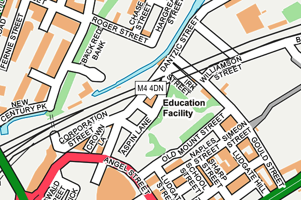
M4 4DN is located in the Piccadilly electoral ward, within the metropolitan district of Manchester and the English Parliamentary constituency of Manchester Central. The Sub Integrated Care Board (ICB) Location is NHS Greater Manchester ICB - 14L and the police force is Greater Manchester. This postcode has been in use since January 1980.


GetTheData
Source: OS OpenMap – Local (Ordnance Survey)
Source: OS VectorMap District (Ordnance Survey)
Licence: Open Government Licence (requires attribution)
| Easting | 384415 |
| Northing | 399242 |
| Latitude | 53.489654 |
| Longitude | -2.236357 |
GetTheData
Source: Open Postcode Geo
Licence: Open Government Licence
| Country | England |
| Postcode District | M4 |
| ➜ M4 open data dashboard ➜ See where M4 is on a map ➜ Where is Manchester? | |
GetTheData
Source: Land Registry Price Paid Data
Licence: Open Government Licence
Elevation or altitude of M4 4DN as distance above sea level:
| Metres | Feet | |
|---|---|---|
| Elevation | 30m | 98ft |
Elevation is measured from the approximate centre of the postcode, to the nearest point on an OS contour line from OS Terrain 50, which has contour spacing of ten vertical metres.
➜ How high above sea level am I? Find the elevation of your current position using your device's GPS.
GetTheData
Source: Open Postcode Elevation
Licence: Open Government Licence
| Ward | Piccadilly |
| Constituency | Manchester Central |
GetTheData
Source: ONS Postcode Database
Licence: Open Government Licence
| May 2022 | Burglary | On or near Durant Street | 245m |
| March 2022 | Violence and sexual offences | On or near Colenso Way | 219m |
| February 2022 | Violence and sexual offences | On or near Baptist Street | 260m |
| ➜ Get more crime data in our Crime section | |||
GetTheData
Source: data.police.uk
Licence: Open Government Licence
| Rochdale Rd/Angel St (Rochdale Rd) | Newtown | 293m |
| Rochdale Rd/Thompson St (Rochdale Rd) | Newtown | 307m |
| Rochdale Rd/Gould St (Rochdale Rd) | Newtown | 325m |
| Cheetham Hill Rd/Park Pl (Cheetham Hill R) | Strangeways | 340m |
| Cheetham Hill Rd/Park Pl (Cheetham Hill R) | Strangeways | 355m |
| Victoria (Manchester Metrolink) (Off Corporation Street) | Manchester City Centre | 458m |
| Shudehill (Manchester Metrolink) (Shudehill) | Manchester City Centre | 553m |
| Exchange Square (Manchester Metrolink) (Corporation St) | Manchester City Centre | 715m |
| Market Street (Manchester Metrolink) (Market Street) | Manchester City Centre | 879m |
| Piccadilly Gardens (Manchester Metrolink) (Portland Street) | Piccadilly Gardens | 1,068m |
| Manchester Victoria Station | 0.5km |
| Manchester Piccadilly Station | 1.4km |
| Salford Central Station | 1.4km |
GetTheData
Source: NaPTAN
Licence: Open Government Licence
GetTheData
Source: ONS Postcode Database
Licence: Open Government Licence


➜ Get more ratings from the Food Standards Agency
GetTheData
Source: Food Standards Agency
Licence: FSA terms & conditions
| Last Collection | |||
|---|---|---|---|
| Location | Mon-Fri | Sat | Distance |
| Roger Street | 19:00 | 12:00 | 193m |
| Opp 27 Cheetham Hill Road | 19:00 | 12:00 | 360m |
| Shudehill | 19:00 | 12:00 | 420m |
GetTheData
Source: Dracos
Licence: Creative Commons Attribution-ShareAlike
| Facility | Distance |
|---|---|
| Pace Health Club & Nu Spa Cheetham Hill Road, Manchester Health and Fitness Gym, Swimming Pool, Studio | 328m |
| Nuffield Health (Manchester) Withy Grove, Manchester Swimming Pool, Health and Fitness Gym, Studio | 579m |
| Chetham's School Of Music Long Millgate, Manchester Swimming Pool, Health and Fitness Gym, Squash Courts | 616m |
GetTheData
Source: Active Places
Licence: Open Government Licence
| School | Phase of Education | Distance |
|---|---|---|
| The Cooperative College Holyoake House, Hanover Street, Manchester, M60 0AS | Not applicable | 410m |
| Digital Advantage Hanover Street, Manchester, M60 0AS | Not applicable | 411m |
| Chetham's School of Music Long Millgate, Manchester, M3 1SB | Not applicable | 616m |
GetTheData
Source: Edubase
Licence: Open Government Licence
| Risk of M4 4DN flooding from rivers and sea | Low |
| ➜ M4 4DN flood map | |
GetTheData
Source: Open Flood Risk by Postcode
Licence: Open Government Licence
The below table lists the International Territorial Level (ITL) codes (formerly Nomenclature of Territorial Units for Statistics (NUTS) codes) and Local Administrative Units (LAU) codes for M4 4DN:
| ITL 1 Code | Name |
|---|---|
| TLD | North West (England) |
| ITL 2 Code | Name |
| TLD3 | Greater Manchester |
| ITL 3 Code | Name |
| TLD33 | Manchester |
| LAU 1 Code | Name |
| E08000003 | Manchester |
GetTheData
Source: ONS Postcode Directory
Licence: Open Government Licence
The below table lists the Census Output Area (OA), Lower Layer Super Output Area (LSOA), and Middle Layer Super Output Area (MSOA) for M4 4DN:
| Code | Name | |
|---|---|---|
| OA | E00176037 | |
| LSOA | E01033664 | Manchester 054D |
| MSOA | E02006902 | Manchester 054 |
GetTheData
Source: ONS Postcode Directory
Licence: Open Government Licence
| M4 4DW | Dantzic Street | 132m |
| M4 4HA | Naples Street | 139m |
| M4 4BJ | Naples Street | 155m |
| M4 4TF | Ludgate Hill | 166m |
| M4 4DB | Naples Street | 177m |
| M4 4DH | Naples Street | 181m |
| M4 4AR | Naples Street | 190m |
| M4 4BZ | Sharp Street | 190m |
| M4 4AJ | Hornbeam Way | 204m |
| M4 4AQ | Hornbeam Way | 204m |
GetTheData
Source: Open Postcode Geo; Land Registry Price Paid Data
Licence: Open Government Licence