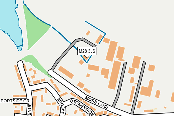
M28 3JS is located in the Walkden North electoral ward, within the metropolitan district of Salford and the English Parliamentary constituency of Worsley and Eccles South. The Sub Integrated Care Board (ICB) Location is NHS Greater Manchester ICB - 01G and the police force is Greater Manchester. This postcode has been in use since June 2004.


GetTheData
Source: OS OpenMap – Local (Ordnance Survey)
Source: OS VectorMap District (Ordnance Survey)
Licence: Open Government Licence (requires attribution)
| Easting | 374237 |
| Northing | 403715 |
| Latitude | 53.529456 |
| Longitude | -2.390121 |
GetTheData
Source: Open Postcode Geo
Licence: Open Government Licence
| Country | England |
| Postcode District | M28 |
| ➜ M28 open data dashboard ➜ See where M28 is on a map ➜ Where is Walkden? | |
GetTheData
Source: Land Registry Price Paid Data
Licence: Open Government Licence
Elevation or altitude of M28 3JS as distance above sea level:
| Metres | Feet | |
|---|---|---|
| Elevation | 100m | 328ft |
Elevation is measured from the approximate centre of the postcode, to the nearest point on an OS contour line from OS Terrain 50, which has contour spacing of ten vertical metres.
➜ How high above sea level am I? Find the elevation of your current position using your device's GPS.
GetTheData
Source: Open Postcode Elevation
Licence: Open Government Licence
| Ward | Walkden North |
| Constituency | Worsley And Eccles South |
GetTheData
Source: ONS Postcode Database
Licence: Open Government Licence
| Stoneyside Ave | Linnyshaw | 158m |
| Meadowside Ave | Linnyshaw | 160m |
| Springside Ave/Glenside Gr (Springside Ave) | Linnyshaw | 299m |
| Sportside Ave | Linnyshaw | 305m |
| Whittle St/Heathside Gr (Whittle St) | Linnyshaw | 379m |
| Walkden Station | 1.2km |
| Kearsley Station | 1.9km |
| Farnworth Station | 2.3km |
GetTheData
Source: NaPTAN
Licence: Open Government Licence
GetTheData
Source: ONS Postcode Database
Licence: Open Government Licence


➜ Get more ratings from the Food Standards Agency
GetTheData
Source: Food Standards Agency
Licence: FSA terms & conditions
| Last Collection | |||
|---|---|---|---|
| Location | Mon-Fri | Sat | Distance |
| Linneyshaw P.o. | 17:30 | 12:00 | 807m |
| Tesco | 17:00 | 12:00 | 915m |
| 6 City Road Off Bridgewater Road | 17:30 | 12:00 | 983m |
GetTheData
Source: Dracos
Licence: Creative Commons Attribution-ShareAlike
| Facility | Distance |
|---|---|
| Harriet Street Playing Fields Harriet Street, Worsley Grass Pitches | 372m |
| Fives Athletic Football Ground Whittle Street, Worsley Grass Pitches | 401m |
| Walkden Cricket Club Harriet Street, Worsley, Manchester Grass Pitches | 586m |
GetTheData
Source: Active Places
Licence: Open Government Licence
| School | Phase of Education | Distance |
|---|---|---|
| St Paul's CofE Primary School Heathside Grove, Walkden, Worsley, Manchester, M28 3NZ | Primary | 500m |
| Christ The King RC Primary School Holly Avenue, Worsley, Manchester, M28 3DW | Primary | 856m |
| St Paul's CofE Primary School Crompton Street, Walkden, St. Pauls C of E Primary School, Manchester, M28 3HP | Primary | 856m |
GetTheData
Source: Edubase
Licence: Open Government Licence
| Risk of M28 3JS flooding from rivers and sea | Low |
| ➜ M28 3JS flood map | |
GetTheData
Source: Open Flood Risk by Postcode
Licence: Open Government Licence
The below table lists the International Territorial Level (ITL) codes (formerly Nomenclature of Territorial Units for Statistics (NUTS) codes) and Local Administrative Units (LAU) codes for M28 3JS:
| ITL 1 Code | Name |
|---|---|
| TLD | North West (England) |
| ITL 2 Code | Name |
| TLD3 | Greater Manchester |
| ITL 3 Code | Name |
| TLD34 | Greater Manchester South West |
| LAU 1 Code | Name |
| E08000006 | Salford |
GetTheData
Source: ONS Postcode Directory
Licence: Open Government Licence
The below table lists the Census Output Area (OA), Lower Layer Super Output Area (LSOA), and Middle Layer Super Output Area (MSOA) for M28 3JS:
| Code | Name | |
|---|---|---|
| OA | E00028884 | |
| LSOA | E01005705 | Salford 003B |
| MSOA | E02001159 | Salford 003 |
GetTheData
Source: ONS Postcode Directory
Licence: Open Government Licence
| M28 3PJ | Meadowside Avenue | 183m |
| M28 3PE | Stoneyside Avenue | 183m |
| M28 3NR | Fernside Grove | 186m |
| M28 3PH | Wayside Grove | 227m |
| M28 3PD | Stoneyside Grove | 227m |
| M28 3PS | Springside Close | 246m |
| M28 3PL | Sportside Avenue | 254m |
| M28 3PX | Dellside Grove | 259m |
| M28 3PP | Sportside Grove | 268m |
| M28 3PF | Meadowside Avenue | 269m |
GetTheData
Source: Open Postcode Geo; Land Registry Price Paid Data
Licence: Open Government Licence