M28 2PR maps, stats, and open data
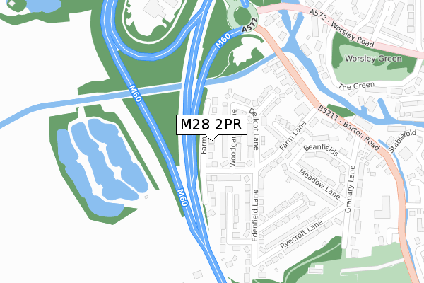
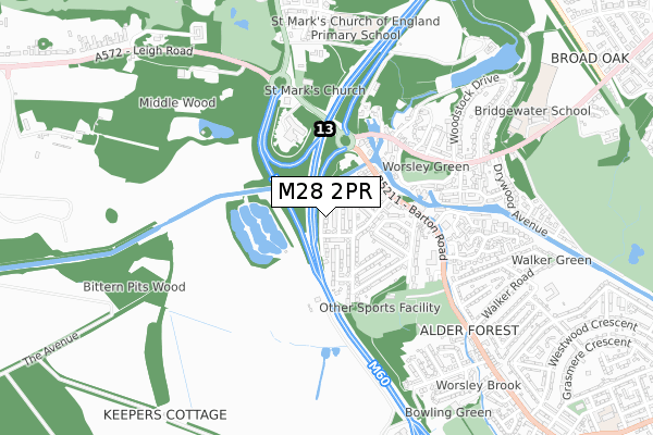
M28 2PR lies on Farm Lane in Worsley, Manchester. M28 2PR is located in the Worsley & Westwood Park electoral ward, within the metropolitan district of Salford and the English Parliamentary constituency of Worsley and Eccles South. The Sub Integrated Care Board (ICB) Location is NHS Greater Manchester ICB - 01G and the police force is Greater Manchester. This postcode has been in use since May 1994.
M28 2PR maps


Licence: Open Government Licence (requires attribution)
Attribution: Contains OS data © Crown copyright and database right 2025
Source: Open Postcode Geo
Licence: Open Government Licence (requires attribution)
Attribution: Contains OS data © Crown copyright and database right 2025; Contains Royal Mail data © Royal Mail copyright and database right 2025; Source: Office for National Statistics licensed under the Open Government Licence v.3.0
M28 2PR geodata
| Easting | 374639 |
| Northing | 400175 |
| Latitude | 53.497658 |
| Longitude | -2.383769 |
Where is M28 2PR?
| Street | Farm Lane |
| Locality | Worsley |
| Town/City | Manchester |
| Country | England |
| Postcode District | M28 |
M28 2PR Elevation
Elevation or altitude of M28 2PR as distance above sea level:
| Metres | Feet | |
|---|---|---|
| Elevation | 30m | 98ft |
Elevation is measured from the approximate centre of the postcode, to the nearest point on an OS contour line from OS Terrain 50, which has contour spacing of ten vertical metres.
➜ How high above sea level am I? Find the elevation of your current position using your device's GPS.
Politics
| Ward | Worsley & Westwood Park |
|---|---|
| Constituency | Worsley And Eccles South |
House Prices
Sales of detached houses in M28 2PR
2011 13 DEC £179,000 |
56, FARM LANE, WORSLEY, MANCHESTER, M28 2PR 2009 16 OCT £160,000 |
2007 9 NOV £250,000 |
2004 3 SEP £165,000 |
64, FARM LANE, WORSLEY, MANCHESTER, M28 2PR 2003 6 OCT £185,000 |
1998 16 JUL £82,000 |
Licence: Contains HM Land Registry data © Crown copyright and database right 2025. This data is licensed under the Open Government Licence v3.0.
Transport
Nearest bus stops to M28 2PR
| Barton Rd/Worsley Court House (Barton Rd) | Worsley | 243m |
| Barton Rd/Worsley Court House (Barton Rd) | Worsley | 291m |
| Worsley Rd/Court House (Worsley Rd) | Worsley | 334m |
| Barton Rd/Granary Ln (Barton Rd) | Worsley | 339m |
| Worsley Rd/Court House (Worsley Rd) | Worsley | 355m |
Nearest railway stations to M28 2PR
| Patricroft Station | 2.2km |
| Walkden Station | 2.6km |
| Moorside Station | 3km |
Broadband
Broadband access in M28 2PR (2020 data)
| Percentage of properties with Next Generation Access | 100.0% |
| Percentage of properties with Superfast Broadband | 100.0% |
| Percentage of properties with Ultrafast Broadband | 100.0% |
| Percentage of properties with Full Fibre Broadband | 100.0% |
Superfast Broadband is between 30Mbps and 300Mbps
Ultrafast Broadband is > 300Mbps
Broadband speed in M28 2PR (2019 data)
Download
| Median download speed | 40.0Mbps |
| Average download speed | 61.7Mbps |
| Maximum download speed | 200.00Mbps |
Upload
| Median upload speed | 7.0Mbps |
| Average upload speed | 6.7Mbps |
| Maximum upload speed | 17.50Mbps |
Broadband limitations in M28 2PR (2020 data)
| Percentage of properties unable to receive 2Mbps | 0.0% |
| Percentage of properties unable to receive 5Mbps | 0.0% |
| Percentage of properties unable to receive 10Mbps | 0.0% |
| Percentage of properties unable to receive 30Mbps | 0.0% |
M28 2PR gas and electricity consumption
Estimated total energy consumption in M28 2PR by fuel type, 2015.
Gas
| Consumption (kWh) | 316,410 |
|---|---|
| Meter count | 22 |
| Mean (kWh/meter) | 14,382 |
| Median (kWh/meter) | 14,085 |
Electricity
| Consumption (kWh) | 87,128 |
|---|---|
| Meter count | 21 |
| Mean (kWh/meter) | 4,149 |
| Median (kWh/meter) | 3,397 |
- Consumption: The estimated total energy consumption, in kWh, across all meters in M28 2PR, for 2015.
- Meter count: The total number of meters in M28 2PR.
- Mean: The mean average consumption per meter, in kWh.
- Median: The median average consumption per meter, in kWh.
Source: Postcode level electricity estimates: 2015 (experimental)
Licence: Open Government Licence
Deprivation
22.4% of English postcodes are less deprived than M28 2PR:Food Standards Agency
Three nearest food hygiene ratings to M28 2PR (metres)


➜ Get more ratings from the Food Standards Agency
Nearest post box to M28 2PR
| Last Collection | |||
|---|---|---|---|
| Location | Mon-Fri | Sat | Distance |
| Ellesmere Road P.o. | 17:30 | 12:00 | 164m |
| Mill Brow / Worsley Road | 17:30 | 12:00 | 389m |
| Walker Road | 17:30 | 12:00 | 899m |
M28 2PR ITL and M28 2PR LAU
The below table lists the International Territorial Level (ITL) codes (formerly Nomenclature of Territorial Units for Statistics (NUTS) codes) and Local Administrative Units (LAU) codes for M28 2PR:
| ITL 1 Code | Name |
|---|---|
| TLD | North West (England) |
| ITL 2 Code | Name |
| TLD3 | Greater Manchester |
| ITL 3 Code | Name |
| TLD34 | Greater Manchester South West |
| LAU 1 Code | Name |
| E08000006 | Salford |
M28 2PR census areas
The below table lists the Census Output Area (OA), Lower Layer Super Output Area (LSOA), and Middle Layer Super Output Area (MSOA) for M28 2PR:
| Code | Name | |
|---|---|---|
| OA | E00029069 | |
| LSOA | E01005738 | Salford 014C |
| MSOA | E02001170 | Salford 014 |
Nearest postcodes to M28 2PR
| M28 2PS | Woodgarth Lane | 35m |
| M28 2PG | Farm Lane | 89m |
| M28 2PT | Dellcot Lane | 97m |
| M28 2PX | Heathfield | 152m |
| M28 2PU | Farm Lane | 153m |
| M28 2GZ | Kenwood Lane | 169m |
| M28 2PP | Edenfield Lane | 203m |
| M28 2PQ | Greenacre Lane | 211m |
| M28 2PJ | Beanfields | 231m |
| M28 2PD | Barton Road | 236m |