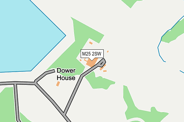
M25 2SW is located in the Higher Blackley electoral ward, within the metropolitan district of Manchester and the English Parliamentary constituency of Blackley and Broughton. The Sub Integrated Care Board (ICB) Location is NHS Greater Manchester ICB - 14L and the police force is Greater Manchester. This postcode has been in use since May 1994.


GetTheData
Source: OS OpenMap – Local (Ordnance Survey)
Source: OS VectorMap District (Ordnance Survey)
Licence: Open Government Licence (requires attribution)
| Easting | 383176 |
| Northing | 404448 |
| Latitude | 53.536425 |
| Longitude | -2.255310 |
GetTheData
Source: Open Postcode Geo
Licence: Open Government Licence
| Country | England |
| Postcode District | M25 |
| ➜ M25 open data dashboard ➜ See where M25 is on a map | |
GetTheData
Source: Land Registry Price Paid Data
Licence: Open Government Licence
Elevation or altitude of M25 2SW as distance above sea level:
| Metres | Feet | |
|---|---|---|
| Elevation | 100m | 328ft |
Elevation is measured from the approximate centre of the postcode, to the nearest point on an OS contour line from OS Terrain 50, which has contour spacing of ten vertical metres.
➜ How high above sea level am I? Find the elevation of your current position using your device's GPS.
GetTheData
Source: Open Postcode Elevation
Licence: Open Government Licence
| Ward | Higher Blackley |
| Constituency | Blackley And Broughton |
GetTheData
Source: ONS Postcode Database
Licence: Open Government Licence
| Middleton Rd/Victoria Ave (Middleton Rd) | Higher Blackley | 820m |
| St. Margarets Rd/Heaton Park (St Margarets Rd) | Prestwich | 842m |
| Middleton Rd/Heaton Park Rd (Middleton Rd) | Higher Blackley | 847m |
| Bury Old Rd/Orange Hill Rd (Bury Old Rd) | Heaton Park | 859m |
| Middleton Rd/Heaton Park Rd (Middleton Rd) | Higher Blackley | 876m |
| Heaton Park (Manchester Metrolink) (Off Bury Old Road) | Heaton Park | 1,007m |
| Bowker Vale (Manchester Metrolink) (Middleton Road) | Bowker Vale | 1,389m |
| Clifton (Manchester) Station | 4.2km |
GetTheData
Source: NaPTAN
Licence: Open Government Licence
GetTheData
Source: ONS Postcode Database
Licence: Open Government Licence


➜ Get more ratings from the Food Standards Agency
GetTheData
Source: Food Standards Agency
Licence: FSA terms & conditions
| Last Collection | |||
|---|---|---|---|
| Location | Mon-Fri | Sat | Distance |
| Whittaker Lane P.o. | 17:30 | 12:00 | 995m |
| Holyrood P.o. | 17:30 | 12:00 | 1,067m |
| Bowker Vale P.o. | 17:30 | 12:00 | 1,092m |
GetTheData
Source: Dracos
Licence: Creative Commons Attribution-ShareAlike
| Facility | Distance |
|---|---|
| Heaton Park St. Margarets Road, Prestwich, Manchester Grass Pitches | 709m |
| Heaton Park Golf Centre (Closed) Middleton Road, Manchester Golf | 720m |
| Carlton Club Bury Old Road, Prestwich, Manchester Sports Hall | 933m |
GetTheData
Source: Active Places
Licence: Open Government Licence
| School | Phase of Education | Distance |
|---|---|---|
| Prestwich Preparatory School 400 Bury Old Road, Prestwich, Manchester, M25 1PZ | Not applicable | 879m |
| Bowker Vale Primary School Middleton Road, Higher Crumpsall, Manchester, M8 4NB | Primary | 951m |
| Parrenthorn High School Heywood Road, Manchester, M25 2BW | Secondary | 1.1km |
GetTheData
Source: Edubase
Licence: Open Government Licence
The below table lists the International Territorial Level (ITL) codes (formerly Nomenclature of Territorial Units for Statistics (NUTS) codes) and Local Administrative Units (LAU) codes for M25 2SW:
| ITL 1 Code | Name |
|---|---|
| TLD | North West (England) |
| ITL 2 Code | Name |
| TLD3 | Greater Manchester |
| ITL 3 Code | Name |
| TLD33 | Manchester |
| LAU 1 Code | Name |
| E08000003 | Manchester |
GetTheData
Source: ONS Postcode Directory
Licence: Open Government Licence
The below table lists the Census Output Area (OA), Lower Layer Super Output Area (LSOA), and Middle Layer Super Output Area (MSOA) for M25 2SW:
| Code | Name | |
|---|---|---|
| OA | E00026136 | |
| LSOA | E01005160 | Manchester 004B |
| MSOA | E02001048 | Manchester 004 |
GetTheData
Source: ONS Postcode Directory
Licence: Open Government Licence
| M8 4LZ | Middleton Road | 836m |
| M25 2GT | St Margarets Road | 859m |
| M25 1NZ | Bury Old Road | 866m |
| M8 4NB | Middleton Road | 870m |
| M25 1QZ | Park Place | 894m |
| M25 1JA | Bury Old Road | 910m |
| M25 1PY | Bury Old Road | 911m |
| M25 2GX | Roseland Drive | 916m |
| M25 1GA | Carver Avenue | 918m |
| M9 0GS | Beadham Drive | 921m |
GetTheData
Source: Open Postcode Geo; Land Registry Price Paid Data
Licence: Open Government Licence