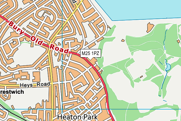
Prestwich Preparatory School is located in Prestwich, Manchester and falls under the local authority of Bury. This mixed-sex school has 56 pupils, with a capacity of 113, aged from two up to eleven, and the type of establishment is other independent school. The most recend Ofsted inspection was 23rd February 2023 resulting in an inadequate rating.
| Address | Prestwich Preparatory School 400 Bury Old Road Prestwich Manchester Lancashire M25 1PZ |
| Website | http://www.prestwichprepschool.net |
| Headteacher | Miss Patricia Shiels |
GetTheData
Source: Get Information About Schools
Licence: Open Government Licence
| Phase of Education | Not applicable |
| Type of Establishment | Other independent school |
| Admissions Policy | Not applicable |
| Statutory Low Age | 2 |
| Statutory High Age | 11 |
| Boarders | No boarders |
| Boarding Establishment | Does not have boarders |
| Official Sixth Form | Does not have a sixth form |
| Gender | Mixed |
| Religious Character | None |
| Diocese | Not applicable |
| Special Classes | No Special Classes |
GetTheData
Source: Get Information About Schools
Licence: Open Government Licence
| Census Date | 20th January 2022 | |
| School Capacity | 113 | |
| Number of Pupils | 56 | 50% capacity |
| Number of Boys | 27 | 48% |
| Number of Girls | 29 | 52% |
| Free School Meals (%) | 0.0% |
GetTheData
Source: Get Information About Schools
Licence: Open Government Licence
| Street Address | 400 Bury Old Road |
| Locality | Prestwich |
| Town | Manchester |
| County | Lancashire |
| Postcode | M25 1PZ |
| ➜ More M25 1PZ open data | |
GetTheData
Source: Get Information About Schools
Licence: Open Government Licence

GetTheData
Source: OS VectorMap District (Ordnance Survey)
Licence: Open Government Licence (requires attribution)
| Ofsted Last Inspection | 23rd February 2023 |
| Ofsted Rating | Inadequate |
| Ofsted Special Measures | Not applicable |
GetTheData
Source: Get Information About Schools
Licence: Open Government Licence
| Establishment Name | Prestwich Preparatory School |
| Establishment Number | 6012 |
| Unique Reference Number | 105997 |
| Local Authority | Bury |
| Local Authority Code | 351 |
| Previous Local Authority Code | 999 |
| Government Statistical Service Local Authority Code | E08000002 |
| Government Office Region | North West |
| District | Bury |
| District Code | E08000002 |
| Ward | Holyrood |
| Parliamentary Constituency | Bury South |
| Urban/Rural Description | (England/Wales) Urban major conurbation |
| Middle Super Output Area | Bury 023 |
| Lower Super Output Area | Bury 023B |
GetTheData
Source: Get Information About Schools
Licence: Open Government Licence
| Establishment Status | Open |
| Last Changed Date | 5th December 2023 |
| Open Date | 1st January 1910 |
| Reason Establishment Closed | Not applicable |
GetTheData
Source: Get Information About Schools
Licence: Open Government Licence
| Teenage Mothers | Not applicable |
| Child Care Facilities | Not applicable |
| Special Educational Needs (SEN) Provision in Primary Care Unit | Not applicable |
| Pupil Referral Unit (PRU) Provides for Educational and Behavioural Difficulties (EBD) | Not applicable |
| Pupil Referral Unit (PRU) Offers Tuition by Another Provider | Not applicable |
GetTheData
Source: Get Information About Schools
Licence: Open Government Licence
| Section 41 Approved | Not approved |
GetTheData
Source: Get Information About Schools
Licence: Open Government Licence
| Trust flag | Not applicable |
| School Sponsor flag | Not applicable |
GetTheData
Source: Get Information About Schools
Licence: Open Government Licence
| Federation flag | Not applicable |
GetTheData
Source: Get Information About Schools
Licence: Open Government Licence
| UK Provider Reference Number | 10077570 |
| Further Education Type | Not applicable |
GetTheData
Source: Get Information About Schools
Licence: Open Government Licence
| Easting | 382304 |
| Northing | 404341 |
| Latitude | 53.53542 |
| Longitude | -2.26846 |
GetTheData
Source: Get Information About Schools
Licence: Open Government Licence
| School | Phase of Education | Distance |
|---|---|---|
| The Heys School Heys Road, Prestwich, Manchester, M25 1JZ | Secondary | 619m |
| St Hilda's Church of England Primary School Whittaker Lane, Prestwich, Manchester, M25 1HA | Primary | 657m |
| Heaton Park Primary School Cuckoo Lane, Whitefield, Manchester, M45 6TE | Primary | 829m |
| St Mary's Church of England Aided Primary School, Prestwich Rectory Lane, Prestwich, Manchester, M25 1BP | Primary | 945m |
| St Monica's RC High School, a Voluntary Academy Bury Old Road, Prestwich, Manchester, M25 1JH | Secondary | 986m |
| Park View Primary School Park View Road, Prestwich, Manchester, M25 1FA | Primary | 1.1km |
| Parrenthorn High School Heywood Road, Manchester, M25 2BW | Secondary | 1.1km |
| St Margaret's Church of England Primary School Heywood Road, Prestwich, Manchester, M25 2BW | Primary | 1.2km |
| Our Lady of Grace RC Primary School Highfield Road, Prestwich, Manchester, M25 3AS | Primary | 1.2km |
| Manchester Mesivta School Beechwood, Charlton Avenue, Prestwich, M25 0PH | Secondary | 1.3km |
GetTheData
Source: Get Information About Schools
Licence: Open Government Licence