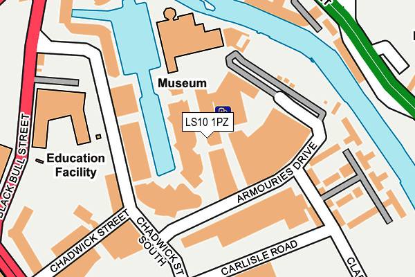
LS10 1PZ is located in the Hunslet & Riverside electoral ward, within the metropolitan district of Leeds and the English Parliamentary constituency of Leeds Central. The Sub Integrated Care Board (ICB) Location is NHS West Yorkshire ICB - 15F and the police force is West Yorkshire. This postcode has been in use since February 2008.


GetTheData
Source: OS OpenMap – Local (Ordnance Survey)
Source: OS VectorMap District (Ordnance Survey)
Licence: Open Government Licence (requires attribution)
| Easting | 430938 |
| Northing | 432790 |
| Latitude | 53.790528 |
| Longitude | -1.531873 |
GetTheData
Source: Open Postcode Geo
Licence: Open Government Licence
| Country | England |
| Postcode District | LS10 |
| ➜ LS10 open data dashboard ➜ See where LS10 is on a map ➜ Where is Leeds? | |
GetTheData
Source: Land Registry Price Paid Data
Licence: Open Government Licence
Elevation or altitude of LS10 1PZ as distance above sea level:
| Metres | Feet | |
|---|---|---|
| Elevation | 30m | 98ft |
Elevation is measured from the approximate centre of the postcode, to the nearest point on an OS contour line from OS Terrain 50, which has contour spacing of ten vertical metres.
➜ How high above sea level am I? Find the elevation of your current position using your device's GPS.
GetTheData
Source: Open Postcode Elevation
Licence: Open Government Licence
| Ward | Hunslet & Riverside |
| Constituency | Leeds Central |
GetTheData
Source: ONS Postcode Database
Licence: Open Government Licence
| January 2024 | Violence and sexual offences | On or near Willis Street | 436m |
| January 2024 | Violence and sexual offences | On or near Willis Street | 436m |
| January 2024 | Other theft | On or near Willis Street | 436m |
| ➜ Get more crime data in our Crime section | |||
GetTheData
Source: data.police.uk
Licence: Open Government Licence
| Royal Armouries (Chadwick Street) | Crown Point | 146m |
| Liberty Dock (Clarence Road) | Crown Point | 170m |
| East Street Zion St (East Street) | Richmond Hill | 248m |
| Black Bull Street | Crown Point | 262m |
| Bow Street Zion St (Bow Street) | Richmond Hill | 305m |
| Leeds Station | 1.2km |
| Burley Park Station | 3.9km |
| Cottingley Station | 4.5km |
GetTheData
Source: NaPTAN
Licence: Open Government Licence
GetTheData
Source: ONS Postcode Database
Licence: Open Government Licence


➜ Get more ratings from the Food Standards Agency
GetTheData
Source: Food Standards Agency
Licence: FSA terms & conditions
| Last Collection | |||
|---|---|---|---|
| Location | Mon-Fri | Sat | Distance |
| Chadwick Street South | 18:45 | 12:30 | 155m |
| Chadwick Street Bus Box | 18:45 | 11:00 | 155m |
| East Street | 17:30 | 11:30 | 407m |
GetTheData
Source: Dracos
Licence: Creative Commons Attribution-ShareAlike
| Facility | Distance |
|---|---|
| Royal Armouries Museum Leeds Sports Hall | 154m |
| Ruth Gorse Academy Black Bull Street, Leeds Sports Hall, Studio | 234m |
| Mount St Mary's Catholic High School Ellerby Road, Leeds Sports Hall, Studio | 481m |
GetTheData
Source: Active Places
Licence: Open Government Licence
| School | Phase of Education | Distance |
|---|---|---|
| The Ruth Gorse Academy Black Bull Street, Leeds, LS10 1HW | Secondary | 234m |
| University Technical College Leeds 2 Sayner Road, Hunslet, Leeds, LS10 1LA | Secondary | 303m |
| Mount St Mary's Catholic High School Ellerby Road, Leeds, LS9 8LA | Secondary | 497m |
GetTheData
Source: Edubase
Licence: Open Government Licence
| Risk of LS10 1PZ flooding from rivers and sea | Medium |
| ➜ LS10 1PZ flood map | |
GetTheData
Source: Open Flood Risk by Postcode
Licence: Open Government Licence
The below table lists the International Territorial Level (ITL) codes (formerly Nomenclature of Territorial Units for Statistics (NUTS) codes) and Local Administrative Units (LAU) codes for LS10 1PZ:
| ITL 1 Code | Name |
|---|---|
| TLE | Yorkshire and The Humber |
| ITL 2 Code | Name |
| TLE4 | West Yorkshire |
| ITL 3 Code | Name |
| TLE42 | Leeds |
| LAU 1 Code | Name |
| E08000035 | Leeds |
GetTheData
Source: ONS Postcode Directory
Licence: Open Government Licence
The below table lists the Census Output Area (OA), Lower Layer Super Output Area (LSOA), and Middle Layer Super Output Area (MSOA) for LS10 1PZ:
| Code | Name | |
|---|---|---|
| OA | E00170038 | |
| LSOA | E01033019 | Leeds 112E |
| MSOA | E02006876 | Leeds 112 |
GetTheData
Source: ONS Postcode Directory
Licence: Open Government Licence
| LS10 1HY | The Boulevard | 31m |
| LS10 1LQ | The Boulevard | 32m |
| LS10 1JT | The Boulevard | 35m |
| LS10 1LP | The Boulevard | 49m |
| LS10 1LR | The Boulevard | 53m |
| LS10 1LG | The Boulevard | 98m |
| LS10 1LH | The Boulevard | 98m |
| LS10 1LL | The Boulevard | 98m |
| LS10 1NH | Chadwick Street | 102m |
| LS10 1NW | Chadwick Street | 107m |
GetTheData
Source: Open Postcode Geo; Land Registry Price Paid Data
Licence: Open Government Licence