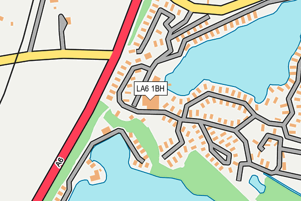
LA6 1BH is located in the Warton electoral ward, within the local authority district of Lancaster and the English Parliamentary constituency of Morecambe and Lunesdale. The Sub Integrated Care Board (ICB) Location is NHS Lancashire and South Cumbria ICB - 01K and the police force is Lancashire. This postcode has been in use since April 2004.


GetTheData
Source: OS OpenMap – Local (Ordnance Survey)
Source: OS VectorMap District (Ordnance Survey)
Licence: Open Government Licence (requires attribution)
| Easting | 351405 |
| Northing | 472739 |
| Latitude | 54.148165 |
| Longitude | -2.745472 |
GetTheData
Source: Open Postcode Geo
Licence: Open Government Licence
| Country | England |
| Postcode District | LA6 |
| ➜ LA6 open data dashboard ➜ See where LA6 is on a map | |
GetTheData
Source: Land Registry Price Paid Data
Licence: Open Government Licence
Elevation or altitude of LA6 1BH as distance above sea level:
| Metres | Feet | |
|---|---|---|
| Elevation | 10m | 33ft |
Elevation is measured from the approximate centre of the postcode, to the nearest point on an OS contour line from OS Terrain 50, which has contour spacing of ten vertical metres.
➜ How high above sea level am I? Find the elevation of your current position using your device's GPS.
GetTheData
Source: Open Postcode Elevation
Licence: Open Government Licence
| Ward | Warton |
| Constituency | Morecambe And Lunesdale |
GetTheData
Source: ONS Postcode Database
Licence: Open Government Licence
| May 2022 | Public order | On or near Parking Area | 276m |
| May 2022 | Other theft | On or near Parking Area | 276m |
| April 2022 | Criminal damage and arson | On or near Parking Area | 276m |
| ➜ Get more crime data in our Crime section | |||
GetTheData
Source: data.police.uk
Licence: Open Government Licence
| Manor Farm (Kellet Lane) | Borwick | 680m |
| Borwick Mews (Tewitfield Lane) | Borwick | 702m |
| Pine Lakes (Scotland Road) | Carnforth | 895m |
| The Green (Borwick Lane) | Borwick | 1,194m |
| Borwick Green (Borwick Lane) | Borwick | 1,200m |
| Carnforth Station | 2.7km |
| Silverdale Station | 4.5km |
GetTheData
Source: NaPTAN
Licence: Open Government Licence
| Median download speed | 39.1Mbps |
| Average download speed | 41.0Mbps |
| Maximum download speed | 80.00Mbps |
| Median upload speed | 10.0Mbps |
| Average upload speed | 9.6Mbps |
| Maximum upload speed | 20.00Mbps |
GetTheData
Source: Ofcom
Licence: Ofcom Terms of Use (requires attribution)
GetTheData
Source: ONS Postcode Database
Licence: Open Government Licence


➜ Get more ratings from the Food Standards Agency
GetTheData
Source: Food Standards Agency
Licence: FSA terms & conditions
| Last Collection | |||
|---|---|---|---|
| Location | Mon-Fri | Sat | Distance |
| Borwick Green | 16:45 | 07:30 | 1,208m |
| New England | 17:00 | 07:00 | 1,794m |
| Priest Hutton | 16:45 | 09:15 | 1,955m |
GetTheData
Source: Dracos
Licence: Creative Commons Attribution-ShareAlike
| Facility | Distance |
|---|---|
| South Lakeland Leisure Village Borwick Lane, Dock Acres, Carnforth Health and Fitness Gym, Swimming Pool, Studio | 0m |
| Warton Cricket Club Borwick Lane, Warton Grass Pitches | 353m |
| Pine Lake Resort Scotland Road, Warton Swimming Pool, Health and Fitness Gym, Outdoor Tennis Courts | 597m |
GetTheData
Source: Active Places
Licence: Open Government Licence
| School | Phase of Education | Distance |
|---|---|---|
| Warton Archbishop Hutton's VC Primary School Warton, Back Lane, Warton, Back Lane, Nr Carnforth, LA5 9QU | Primary | 1.5km |
| Our Lady of Lourdes Catholic Primary School, Carnforth Kellet Road, Carnforth, LA5 9LS | Primary | 2.6km |
| Carnforth High School Kellet Road, Carnforth, LA5 9LS | Secondary | 2.7km |
GetTheData
Source: Edubase
Licence: Open Government Licence
| Risk of LA6 1BH flooding from rivers and sea | Medium |
| ➜ LA6 1BH flood map | |
GetTheData
Source: Open Flood Risk by Postcode
Licence: Open Government Licence
The below table lists the International Territorial Level (ITL) codes (formerly Nomenclature of Territorial Units for Statistics (NUTS) codes) and Local Administrative Units (LAU) codes for LA6 1BH:
| ITL 1 Code | Name |
|---|---|
| TLD | North West (England) |
| ITL 2 Code | Name |
| TLD4 | Lancashire |
| ITL 3 Code | Name |
| TLD44 | Lancaster and Wyre |
| LAU 1 Code | Name |
| E07000121 | Lancaster |
GetTheData
Source: ONS Postcode Directory
Licence: Open Government Licence
The below table lists the Census Output Area (OA), Lower Layer Super Output Area (LSOA), and Middle Layer Super Output Area (MSOA) for LA6 1BH:
| Code | Name | |
|---|---|---|
| OA | E00127743 | |
| LSOA | E01025169 | Lancaster 001G |
| MSOA | E02005221 | Lancaster 001 |
GetTheData
Source: ONS Postcode Directory
Licence: Open Government Licence
| LA6 1HP | 357m | |
| LA6 1JZ | 369m | |
| LA6 1JU | Borwick Mews | 829m |
| LA6 1GP | Tewitfield Marina | 1018m |
| LA5 9QN | Borwick Lane | 1026m |
| LA5 9QG | The Roods | 1028m |
| LA6 1GQ | Tewitfield Marina | 1045m |
| LA6 1GS | Tewitfield Marina | 1058m |
| LA5 9QQ | The Roods | 1067m |
| LA6 1JH | 1069m |
GetTheData
Source: Open Postcode Geo; Land Registry Price Paid Data
Licence: Open Government Licence